File:Piri Reis - Map of the Crimea, the Sea of Azov, and the Mouth of the Dnieper - Walters W658372A - Full Page.jpg
Original file (1,800 × 1,228 pixels, file size: 2.91 MB, MIME type: image/jpeg)
Captions
Captions
Summary edit
| Piri Reis: Map of the Crimea, the Sea of Azov, and the Mouth of the Dnieper
( |
||||||||||||||||||||||||
|---|---|---|---|---|---|---|---|---|---|---|---|---|---|---|---|---|---|---|---|---|---|---|---|---|
| Artist |
|
|||||||||||||||||||||||
| Title |
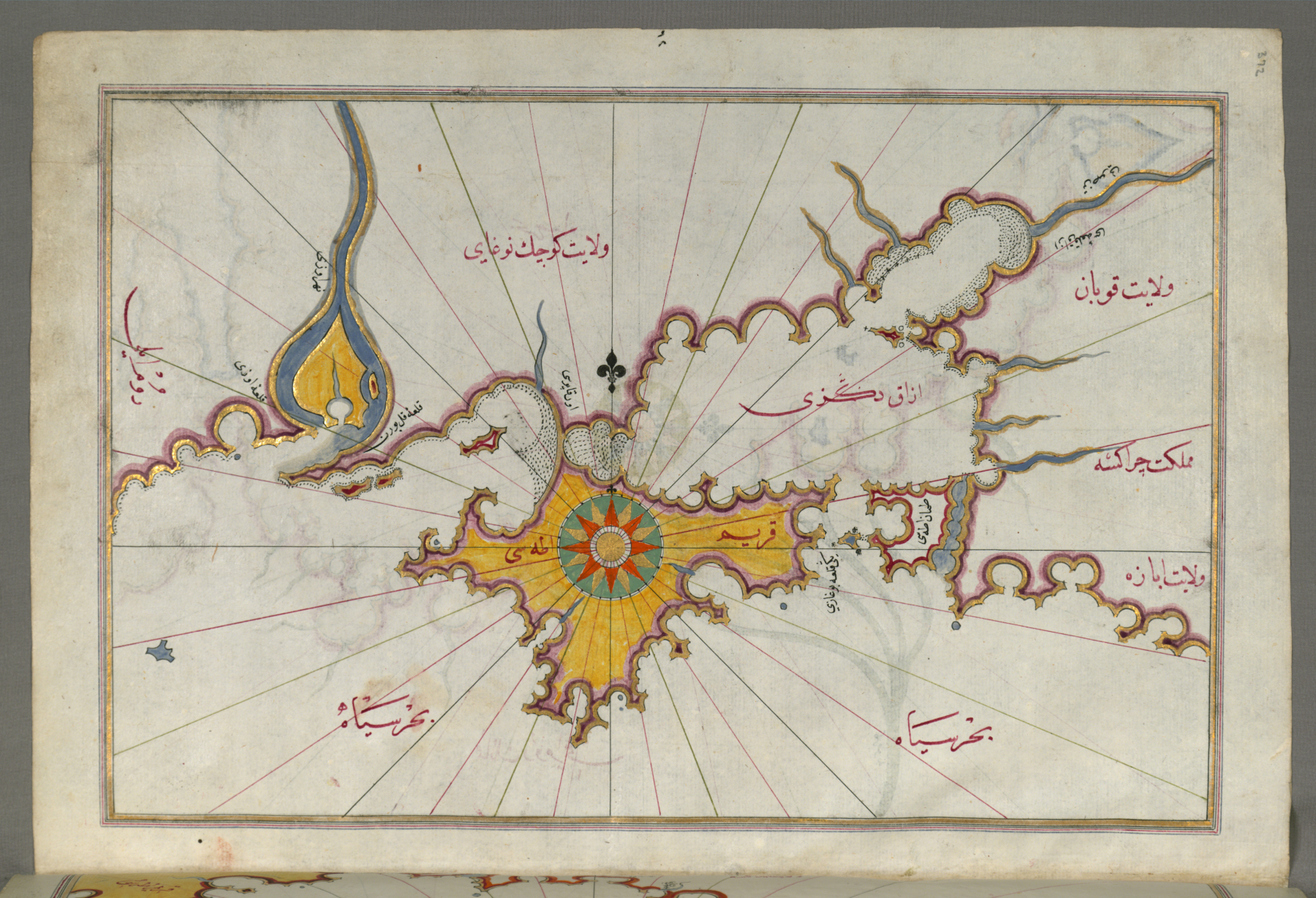
Map of the Crimea, the Sea of Azov, and the Mouth of the Dnieper |
|||||||||||||||||||||||
| Description |
English: This folio from Walters manuscript W.658 contains a map of the Crimea (Qrim), the Sea of Azov, and the mouth of the Dnieper. |
|||||||||||||||||||||||
| Date | late 11th century AH/AD 17th century-early 12th century AH/AD 18th century (Ottoman Empire) | |||||||||||||||||||||||
| Medium | ink and pigments on laid European paper | |||||||||||||||||||||||
| Dimensions | height: 34 cm (13.3 in); width: 24 cm (9.4 in) | |||||||||||||||||||||||
| Collection |
|
|||||||||||||||||||||||
| Accession number |
W.658.372A |
|||||||||||||||||||||||
| Place of creation | Turkey | |||||||||||||||||||||||
| Object history |
|
|||||||||||||||||||||||
| Credit line | Acquired by Henry Walters | |||||||||||||||||||||||
| Source |
Walters Art Museum: |
|||||||||||||||||||||||
| Permission (Reusing this file) |
||||||||||||||||||||||||

Licensing edit
This file was provided to Wikimedia Commons by the Walters Art Museum as part of a cooperation project. All artworks in the photographs are in public domain due to age. The photographs of two-dimensional objects are also in the public domain. Photographs of three-dimensional objects and all descriptions have been released under the Creative Commons Attribution-Share Alike 3.0 Unported License and the GNU Free Documentation License.
In the case of the text descriptions, copyright restrictions only apply to longer descriptions which cross the threshold of originality.
|
|
This is a faithful photographic reproduction of an original two-dimensional work of art. The work of art itself is in the public domain for the following reason:
This digital reproduction has been released under the following licenses:
In many jurisdictions, faithful reproductions of two-dimensional public domain works of art are not copyrightable. The Wikimedia Foundation's position is that these works are not copyrightable in the United States (see Commons:Reuse of PD-Art photographs). In these jurisdictions, this work is actually in the public domain and the requirements of the digital reproduction's license are not compulsory. | ||||||
File history
Click on a date/time to view the file as it appeared at that time.
| Date/Time | Thumbnail | Dimensions | User | Comment | |
|---|---|---|---|---|---|
| current | 15:18, 8 December 2012 | | 1,800 × 1,228 (2.91 MB) | Rotatebot (talk | contribs) | Bot: Image rotated by 90° |
| 10:09, 26 March 2012 |  | 1,228 × 1,800 (2.73 MB) | File Upload Bot (Kaldari) (talk | contribs) | == {{int:filedesc}} == {{Walters Art Museum artwork |artist = {{Creator:Piri Reis}} |title = ''Map of the Crimea, the Sea of Azov, and the Mouth of the Dnieper'' |description = {{en|This folio from Walters manuscript W.658 con... |
You cannot overwrite this file.
File usage on Commons
The following page uses this file:
File usage on other wikis
The following other wikis use this file:
- Usage on de.wikipedia.org
- Usage on en.wikipedia.org
- Rupes Nigra
- The Professional Geographer
- Area (journal)
- The Geographical Journal
- Transactions of the Institute of British Geographers
- Polar Research
- Urban Geography (journal)
- GeoJournal
- Journal of Regional Science
- Networks and Spatial Economics
- Journal of the Royal Geographical Society of London
- Yearbook of the Association of Pacific Coast Geographers
- Opera Corcontica
- African Geographical Review
- Hérodote
- Eurasian Geography and Economics
- Geografiska Annaler
- Journal of Borderlands Studies
- Imago Mundi
- Geographische Zeitschrift
- South African Geographical Journal
- Espacio y Desarrollo
- Progress in Physical Geography
- The Canadian Geographer
- Norte Grande Geography Journal
- Papers in Regional Science
- International Journal of Urban and Regional Research
- Tijdschrift voor economische en sociale geografie
- Eco.mont
- Geographical Analysis (journal)
- International Journal of Geographical Information Science
- Applied Geography
- Acta Geographica Slovenica
- Annals of the American Association of Geographers
- Journal of Transport Geography
- Journal of Economic Geography
- Fennia (journal)
- Mitteilungen der Österreichischen Geographischen Gesellschaft
- Template:Geography-journal-stub
- Health & Place
- Journal of Historical Geography
- Norwegian Journal of Geography
- Ymer (journal)
- Journal of Latin American Geography
- Cartography and Geographic Information Science
- Annales de Géographie
- Danish Journal of Geography
- Geographia Polonica
- Journal of Coastal Research
View more global usage of this file.