File:Plan-Routier De La Ville De Bruxelles.jpg

Size of this preview: 800 × 596 pixels. Other resolutions: 320 × 238 pixels | 640 × 477 pixels | 1,024 × 763 pixels | 1,280 × 954 pixels | 2,560 × 1,908 pixels | 6,145 × 4,579 pixels.
Original file (6,145 × 4,579 pixels, file size: 8.64 MB, MIME type: image/jpeg)
Captions
Captions
Add a one-line explanation of what this file represents
Summary
edit
| Description |
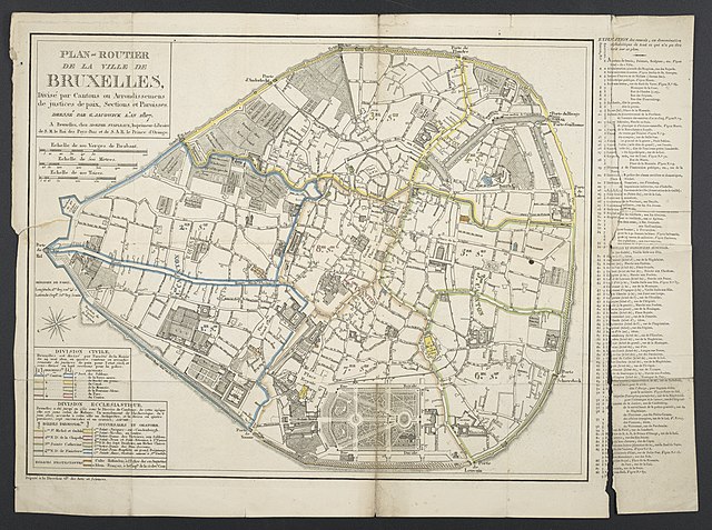
Deutsch: 1 Kt. : Verwaltungsgrenzen kolor. (40 x 31 cm); Koordinaten E 4°20'14"-E 4°22'09"/N 50°51'29"-N 50°49'56"; Maßstab in graph. Form (Verges de Brabant, Métres). - Titel oben links. - Mit. Erl. zu Sehenswürdigkeiten. - Nullmeridian: Paris. - Ohne Relief |
| Date | |
| Source | Leibniz-Institut für Länderkunde, Leipzig |
| Author | Jacowick, G. et al. |
Stadtplan von Brüssel mit Einrichtungen etc.
Licensing
edit
|
This work is in the public domain in its country of origin and other countries and areas where the copyright term is the author's life plus 100 years or fewer. This work is in the public domain in the United States because it was published (or registered with the U.S. Copyright Office) before January 1, 1929. | |
| This file has been identified as being free of known restrictions under copyright law, including all related and neighboring rights. | |
File history
Click on a date/time to view the file as it appeared at that time.
| Date/Time | Thumbnail | Dimensions | User | Comment | |
|---|---|---|---|---|---|
| current | 10:22, 6 September 2018 | | 6,145 × 4,579 (8.64 MB) | Higgenhorscht (talk | contribs) | User created page with UploadWizard |
You cannot overwrite this file.
File usage on Commons
There are no pages that use this file.