File:Plan Charleville Meziere Edme Moreau 1625.jpg

Size of this preview: 654 × 600 pixels. Other resolutions: 262 × 240 pixels | 524 × 480 pixels | 838 × 768 pixels | 1,117 × 1,024 pixels | 1,372 × 1,258 pixels.
Original file (1,372 × 1,258 pixels, file size: 591 KB, MIME type: image/jpeg)
Captions
Captions
Add a one-line explanation of what this file represents
Summary edit
| Description |
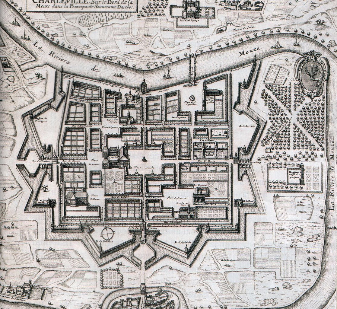
English: Map of Charleville* by Edmé Moreau about 1625.
Français : Plan de Charleville* par Edmé Moreau vers 1625.
|
| Date | |
| Source | Historia n°767 - Novembre 2010 - page 67 |
| Author | Edme Moreau |
| Annotations | This image is annotated: View the annotations at Commons |
Licensing edit
|
This work is in the public domain in its country of origin and other countries and areas where the copyright term is the author's life plus 100 years or fewer. | |
| This file has been identified as being free of known restrictions under copyright law, including all related and neighboring rights. | |
File history
Click on a date/time to view the file as it appeared at that time.
| Date/Time | Thumbnail | Dimensions | User | Comment | |
|---|---|---|---|---|---|
| current | 21:45, 21 November 2010 | | 1,372 × 1,258 (591 KB) | KoS (talk | contribs) | {{Information |Description={{en|1=Map of Charleville-Mézières by Edme Moreau about 1625.}} {{fr|1=Plan de Charleville-Mézières par Edme Moreau vers 1625.}} |Source=Historia n°767 - Novembr |
You cannot overwrite this file.
File usage on Commons
There are no pages that use this file.
File usage on other wikis
The following other wikis use this file:
- Usage on ar.wikipedia.org
- Usage on azb.wikipedia.org
- Usage on de.wikipedia.org
- Usage on en.wikipedia.org
- Usage on es.wikipedia.org
- Usage on eu.wikipedia.org
- Usage on fr.wikipedia.org
- Usage on fr.wikivoyage.org
- Usage on ru.wikipedia.org
- Usage on uk.wikipedia.org
- Usage on zh.wikipedia.org