File:Plan af Helsingfors jemte kartor öfver Finland, hufvudstadens omgifningar, Saima kanal och Helsingfors-Tavastehus jernväg samt tjugyfyra vyer 1860.jpeg

Size of this preview: 750 × 600 pixels. Other resolutions: 300 × 240 pixels | 600 × 480 pixels | 960 × 768 pixels | 1,280 × 1,024 pixels | 2,560 × 2,048 pixels | 5,240 × 4,192 pixels.
Original file (5,240 × 4,192 pixels, file size: 3.01 MB, MIME type: image/jpeg)
Captions
Captions
Add a one-line explanation of what this file represents
| Title |
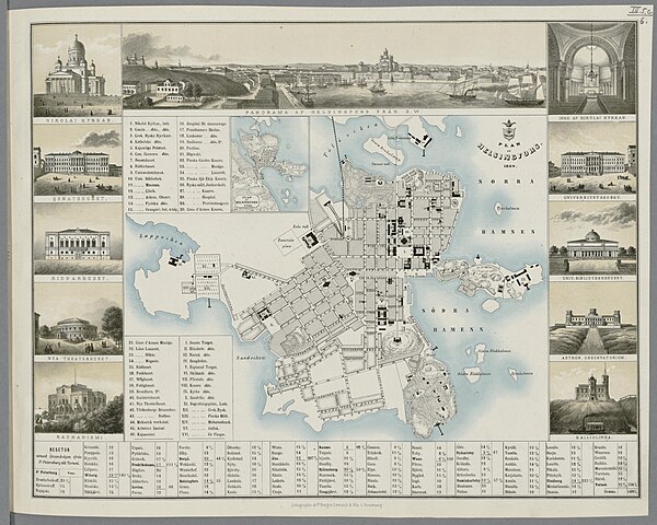
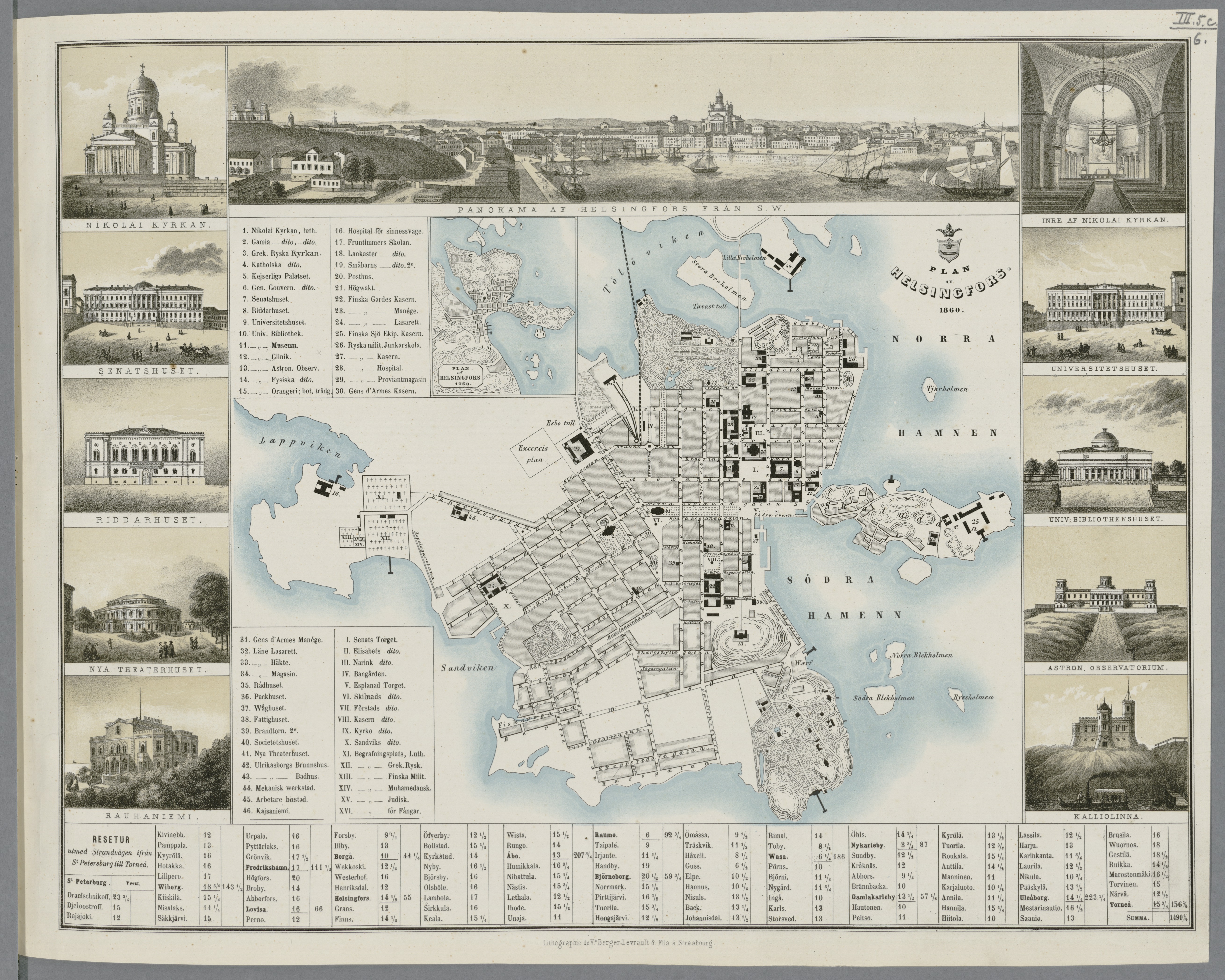
Svenska: Plan af Helsingfors jemte kartor öfver Finland, hufvudstadens omgifningar, Saima kanal och Helsingfors-Tavastehus jernväg samt tjugyfyra vyer |
|||||||||||||||||||||||
| Description |
Suomi: Kartat molemmin puolin lehteä. |
|||||||||||||||||||||||
| Date | ||||||||||||||||||||||||
| Source |
|
|||||||||||||||||||||||
| Permission (Reusing this file) |
|
|||||||||||||||||||||||
| Geotemporal data | ||||||||||||||||||||||||
| Map location | Helsinki, Saimaan kanava | |||||||||||||||||||||||
| Georeferencing | If inappropriate please set warp_status = skip to hide. | |||||||||||||||||||||||
| Bibliographic data | ||||||||||||||||||||||||
| Publisher |
Wasenius & Co, Helsingfors |
|||||||||||||||||||||||
| Printed by |
Lithographie de Ve Berger-Levrault & fils à Strasbourg |
|||||||||||||||||||||||
| Archival data | ||||||||||||||||||||||||
| Collection |
|
|||||||||||||||||||||||
| Accession number | ||||||||||||||||||||||||


File history
Click on a date/time to view the file as it appeared at that time.
| Date/Time | Thumbnail | Dimensions | User | Comment | |
|---|---|---|---|---|---|
| current | 19:46, 4 February 2015 | | 5,240 × 4,192 (3.01 MB) | Artturimatias (talk | contribs) | uploaded with click2commons |
You cannot overwrite this file.
File usage on Commons
The following page uses this file: