File:Plan de Maestricht et environs 1748, detail Scharn & Heer.jpg

Size of this preview: 800 × 436 pixels. Other resolutions: 320 × 175 pixels | 640 × 349 pixels | 1,024 × 558 pixels | 1,280 × 698 pixels | 2,560 × 1,396 pixels | 3,849 × 2,099 pixels.
Original file (3,849 × 2,099 pixels, file size: 2.05 MB, MIME type: image/jpeg)
Captions
Captions
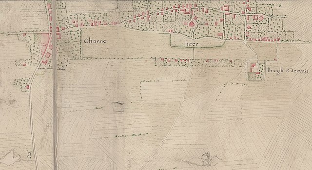
Detail of a map of Maastricht during the siege of 1748.
Summary edit
| Description |
Nederlands: Detail van een Franse kaart van Maastricht en omgeving tijdens het beleg van 1748. De uitsnede toont het dorp Heer en het gehucht Scharn ("Channe"). Aan de Scharnerweg (linksonder) het galgenveld. |
| Date | circa 1748 |
| Source | https://gallica.bnf.fr/ark:/12148/btv1b530997535/f1.item.r=Maestricht.zoom# |
| Author | unknown cartographer |
| Other versions |

Licensing edit
|
This work is in the public domain in its country of origin and other countries and areas where the copyright term is the author's life plus 70 years or fewer. This work is in the public domain in the United States because it was published (or registered with the U.S. Copyright Office) before January 1, 1929. | |
| This file has been identified as being free of known restrictions under copyright law, including all related and neighboring rights. | |
File history
Click on a date/time to view the file as it appeared at that time.
| Date/Time | Thumbnail | Dimensions | User | Comment | |
|---|---|---|---|---|---|
| current | 07:24, 25 October 2021 | | 3,849 × 2,099 (2.05 MB) | Kleon3 (talk | contribs) | Cropped 2 % vertically using CropTool with precise mode. |
| 07:22, 25 October 2021 |  | 3,849 × 2,133 (1.83 MB) | Kleon3 (talk | contribs) | Uploaded a work by unknown cartographer from https://gallica.bnf.fr/ark:/12148/btv1b530997535/f1.item.r=Maestricht.zoom# with UploadWizard |
You cannot overwrite this file.
File usage on Commons
The following page uses this file:
File usage on other wikis
The following other wikis use this file:
- Usage on nl.wikipedia.org