File:Plan de Paris et de ses environs. 1565 - Gallica.jpg
Size of this preview: 800 × 581 pixels. Other resolutions: 320 × 233 pixels | 640 × 465 pixels | 1,024 × 744 pixels | 1,280 × 930 pixels | 2,560 × 1,861 pixels | 5,856 × 4,256 pixels.
Original file (5,856 × 4,256 pixels, file size: 4 MB, MIME type: image/jpeg)
Captions
Captions
Add a one-line explanation of what this file represents
Summary edit
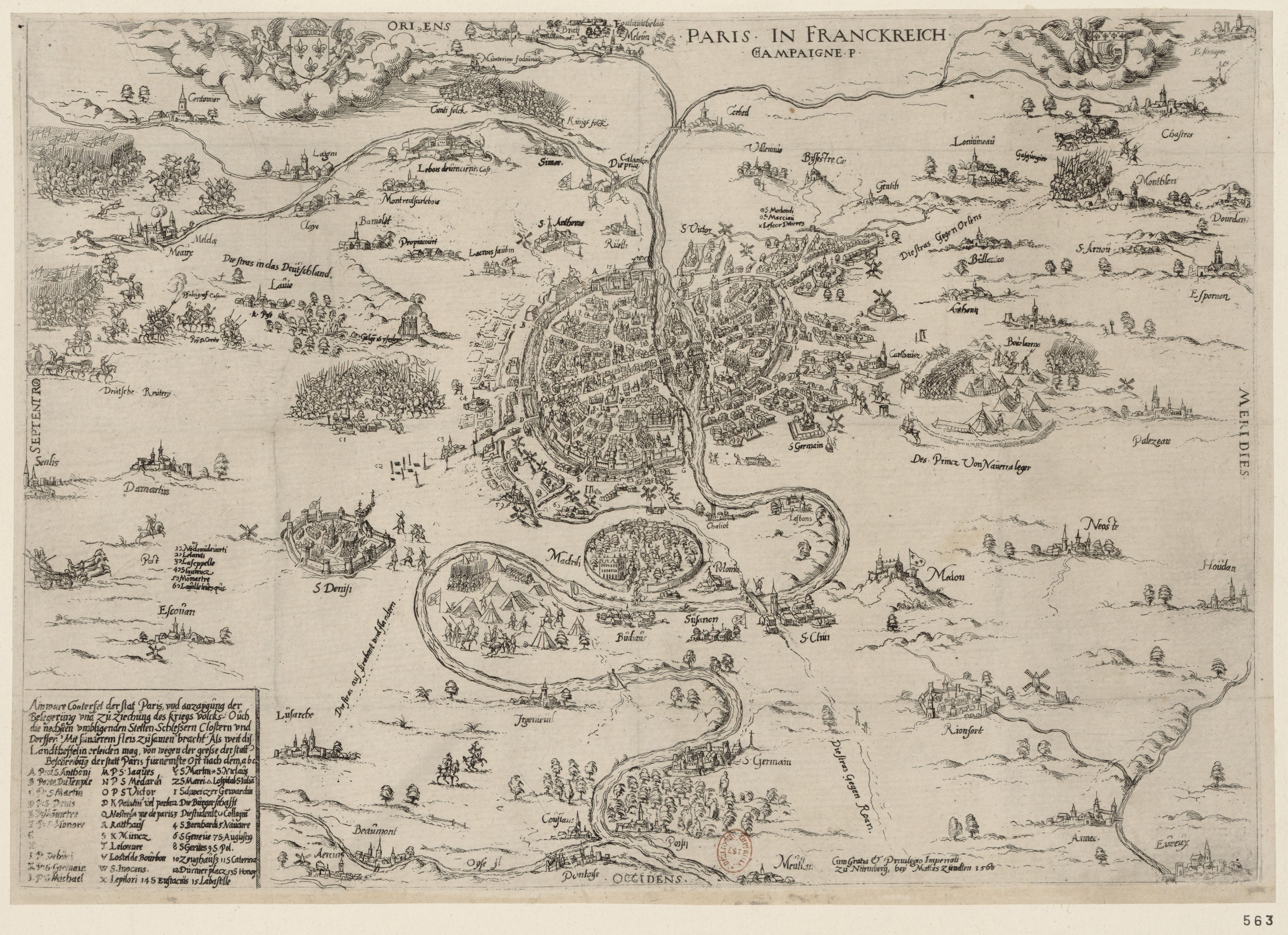
| Title |
Français : Plan de Paris et de ses environs. 1565 |
||||||||||||||||||||||||||
| Description |
An old map of Paris. |
||||||||||||||||||||||||||
| Date | |||||||||||||||||||||||||||
| Source |
|
||||||||||||||||||||||||||
| Creator |
Unknown author |
||||||||||||||||||||||||||
| Geotemporal data | |||||||||||||||||||||||||||
| Date depicted | |||||||||||||||||||||||||||
| Map location | Paris | ||||||||||||||||||||||||||
| Georeferencing | If inappropriate please set warp_status = skip to hide. | ||||||||||||||||||||||||||
| Bibliographic data | |||||||||||||||||||||||||||
| Language | french | ||||||||||||||||||||||||||
| Publisher |
Cum gratia et privilegio Imperiali zu Nurmberg bey Mathis Zundten. [1565] |
||||||||||||||||||||||||||
| Archival data | |||||||||||||||||||||||||||
| Collection |
|
||||||||||||||||||||||||||
| Medium | engraving | ||||||||||||||||||||||||||
| Other versions | |||||||||||||||||||||||||||
| Keywords | Français : Plan • environs de Paris • 1565 |
||||||||||||||||||||||||||

Licensing edit
|
This work is in the public domain in its country of origin and other countries and areas where the copyright term is the author's life plus 100 years or fewer. | |
| This file has been identified as being free of known restrictions under copyright law, including all related and neighboring rights. | |
File history
Click on a date/time to view the file as it appeared at that time.
| Date/Time | Thumbnail | Dimensions | User | Comment | |
|---|---|---|---|---|---|
| current | 17:00, 5 July 2020 | | 5,856 × 4,256 (4 MB) | Paris 16 (talk | contribs) | Uploaded own work with UploadWizard |
You cannot overwrite this file.
File usage on Commons
The following page uses this file: