File:Plan de la cathedrale Bayeux 1852 Archives nationales France.jpg

Size of this preview: 800 × 529 pixels. Other resolutions: 320 × 212 pixels | 640 × 424 pixels | 1,024 × 678 pixels | 1,280 × 847 pixels | 2,560 × 1,694 pixels | 6,152 × 4,071 pixels.
Original file (6,152 × 4,071 pixels, file size: 5.96 MB, MIME type: image/jpeg)
Captions
Captions
Add a one-line explanation of what this file represents
Summary
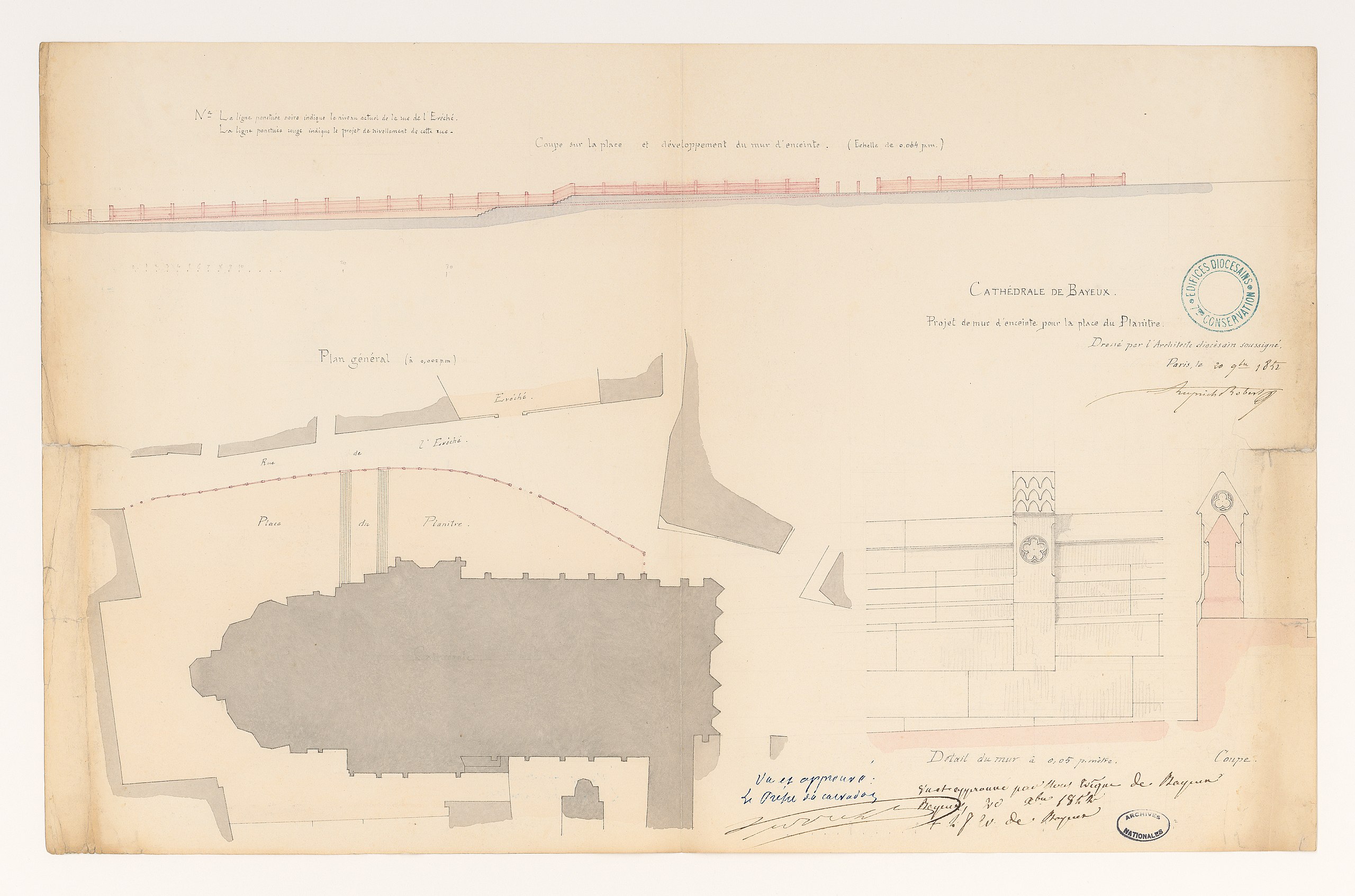
edit| Victor Ruprich-Robert: Q65008394
|
||||||||||||||||||||||||
|---|---|---|---|---|---|---|---|---|---|---|---|---|---|---|---|---|---|---|---|---|---|---|---|---|
| Artist |
|
 | ||||||||||||||||||||||
| Title |
French: Projet de mur d'enceinte pour la place de Planitre de Bayeux |
|||||||||||||||||||||||
| Part of |
Sub-series F/19 of the Archives nationales |
|||||||||||||||||||||||
| Object type |
drawing / architectural plan |
|||||||||||||||||||||||
| Description |
Projet de mur d'enceinte pour la place de Planitre. Plan issu des dossiers de travaux de restauration des cathédrales (1802-1912), conservés aux Archives nationales (inventaire et autres documents numérisés consultables en ligne). |
|||||||||||||||||||||||
| Date |
20 November 1852 |
|||||||||||||||||||||||
| Medium |
paper and ink |
|||||||||||||||||||||||
| Dimensions |
height: 31.3 cm (12.3 in) |
|||||||||||||||||||||||
| Collection |
|
|||||||||||||||||||||||
| Accession number |
CP/F/19/7629, Plan 1 (Archives nationales) |
|||||||||||||||||||||||
| Object location |
|
|||||||||||||||||||||||
| Place of creation | Bayeux | |||||||||||||||||||||||
| References |
http://www.siv.archives-nationales.culture.gouv.fr/siv/UD/FRAN_IR_054873/c-lru22lgi--15j5v575k046m |
|||||||||||||||||||||||
| Source/Photographer |
|
|||||||||||||||||||||||
| Permission (Reusing this file) |
|
|||||||||||||||||||||||

| Object location | | View this and other nearby images on: OpenStreetMap |
|---|
File history
Click on a date/time to view the file as it appeared at that time.
| Date/Time | Thumbnail | Dimensions | User | Comment | |
|---|---|---|---|---|---|
| current | 14:38, 26 June 2018 | | 6,152 × 4,071 (5.96 MB) | Archives nationales DJI (talk | contribs) | Téléversé avec ComeOn! 3.5.1 |
You cannot overwrite this file.
File usage on Commons
The following 2 pages use this file:
File usage on other wikis
The following other wikis use this file:
- Usage on fr.wikipedia.org
- Usage on www.wikidata.org