File:Plan de la citadelle de Tournai 1669.jpg

Original file (2,592 × 3,904 pixels, file size: 1.36 MB, MIME type: image/jpeg)
Captions
Captions
Summary
edit| Title |
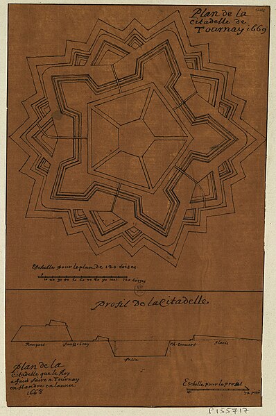
Français : Plan de la citadelle de Tournay, 1669. |
||||
| Date | |||||
| Source |
|
||||
| Creator |
Sébastien Pontault de Beaulieu |
||||
| Permission (Reusing this file) |
|
||||
| Geotemporal data | |||||
| Date depicted | |||||
| Map location | Tournai | ||||
| Georeferencing | If inappropriate please set warp_status = skip to hide. | ||||
| Bibliographic data | |||||
| Language | French | ||||
| Other versions |
|
||||
.svg)
Licensing
edit
|
This work is in the public domain in its country of origin and other countries and areas where the copyright term is the author's life plus 70 years or fewer.
| |
| This file has been identified as being free of known restrictions under copyright law, including all related and neighboring rights. | |
File history
Click on a date/time to view the file as it appeared at that time.
| Date/Time | Thumbnail | Dimensions | User | Comment | |
|---|---|---|---|---|---|
| current | 17:26, 10 October 2019 | | 2,592 × 3,904 (1.36 MB) | Arflhn (talk | contribs) | User created page with UploadWizard |
You cannot overwrite this file.
File usage on Commons
The following 3 pages use this file: