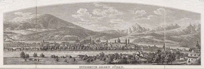
File:Plan der kk Provinzial-Hauptstadt Innsbruck (Innsbruck gegen Süden).png

Original file (2,060 × 700 pixels, file size: 4.13 MB, MIME type: image/png)
Captions
Captions
Summary
edit| DescriptionPlan der kk Provinzial-Hauptstadt Innsbruck (Innsbruck gegen Süden).png |
Plan der kaiserl. koenigl. Provinzial Hauptstadt Innsbruck u. der nächsten Umgebungen — Innsbruck gegen Süden Deutsch: Plan der k.k. Provinzialhauptstadt Innsbruck und der nächsten Umgebungen: Detail Innsbruck gegen Süden
English: Map of Imperial and Royal Provincial Capital Innsbruck and surroundings: detail Innsbruck, viewing south |
| Date |
19th century date QS:P,+1850-00-00T00:00:00Z/7 |
| Source |
NL, Universiteitsbibliotheek Vrije Universiteit, LL.04961gk: 166/od/1866; http://imagebase.ubvu.vu.nl/getobj.php?ppn=330024280 This file was derived from: Plan der kk Privinzial-Hauptstadt Innsbruck.jpg: |
| Author |
Unknown authorUnknown author: nonymous
|
| This is a retouched picture, which means that it has been digitally altered from its original version. Modifications: cutout, part sheets (originally applied to linen) stiched. The original can be viewed here: Plan der kk Privinzial-Hauptstadt Innsbruck.jpg:
|
Licensing
edit| Public domainPublic domainfalsefalse |
|
This work is in the public domain in its country of origin and other countries and areas where the copyright term is the author's life plus 70 years or fewer. Note that a few countries have copyright terms longer than 70 years: Mexico has 100 years, Jamaica has 95 years, Colombia has 80 years, and Guatemala and Samoa have 75 years. This image may not be in the public domain in these countries, which moreover do not implement the rule of the shorter term. Honduras has a general copyright term of 75 years, but it does implement the rule of the shorter term. Copyright may extend on works created by French who died for France in World War II (more information), Russians who served in the Eastern Front of World War II (known as the Great Patriotic War in Russia) and posthumously rehabilitated victims of Soviet repressions (more information).
| |
| This file has been identified as being free of known restrictions under copyright law, including all related and neighboring rights. | |
https://creativecommons.org/publicdomain/mark/1.0/PDMCreative Commons Public Domain Mark 1.0falsefalse
File history
Click on a date/time to view the file as it appeared at that time.
| Date/Time | Thumbnail | Dimensions | User | Comment | |
|---|---|---|---|---|---|
| current | 12:13, 15 October 2012 | 2,060 × 700 (4.13 MB) | W!B: (talk | contribs) | User created page with UploadWizard |
You cannot overwrite this file.
File usage on Commons
The following page uses this file:
Metadata
This file contains additional information such as Exif metadata which may have been added by the digital camera, scanner, or software program used to create or digitize it. If the file has been modified from its original state, some details such as the timestamp may not fully reflect those of the original file. The timestamp is only as accurate as the clock in the camera, and it may be completely wrong.
| Horizontal resolution | 118.11 dpc |
|---|---|
| Vertical resolution | 118.11 dpc |
| File change date and time | 20:39, 15 October 2012 |