File:Plan du fort anglois de Whidah - btv1b53168786r.jpg
Size of this preview: 452 × 599 pixels. Other resolutions: 181 × 240 pixels | 362 × 480 pixels | 579 × 768 pixels | 772 × 1,024 pixels | 1,545 × 2,048 pixels | 3,719 × 4,929 pixels.
Original file (3,719 × 4,929 pixels, file size: 2.1 MB, MIME type: image/jpeg)
Captions
Captions
Add a one-line explanation of what this file represents
Summary edit
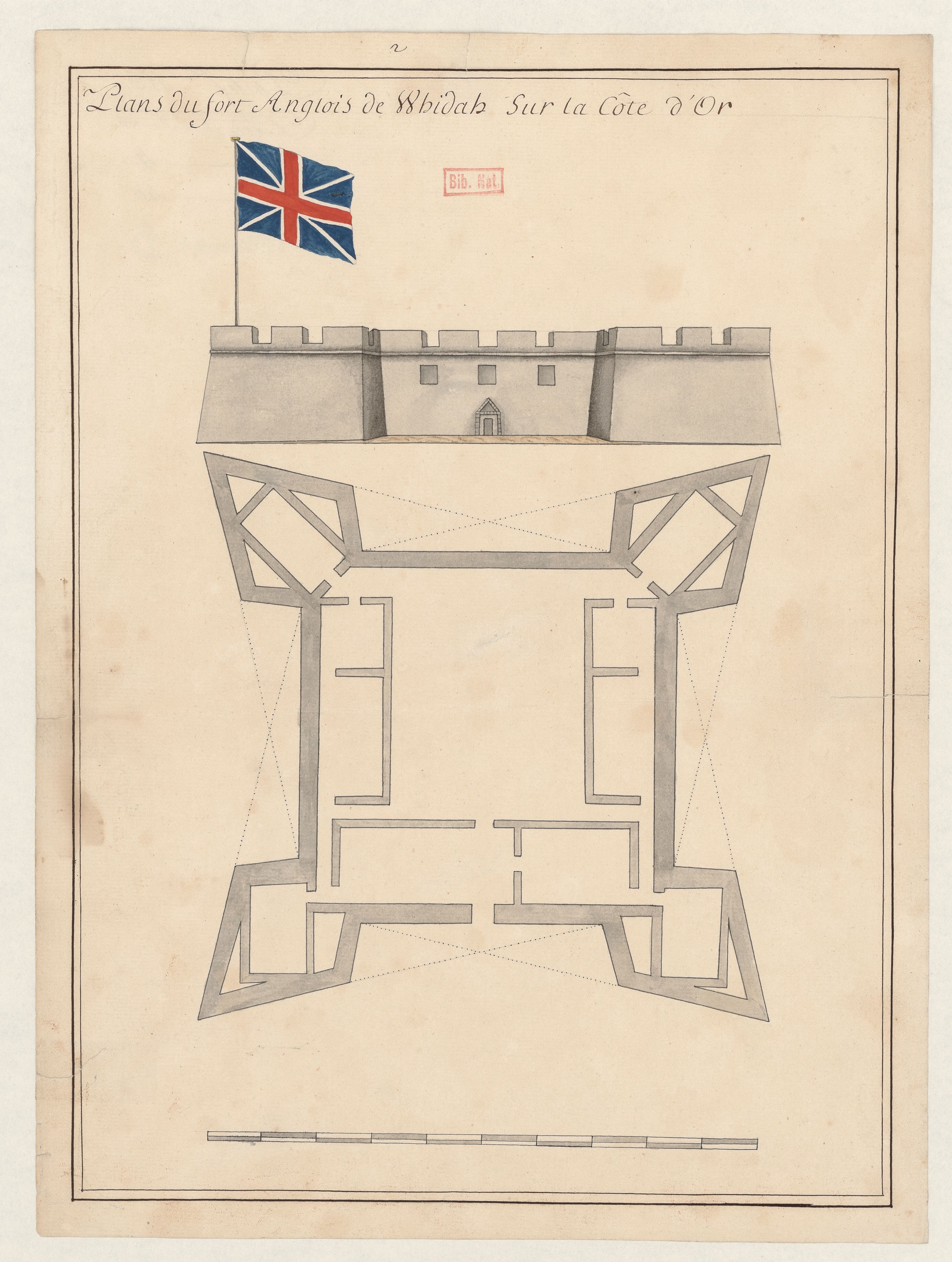
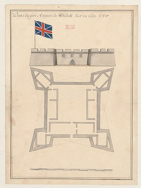
| Plan du fort anglois de Whidah
( |
|||||||||||||||||||||||||||
|---|---|---|---|---|---|---|---|---|---|---|---|---|---|---|---|---|---|---|---|---|---|---|---|---|---|---|---|
| Title |
Plan du fort anglois de Whidah |
||||||||||||||||||||||||||
| Description |
Français : Langue : français |
||||||||||||||||||||||||||
| Date | 18th century | ||||||||||||||||||||||||||
| Dimensions | height: 27 cm (10.6 in); width: 37.5 cm (14.7 in) | ||||||||||||||||||||||||||
| Collection |
|
||||||||||||||||||||||||||
| References |
Français : Notice de recueil : http://catalogue.bnf.fr/ark:/12148/cb43578106g
Appartient à : [Division 4 du portefeuille 113 du Service hydrographique de la marine consacrée aux côtes occidentales d'Afrique du cap des Trois-Pointes au cap Formose] ; 40 D Notice du catalogue : http://catalogue.bnf.fr/ark:/12148/cb435790111 |
||||||||||||||||||||||||||
| Source/Photographer |
Français : Bibliothèque nationale de France, département Cartes et plans, GE SH 18 PF 113 DIV 4 P 40 D
Bibliothèque nationale de France |
||||||||||||||||||||||||||
| Permission (Reusing this file) |
|
||||||||||||||||||||||||||

File history
Click on a date/time to view the file as it appeared at that time.
| Date/Time | Thumbnail | Dimensions | User | Comment | |
|---|---|---|---|---|---|
| current | 21:57, 14 July 2022 | | 3,719 × 4,929 (2.1 MB) | Gzen92Bot (talk | contribs) | Gallica btv1b53168786r |
You cannot overwrite this file.
File usage on Commons
The following page uses this file: