File:Plan of En Esur.svg

Size of this PNG preview of this SVG file: 425 × 567 pixels. Other resolutions: 180 × 240 pixels | 360 × 480 pixels | 576 × 768 pixels | 767 × 1,024 pixels | 1,535 × 2,048 pixels.
Original file (SVG file, nominally 425 × 567 pixels, file size: 86 KB)
Captions
Captions
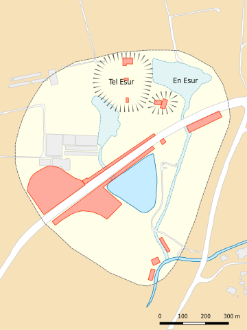
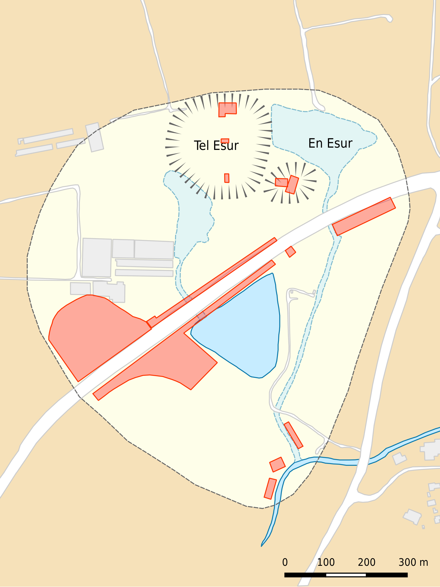
Plan of the archaeological site of En Esur (Ein Asawir) and its immediate surroundings.
Summary
edit
| Description |
English: Plan of the archaeological site of En Esur (Ein Asawir) showing its immediate surroundings and the areas excavated as of 2019. The site encompasses two tells (including Tel Esur) and two springs (including En Esur) on either side of Highway 65 between Pardes Hanna-Karkur and Ar'ara in Haifa District, Israel. In addition to the road, the site has been disturbed by modern developments including several buildings and a reservoir.
Extent of the site
Excavated areas
Rivers/reservoir
Springs/streams
Roads/tracks
Modern buildings
|
| Date | |
| Source | Own work |
| Author | Joe Roe |
| Camera location | | View this and other nearby images on: OpenStreetMap |
|---|
Licensing
edit
I, the copyright holder of this work, hereby publish it under the following license:
This file is licensed under the Creative Commons Attribution-Share Alike 4.0 International license.
- You are free:
- to share – to copy, distribute and transmit the work
- to remix – to adapt the work
- Under the following conditions:
- attribution – You must give appropriate credit, provide a link to the license, and indicate if changes were made. You may do so in any reasonable manner, but not in any way that suggests the licensor endorses you or your use.
- share alike – If you remix, transform, or build upon the material, you must distribute your contributions under the same or compatible license as the original.
File history
Click on a date/time to view the file as it appeared at that time.
| Date/Time | Thumbnail | Dimensions | User | Comment | |
|---|---|---|---|---|---|
| current | 14:56, 13 October 2019 | | 425 × 567 (86 KB) | Joe Roe (talk | contribs) | User created page with UploadWizard |
You cannot overwrite this file.
File usage on Commons
The following 2 pages use this file:
File usage on other wikis
The following other wikis use this file:
- Usage on ca.wikipedia.org
- Usage on en.wikipedia.org
- Usage on es.wikipedia.org
- Usage on www.wikidata.org