File:Plan of the subdivision of the lands on the Belle Anse road in the district of Gaspe, 1846.jpg
Size of this preview: 800 × 538 pixels. Other resolutions: 320 × 215 pixels | 640 × 430 pixels | 1,024 × 688 pixels | 1,280 × 860 pixels | 2,560 × 1,721 pixels | 7,112 × 4,781 pixels.
Original file (7,112 × 4,781 pixels, file size: 5.65 MB, MIME type: image/jpeg)
Captions
Captions
Add a one-line explanation of what this file represents
Summary
edit
| Description |
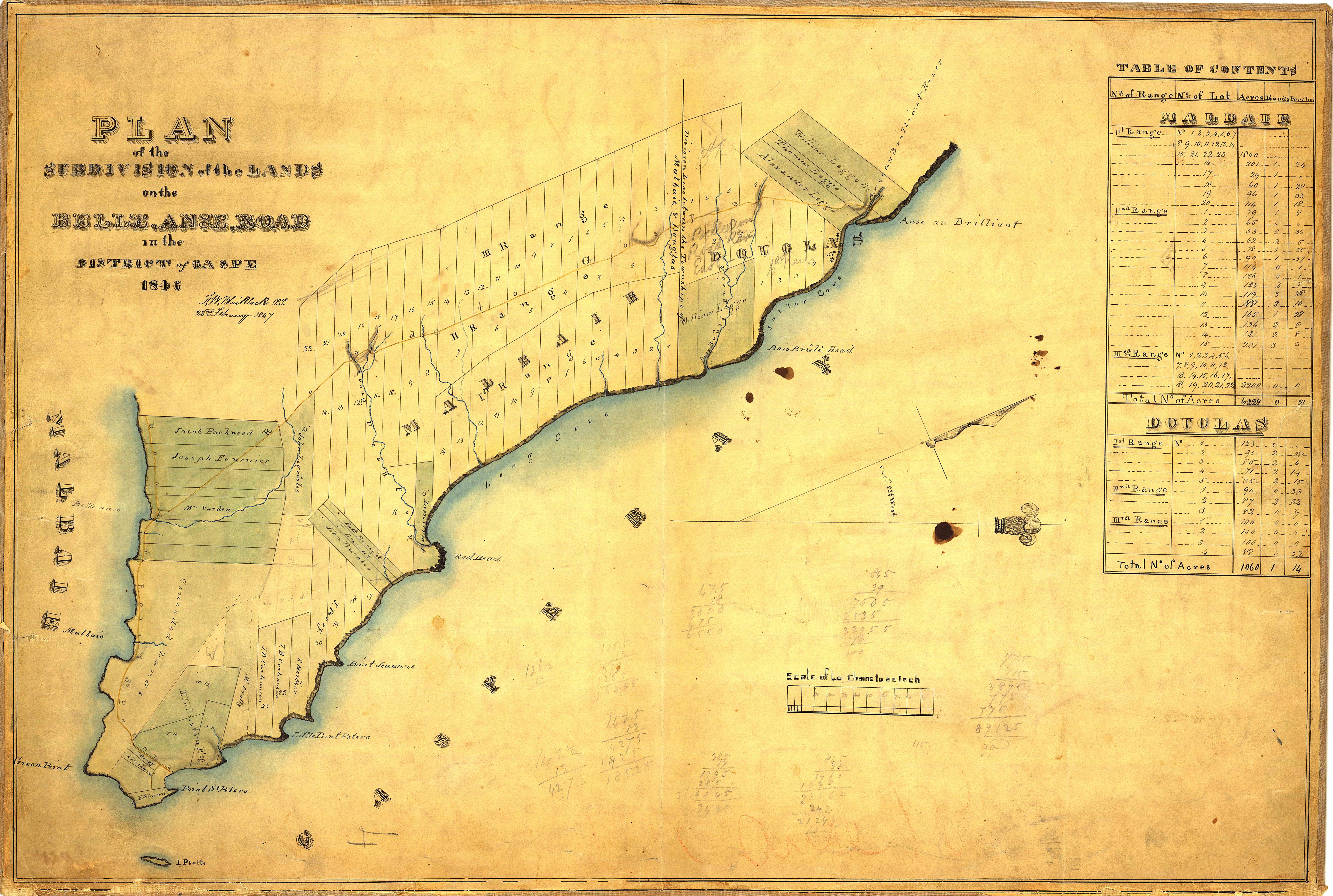
English: Plan of the subdivision of the lands on the Belle Anse road in the district of Gaspe. 1846. |
| Date | |
| Source | https://numerique.banq.qc.ca/patrimoine/details/52327/3473405 |
| Author | Frederick William Blaiklock |
Licensing
edit
|
This work is in the public domain in its country of origin and other countries and areas where the copyright term is the author's life plus 70 years or fewer. This work is in the public domain in the United States because it was published (or registered with the U.S. Copyright Office) before January 1, 1929. | |
| This file has been identified as being free of known restrictions under copyright law, including all related and neighboring rights. | |
File history
Click on a date/time to view the file as it appeared at that time.
| Date/Time | Thumbnail | Dimensions | User | Comment | |
|---|---|---|---|---|---|
| current | 23:04, 14 September 2021 | | 7,112 × 4,781 (5.65 MB) | Jeangagnon (talk | contribs) | Uploaded a work by Frederick William Blaiklock from https://numerique.banq.qc.ca/patrimoine/details/52327/3473405 with UploadWizard |
You cannot overwrite this file.
File usage on Commons
There are no pages that use this file.