File:Plano de la entrada de la Ria de Avilés hasta el fondeadero de San Juan (1913).pdf

Size of this JPG preview of this PDF file: 800 × 532 pixels. Other resolutions: 320 × 213 pixels | 640 × 426 pixels | 1,024 × 681 pixels | 1,280 × 852 pixels | 2,560 × 1,703 pixels | 6,181 × 4,112 pixels.
Original file (6,181 × 4,112 pixels, file size: 760 KB, MIME type: application/pdf)
Captions
Captions
Add a one-line explanation of what this file represents
Summary edit
| Description |
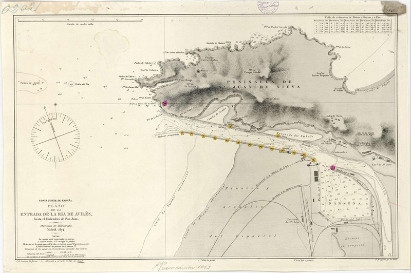
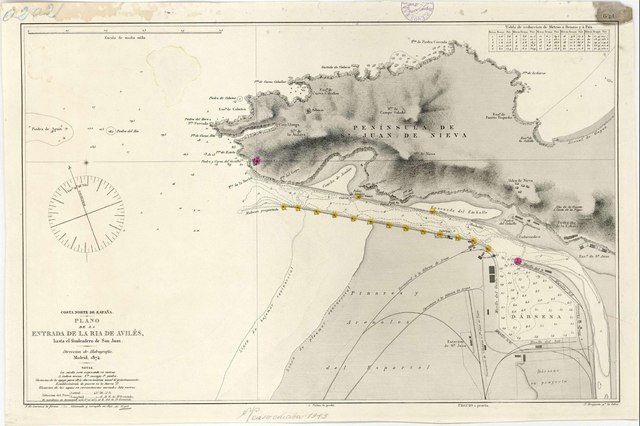
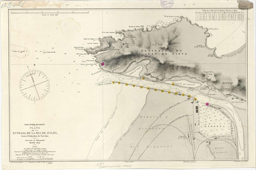
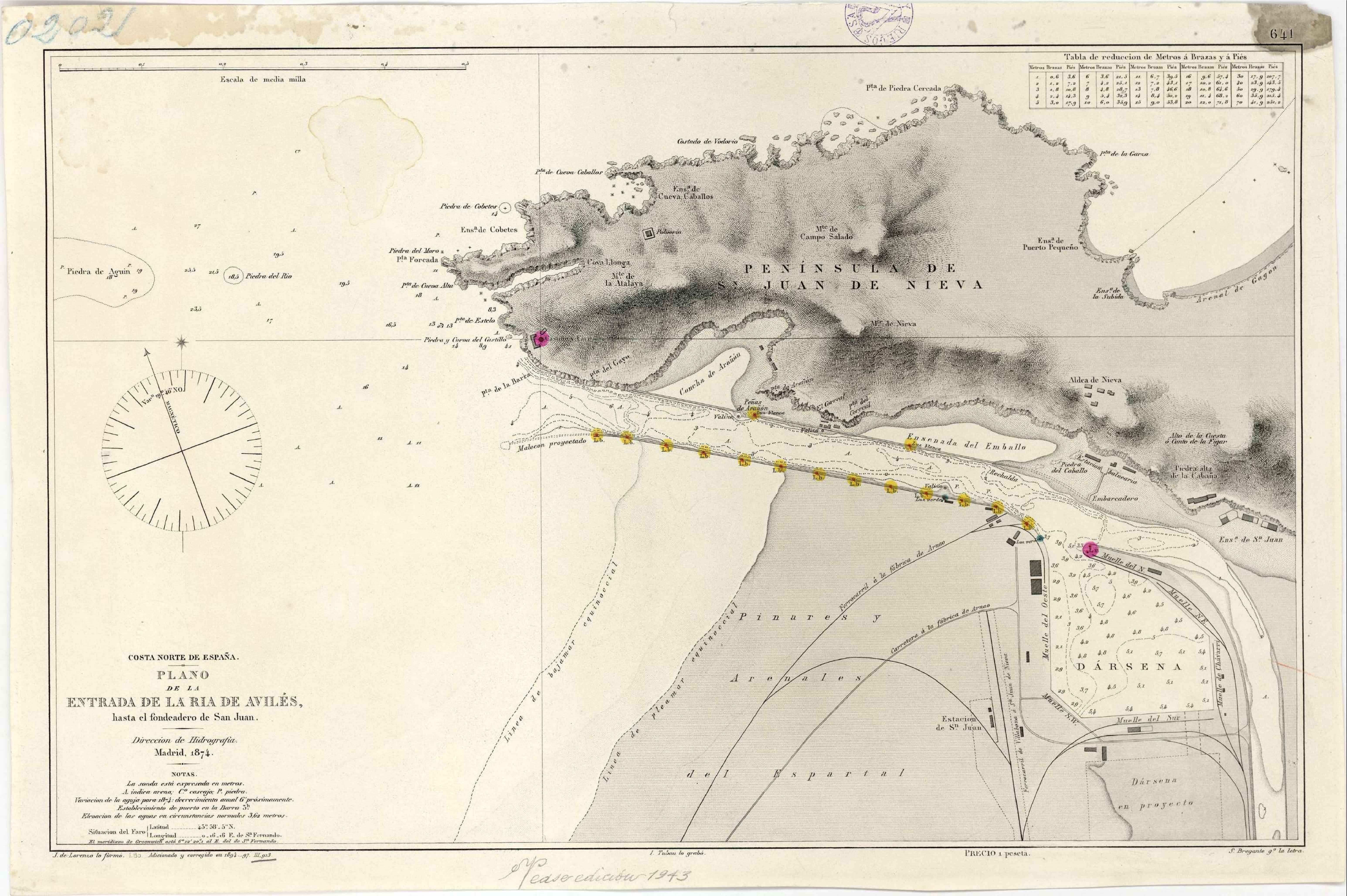
Español: Plano de la entrada de la Ria de Avilés hasta el fondeadero de San Juan / Direccion de Hidrografia Madrid 1874; J. de Lorenzo lo formó; I. Tubau lo grabó, S. Bregante gº la letra |
| Date | |
| Source | https://bibliotecavirtual.defensa.gob.es/BVMDefensa/es/consulta/registro.do?id=102383 |
| Creator |
José de Lorenzo (lo formó) Ignacio Tubau (lo grabó) S. Bregante y Martínez (la letra) Dirección de Hidrografía de España |
| Georeferencing | If inappropriate please set warp_status = skip to hide. |
Licensing edit
This file is licensed under the Creative Commons Attribution 4.0 International license.
- You are free:
- to share – to copy, distribute and transmit the work
- to remix – to adapt the work
- Under the following conditions:
- attribution – You must give appropriate credit, provide a link to the license, and indicate if changes were made. You may do so in any reasonable manner, but not in any way that suggests the licensor endorses you or your use.
File history
Click on a date/time to view the file as it appeared at that time.
| Date/Time | Thumbnail | Dimensions | User | Comment | |
|---|---|---|---|---|---|
| current | 20:19, 29 May 2021 |  | 6,181 × 4,112 (760 KB) | LMLM (talk | contribs) | Uploaded a work by José de Lorenzo (lo formó) Ignacio Tubau (lo grabó) S. Bregante y Martínez (la letra) Dirección de Hidrografía de España from https://bibliotecavirtual.defensa.gob.es/BVMDefensa/es/consulta/registro.do?id=102383 with UploadWizard |
You cannot overwrite this file.
File usage on Commons
There are no pages that use this file.
File usage on other wikis
The following other wikis use this file:
- Usage on es.wikipedia.org