File:Plano topographico del puerto de La Ceiba - btv1b530882525.jpg
Size of this preview: 800 × 588 pixels. Other resolutions: 320 × 235 pixels | 640 × 470 pixels | 1,024 × 753 pixels | 1,280 × 941 pixels | 2,560 × 1,882 pixels | 6,824 × 5,016 pixels.
Original file (6,824 × 5,016 pixels, file size: 4.12 MB, MIME type: image/jpeg)
Captions
Captions
Add a one-line explanation of what this file represents
Summary
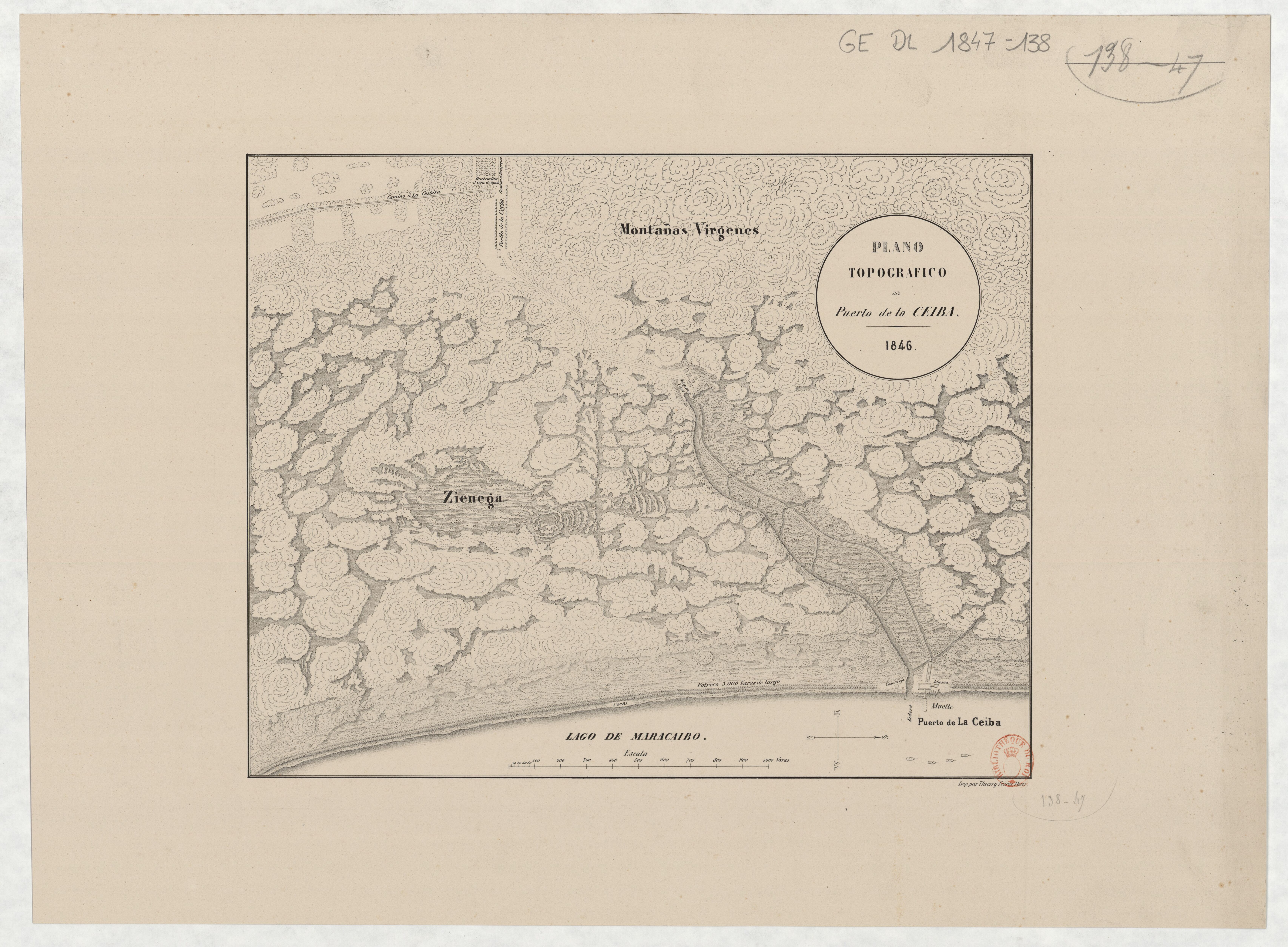
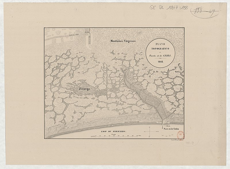
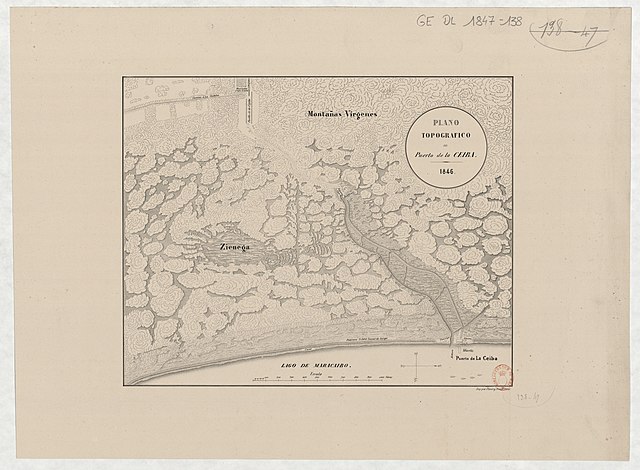
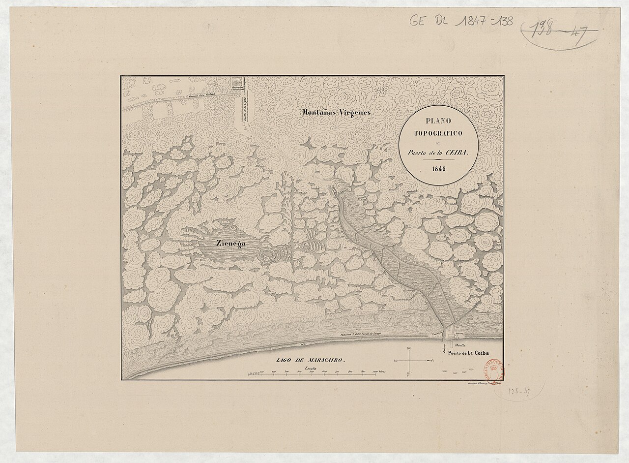
edit| Plano topographico del puerto de La Ceiba
( |
|||||||||||||||||||||||||||
|---|---|---|---|---|---|---|---|---|---|---|---|---|---|---|---|---|---|---|---|---|---|---|---|---|---|---|---|
| Title |
Plano topographico del puerto de La Ceiba |
||||||||||||||||||||||||||
| Description |
Français : Sujet : La Ceiba
Échelle(s) : [ca 1:7 200], 1 000 varas [= 11,7 cm] Couverture : Venezuela W 71°3' / N 9°28' Langue : espagnol Éditeur : [s.n.] |
||||||||||||||||||||||||||
| Date | 1846 | ||||||||||||||||||||||||||
| Dimensions | height: 35.5 cm (13.9 in); width: 28 cm (11 in) | ||||||||||||||||||||||||||
| Collection |
|
||||||||||||||||||||||||||
| References |
Français : Notice du catalogue : http://catalogue.bnf.fr/ark:/12148/cb43681039v |
||||||||||||||||||||||||||
| Source/Photographer |
Français : Bibliothèque nationale de France, département Cartes et plans, GE DL 1847-138
Bibliothèque nationale de France |
||||||||||||||||||||||||||
| Permission (Reusing this file) |
|
||||||||||||||||||||||||||

File history
Click on a date/time to view the file as it appeared at that time.
| Date/Time | Thumbnail | Dimensions | User | Comment | |
|---|---|---|---|---|---|
| current | 02:07, 20 August 2022 | | 6,824 × 5,016 (4.12 MB) | Gzen92Bot (talk | contribs) | Gallica btv1b530882525 |
You cannot overwrite this file.
File usage on Commons
The following page uses this file: