File:Plaque Maquis des Confins.jpg
Size of this preview: 800 × 600 pixels. Other resolutions: 320 × 240 pixels | 640 × 480 pixels | 1,024 × 768 pixels | 1,280 × 960 pixels | 2,560 × 1,920 pixels | 4,416 × 3,312 pixels.
Original file (4,416 × 3,312 pixels, file size: 1.98 MB, MIME type: image/jpeg)
Captions
Captions
Add a one-line explanation of what this file represents
Summary edit
| Description |
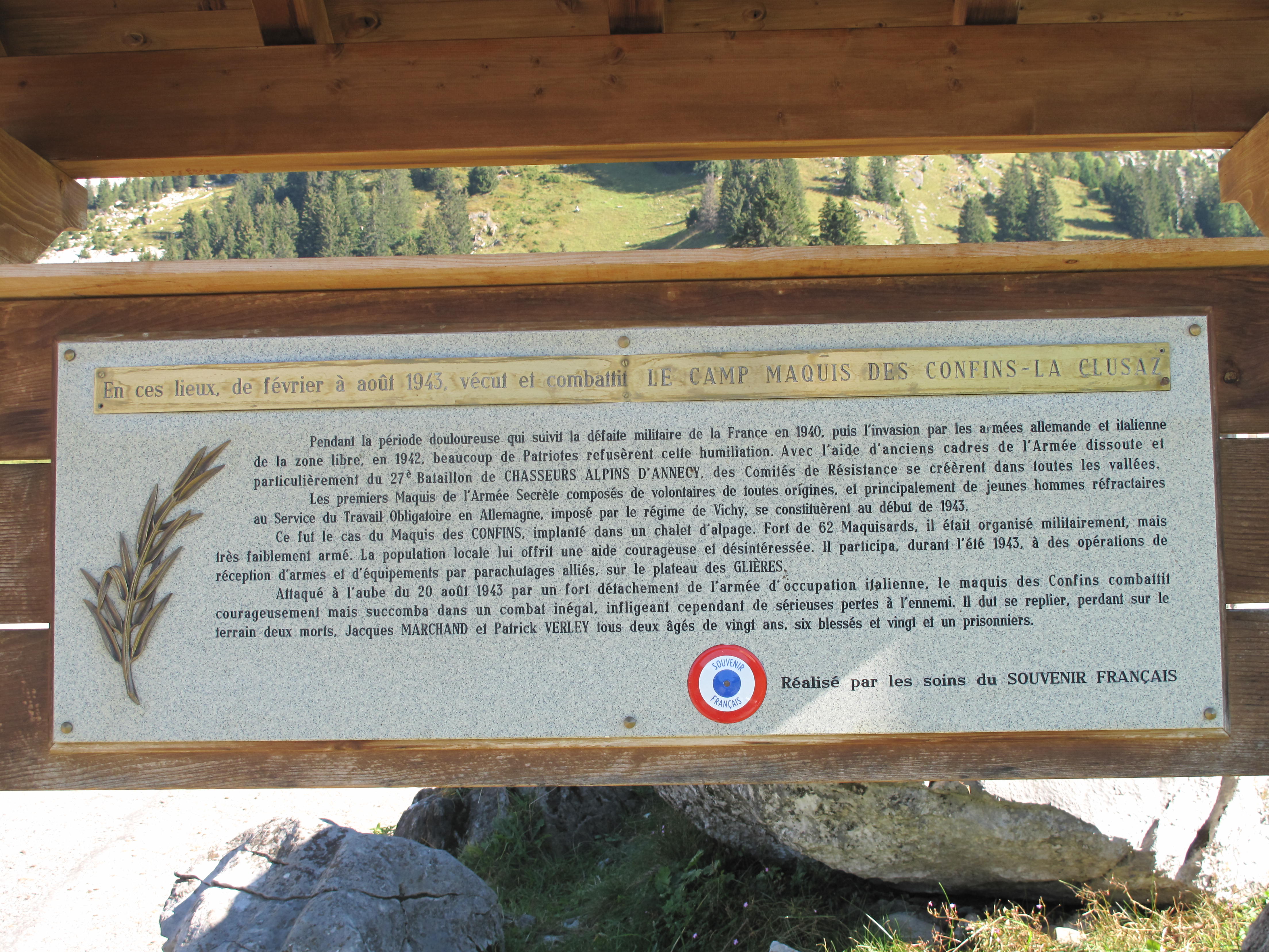
English: Closeup of the commemorative monument about the maquis des Confins (Haute-Savoie, France).
Français : Détail du monument commémoratif du maquis des Confins (Haute-Savoie). |
| Date | |
| Source | Own work |
| Author | Tangopaso |
| Other versions |
 |
| Camera location | | View this and other nearby images on: OpenStreetMap |
|---|
Licensing edit
| I, the copyright holder of this work, release this work into the public domain. This applies worldwide. In some countries this may not be legally possible; if so: I grant anyone the right to use this work for any purpose, without any conditions, unless such conditions are required by law. |
File history
Click on a date/time to view the file as it appeared at that time.
| Date/Time | Thumbnail | Dimensions | User | Comment | |
|---|---|---|---|---|---|
| current | 10:21, 15 December 2012 | | 4,416 × 3,312 (1.98 MB) | Tangopaso (talk | contribs) | {{Information |Description= {{en|1=Closeup of the commemorative monument about the maquis des Confins (Haute-Savoie, France).}} {{fr|1=Détail du monument commémoratif du maquis des Confins (Haute-Savoie).}} |Source={{own}} |Author=[[User:Tangopaso|Ta... |
You cannot overwrite this file.
File usage on Commons
The following page uses this file: