File:Plattegrond Maastricht, ca 1830 (RAL K 165) (crop1).jpg

Original file (1,936 × 1,229 pixels, file size: 1.18 MB, MIME type: image/jpeg)
Captions
Captions
Summary
edit| Description |
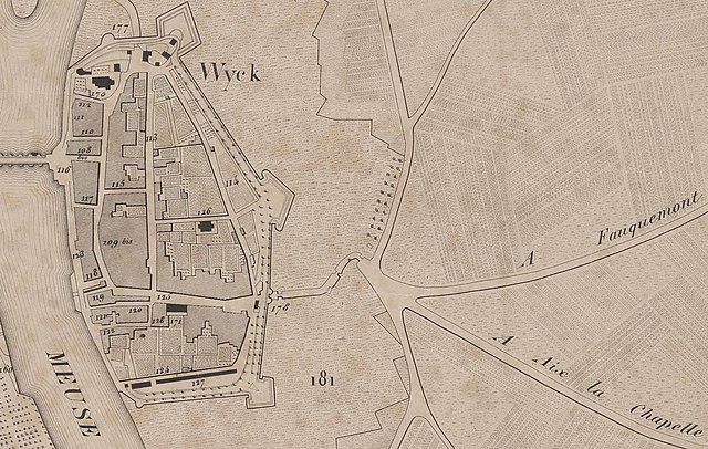
Nederlands: Detail van een plattegrond van Maastricht, omstreeks 1830. Deze uitsnede toont de wegen ten oosten van Wyck. Alle namen van straten en gebouwen zijn in het Frans. A Fauquemont = naar Valkenburg (de Scharnerweg). A Aix la Chapelle = naar Aken (de Heerderstraat, overgaand in de Akersteenweg). De weg naar het noorden is de latere Meerssenerweg, maar verschoof na de komst van de spoorwegen naar het oosten. In het zuiden de Heugemerweg met afsplitsing Gronsvelderweg. De van oorsprong Franse lithograaf Jobard werkte waarschijnlijk al in de Franse tijd bij het kadaster in de geannexeerde Nederlandse departementen, o.a. in Maastricht. Zijn uitgeverij was gevestigd in Brussel. Collectie RHCL Maastricht, RAL K 165. |
| Date | between 1825 and 1835 |
| Source | https://beeldbank.rhcl.nl/detail.php?nav_id=3-1&id=5756191&index=426 |
| Author | Marcellin Jobard (1792-1861), lithographer |
| Other versions |
.jpg)
_(crop1).jpg&action=edit§ion=1)
Licensing
edit_(crop1).jpg&action=edit§ion=2)
|
This work is in the public domain in its country of origin and other countries and areas where the copyright term is the author's life plus 70 years or fewer.
| |
| This file has been identified as being free of known restrictions under copyright law, including all related and neighboring rights. | |
File history
Click on a date/time to view the file as it appeared at that time.
| Date/Time | Thumbnail | Dimensions | User | Comment | |
|---|---|---|---|---|---|
| current | 13:45, 19 October 2021 | | 1,936 × 1,229 (1.18 MB) | Kleon3 (talk | contribs) | File:Plattegrond Maastricht, ca 1830 (RAL K 165).jpg cropped 73 % horizontally, 80 % vertically using CropTool with precise mode. |
You cannot overwrite this file.
File usage on Commons
The following page uses this file:
File usage on other wikis
The following other wikis use this file:
- Usage on nl.wikipedia.org
_(crop1).jpg&oldid=753974772)