File:Plazoleta Héroes de Malvinas en Lanús.jpg

Size of this preview: 800 × 449 pixels. Other resolutions: 320 × 180 pixels | 640 × 360 pixels | 1,024 × 575 pixels | 1,280 × 719 pixels | 2,592 × 1,456 pixels.
Original file (2,592 × 1,456 pixels, file size: 1.33 MB, MIME type: image/jpeg)
Captions
Captions
Add a one-line explanation of what this file represents
Summary edit
| Description |
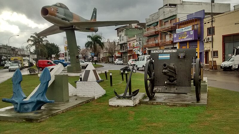
Español: Este monumento está ubicado en la plazoleta "Héroes de Malvinas" ubicada sobre la avenida Remedios de Escalada de San Martín, en la localidad de Lanús, provincia de Buenos Aires. Fue inaugurado por asociaciones de vecinos el 10 de junio de 1984. En el mismo observamos un avión F-86F de la Fuerza Aérea Argentina, un cañón representando al Ejército Argentino y un ancla de buque, donación de la Armada Argentina. El monumento conmemora a los soldados caídos en la Guerra de Malvinas del año 1982 entre Argentina y Gran Bretaña. Plazoleta Héroes de Malvinas en Lanús |
| Date | |
| Source | Own work |
| Author | Esteban Robles |
| Camera location | | View this and other nearby images on: OpenStreetMap |
|---|
Licensing edit
I, the copyright holder of this work, hereby publish it under the following license:
This file is licensed under the Creative Commons Attribution-Share Alike 4.0 International license.
- You are free:
- to share – to copy, distribute and transmit the work
- to remix – to adapt the work
- Under the following conditions:
- attribution – You must give appropriate credit, provide a link to the license, and indicate if changes were made. You may do so in any reasonable manner, but not in any way that suggests the licensor endorses you or your use.
- share alike – If you remix, transform, or build upon the material, you must distribute your contributions under the same or compatible license as the original.
File history
Click on a date/time to view the file as it appeared at that time.
| Date/Time | Thumbnail | Dimensions | User | Comment | |
|---|---|---|---|---|---|
| current | 17:19, 12 July 2017 | | 2,592 × 1,456 (1.33 MB) | Esteban robles (talk | contribs) | User created page with UploadWizard |
You cannot overwrite this file.
File usage on Commons
There are no pages that use this file.
File usage on other wikis
The following other wikis use this file:
- Usage on ja.wikipedia.org