File:Plymouth Street at its junction with Drove Road, Swindon - geograph.org.uk - 1726410.jpg

Size of this preview: 800 × 600 pixels. Other resolutions: 320 × 240 pixels | 640 × 480 pixels | 1,024 × 768 pixels | 1,280 × 960 pixels | 1,600 × 1,200 pixels.
Original file (1,600 × 1,200 pixels, file size: 523 KB, MIME type: image/jpeg)
Captions
Captions
Add a one-line explanation of what this file represents
Summary
edit
| Description |
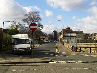
English: Plymouth Street at its junction with Drove Road, Swindon. Plymouth Street is part of what used to be known as the New Town part of Swindon. Although New Town still appears on some maps hardly anyone uses the name in contrast to the Old Town area, south of here and on a hill where, perhaps because it has some cachet, the term is commonly heard. Just visible to the right is the recently cleared site seen in this image 1726393 For a view along Plymouth Street see this image 1626896 At the left is a 2006-registered Ford Transit operated by BT. The Transit is perhaps the most ubiquitous 'white van' to be seen on Britain's road. It first appeared in the mid 1960s as a replacement for the Ford Thames. I haven't checked but I believe that the Transits are built in Slough or Southampton or perhaps both. |
| Date | |
| Source | From geograph.org.uk |
| Author | Brian Robert Marshall |
| Attribution (required by the license) | Brian Robert Marshall / Plymouth Street at its junction with Drove Road, Swindon / |
| Camera location | | View this and other nearby images on: OpenStreetMap |
|---|
_heading:270.00&language=en)
| Object location | | View this and other nearby images on: OpenStreetMap |
|---|
_heading:270.00&language=en)
Licensing
edit

|
This image was taken from the Geograph project collection. See this photograph's page on the Geograph website for the photographer's contact details. The copyright on this image is owned by Brian Robert Marshall and is licensed for reuse under the Creative Commons Attribution-ShareAlike 2.0 license.
|
This file is licensed under the Creative Commons Attribution-Share Alike 2.0 Generic license.
Attribution: Brian Robert Marshall
- You are free:
- to share – to copy, distribute and transmit the work
- to remix – to adapt the work
- Under the following conditions:
- attribution – You must give appropriate credit, provide a link to the license, and indicate if changes were made. You may do so in any reasonable manner, but not in any way that suggests the licensor endorses you or your use.
- share alike – If you remix, transform, or build upon the material, you must distribute your contributions under the same or compatible license as the original.
File history
Click on a date/time to view the file as it appeared at that time.
| Date/Time | Thumbnail | Dimensions | User | Comment | |
|---|---|---|---|---|---|
| current | 12:29, 5 March 2011 | | 1,600 × 1,200 (523 KB) | GeographBot (talk | contribs) | == {{int:filedesc}} == {{Information |description={{en|1=Plymouth Street at its junction with Drove Road, Swindon Plymouth Street is part of what used to be known as the New Town part of Swindon. Although New Town still appears on some maps hardly anyone |
You cannot overwrite this file.
File usage on Commons
There are no pages that use this file.