File:Po River Delta- ISS020-E-9731.JPG
Size of this preview: 800 × 547 pixels. Other resolutions: 320 × 219 pixels | 640 × 438 pixels | 1,024 × 701 pixels | 1,280 × 876 pixels | 2,560 × 1,752 pixels | 4,256 × 2,912 pixels.
Original file (4,256 × 2,912 pixels, file size: 867 KB, MIME type: image/jpeg)
Captions
Captions
Add a one-line explanation of what this file represents
Summary
edit
| Description |
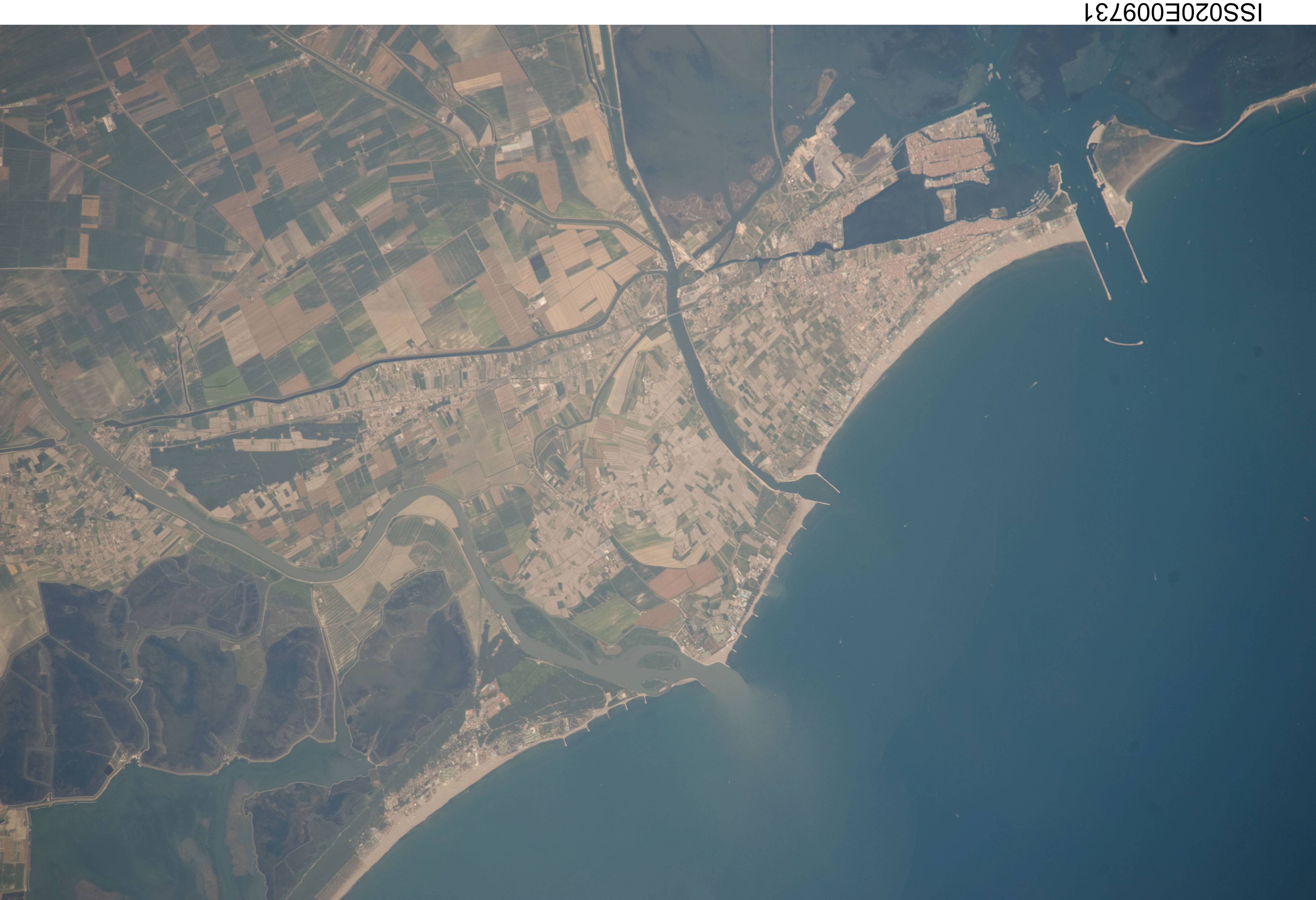
English: Delta of the Po River, Gulf of Venice and Chioggia. Satellital photo (NASA). Español: Delta de río Po, Golfo de Venecia y ChioGgia. Foto satelital (NASA). |
| Date | |
| Source | http://earth.jsc.nasa.gov/sseop/images/ESC/large/ISS020/ISS020-E-9731.JPG |
| Author |
NASA, Mission: ISS020 Roll: E Frame: 9731 Mission ID on the Film or image: ISS020 Country or Geographic Name: ITALY Features: N. PO RIVER DELTA, G. OF VENICE, AGR., CHIOGGIA |
| Camera location | | View this and other nearby images on: OpenStreetMap |
|---|
Nadir to Photo Center Direction: North Sun Azimuth: 216 (Clockwise angle in degrees from north to the sun measured at the nadir point) Spacecraft Altitude: 182 nautical miles (337 km) Sun Elevation Angle: 66 (Angle in degrees between the horizon and the sun, measured at the nadir point) Orbit Number: 537
Licensing
edit
| This file is in the public domain in the United States because it was solely created by NASA. NASA copyright policy states that "NASA material is not protected by copyright unless noted". (See Template:PD-USGov, NASA copyright policy page or JPL Image Use Policy.) | ||
 |
Warnings:
|
File history
Click on a date/time to view the file as it appeared at that time.
| Date/Time | Thumbnail | Dimensions | User | Comment | |
|---|---|---|---|---|---|
| current | 17:00, 21 November 2013 | | 4,256 × 2,912 (867 KB) | Rotatebot (talk | contribs) | Bot: Image rotated by 180° |
| 16:10, 21 November 2013 |  | 4,256 × 2,913 (878 KB) | Dorieo (talk | contribs) | User created page with UploadWizard |
You cannot overwrite this file.
File usage on Commons
The following 2 pages use this file:
File usage on other wikis
The following other wikis use this file:
- Usage on de.wikipedia.org
- Usage on vec.wikipedia.org