File:Pohnpei Island municipalities.jpg
Size of this preview: 567 × 599 pixels. Other resolutions: 227 × 240 pixels | 454 × 480 pixels | 727 × 768 pixels | 969 × 1,024 pixels | 1,939 × 2,048 pixels | 6,554 × 6,924 pixels.
Original file (6,554 × 6,924 pixels, file size: 15.63 MB, MIME type: image/jpeg)
Captions
Captions
Add a one-line explanation of what this file represents
Summary edit
| Description |
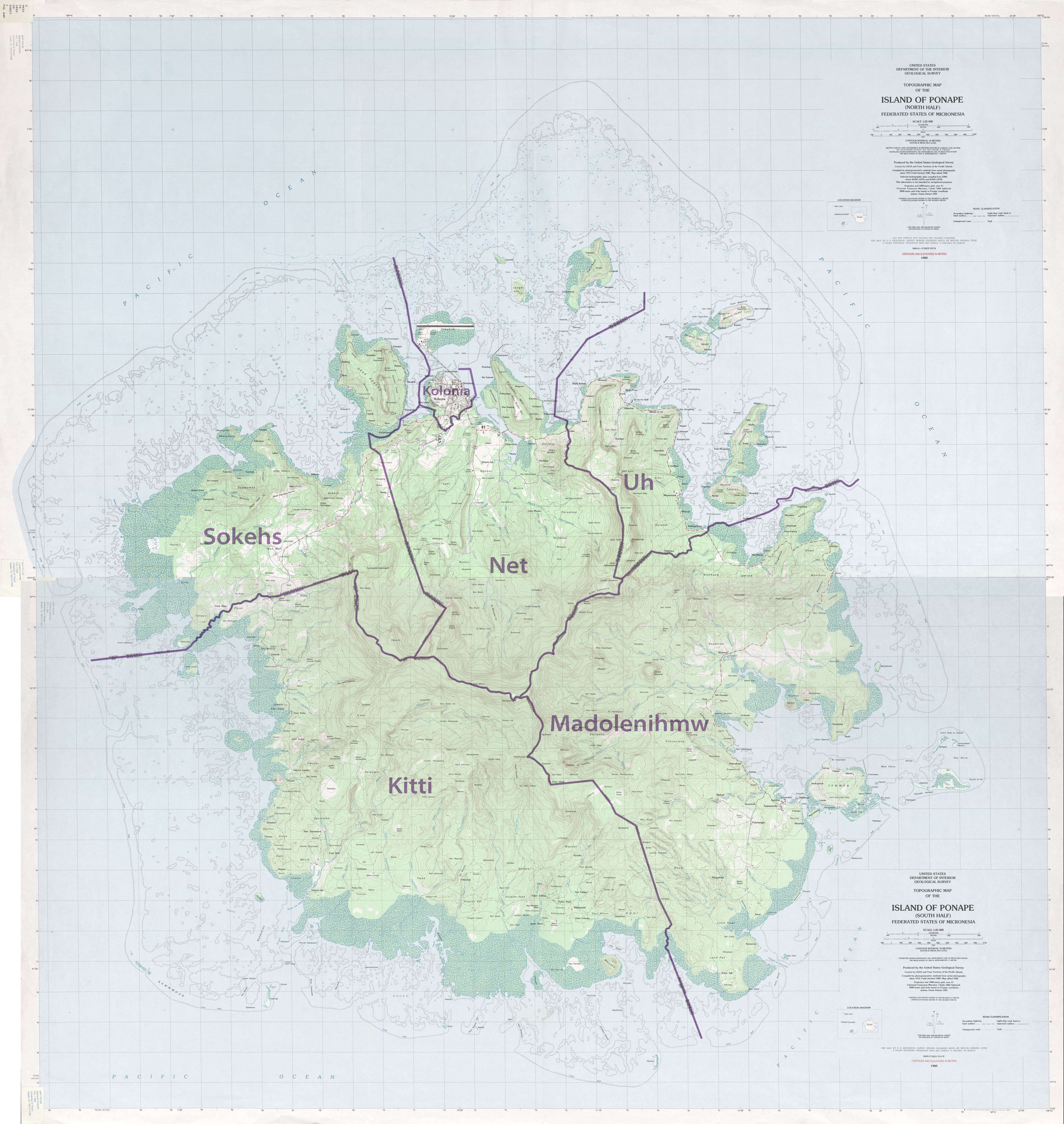
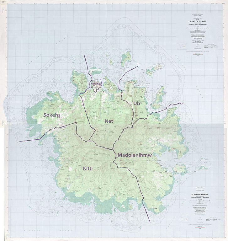
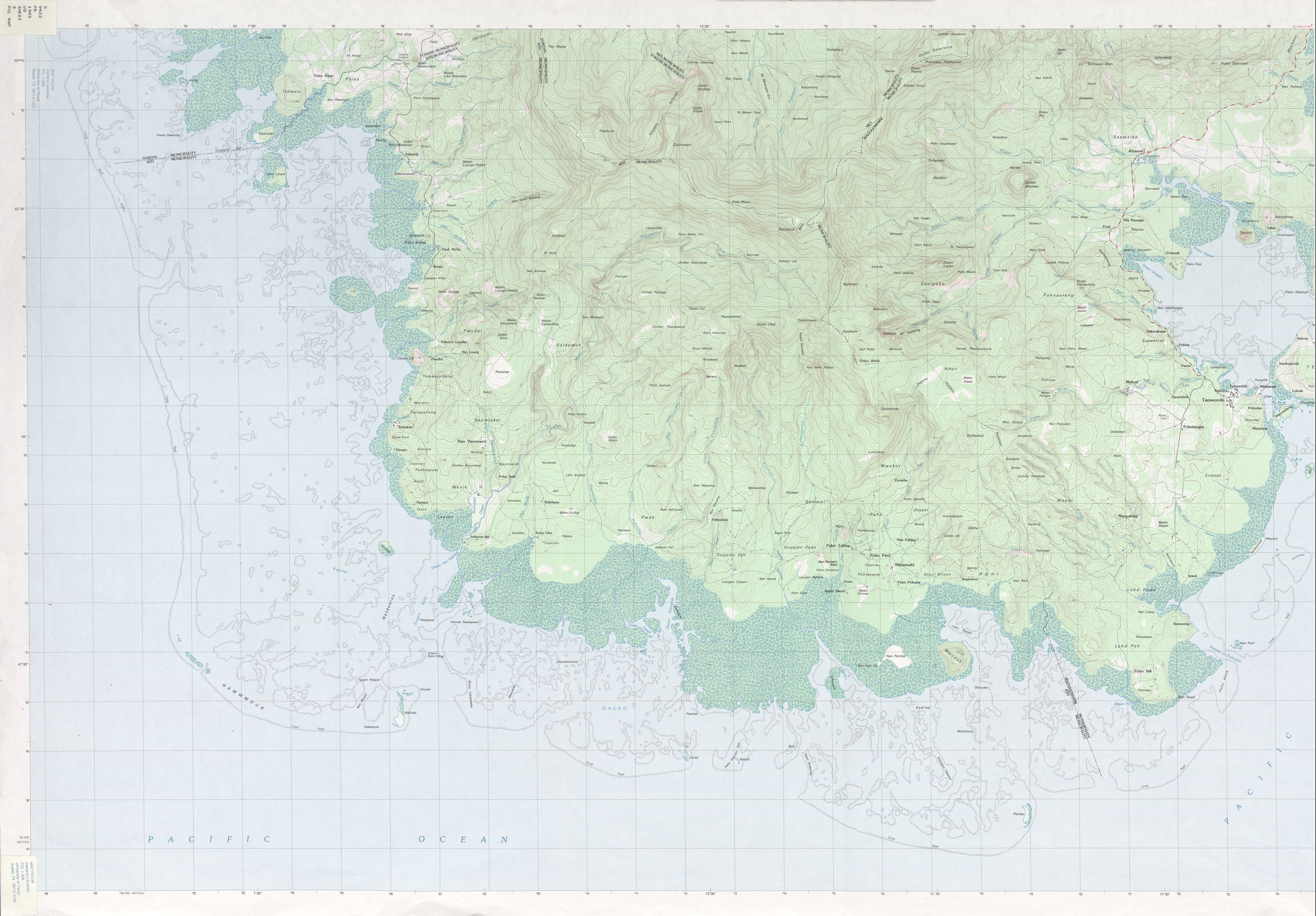
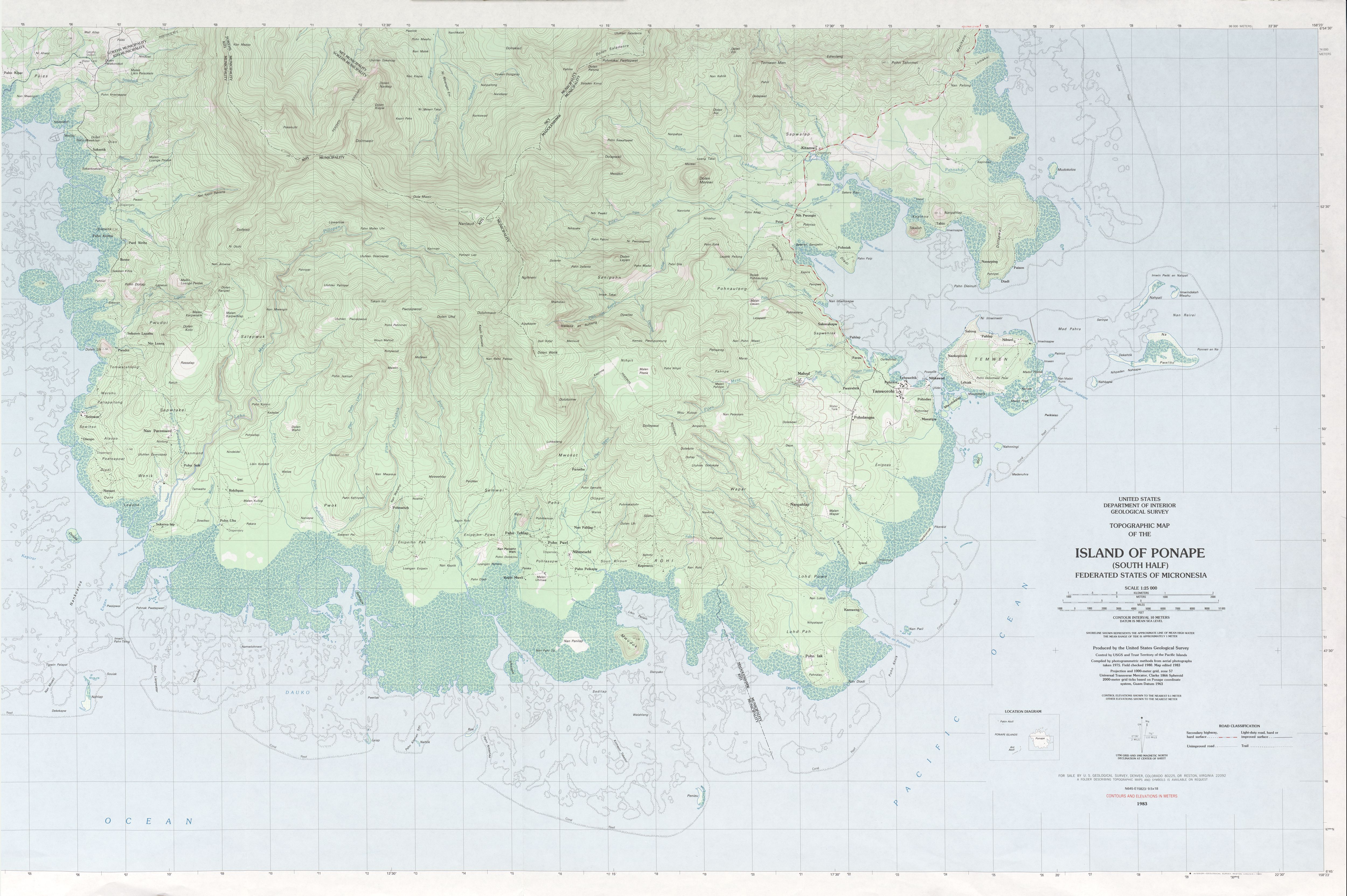
Deutsch: Pohnpei mit Gemeindegrenzen, Mikronesien, Pazifischer Ozean, vier Karten gestitcht
English: Pohnpei Island with municipality boundaries, Micronesia, Pacific Ocean, stitching of 4 maps |
|||
| Date | ||||
| Source |
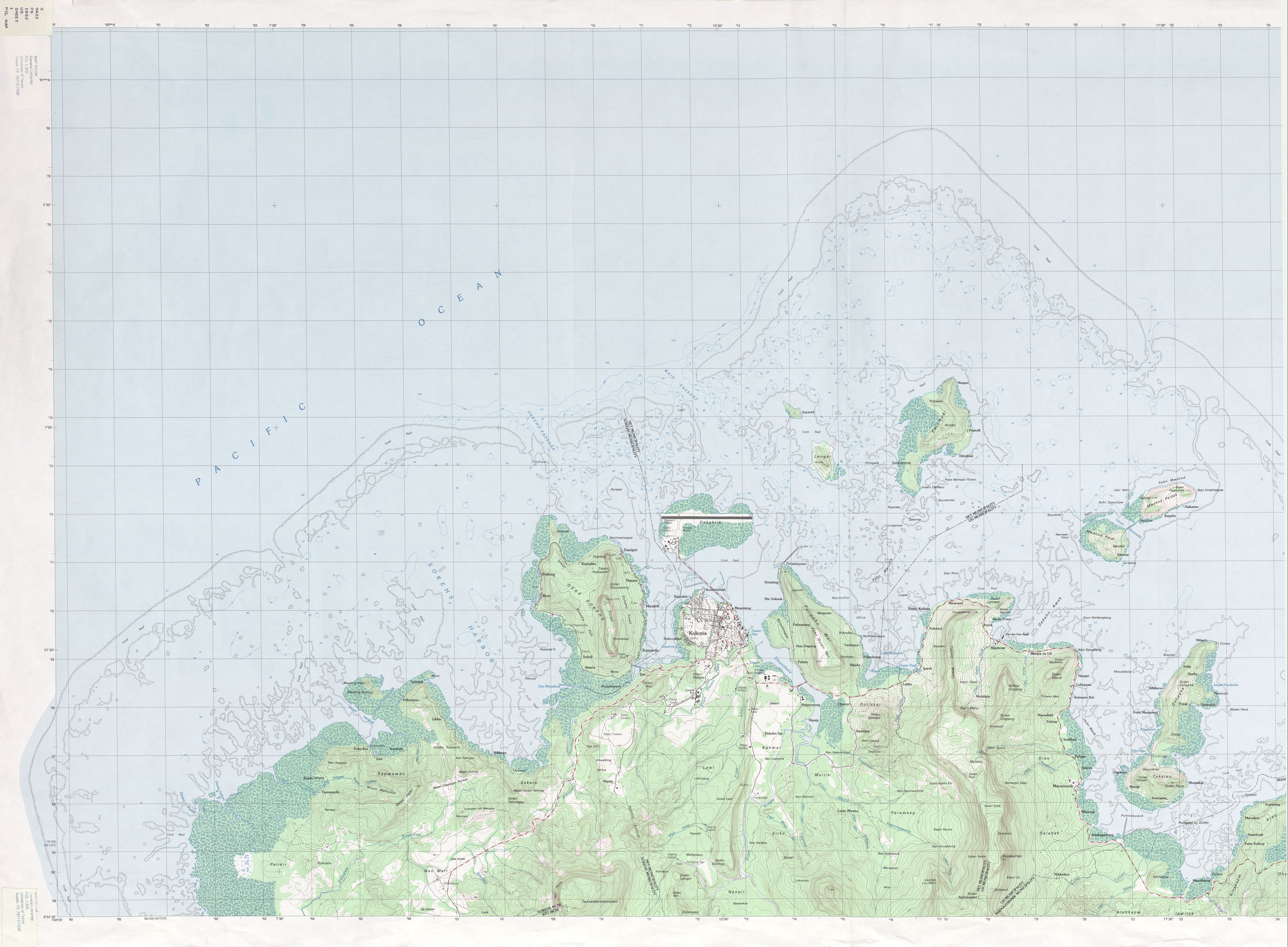
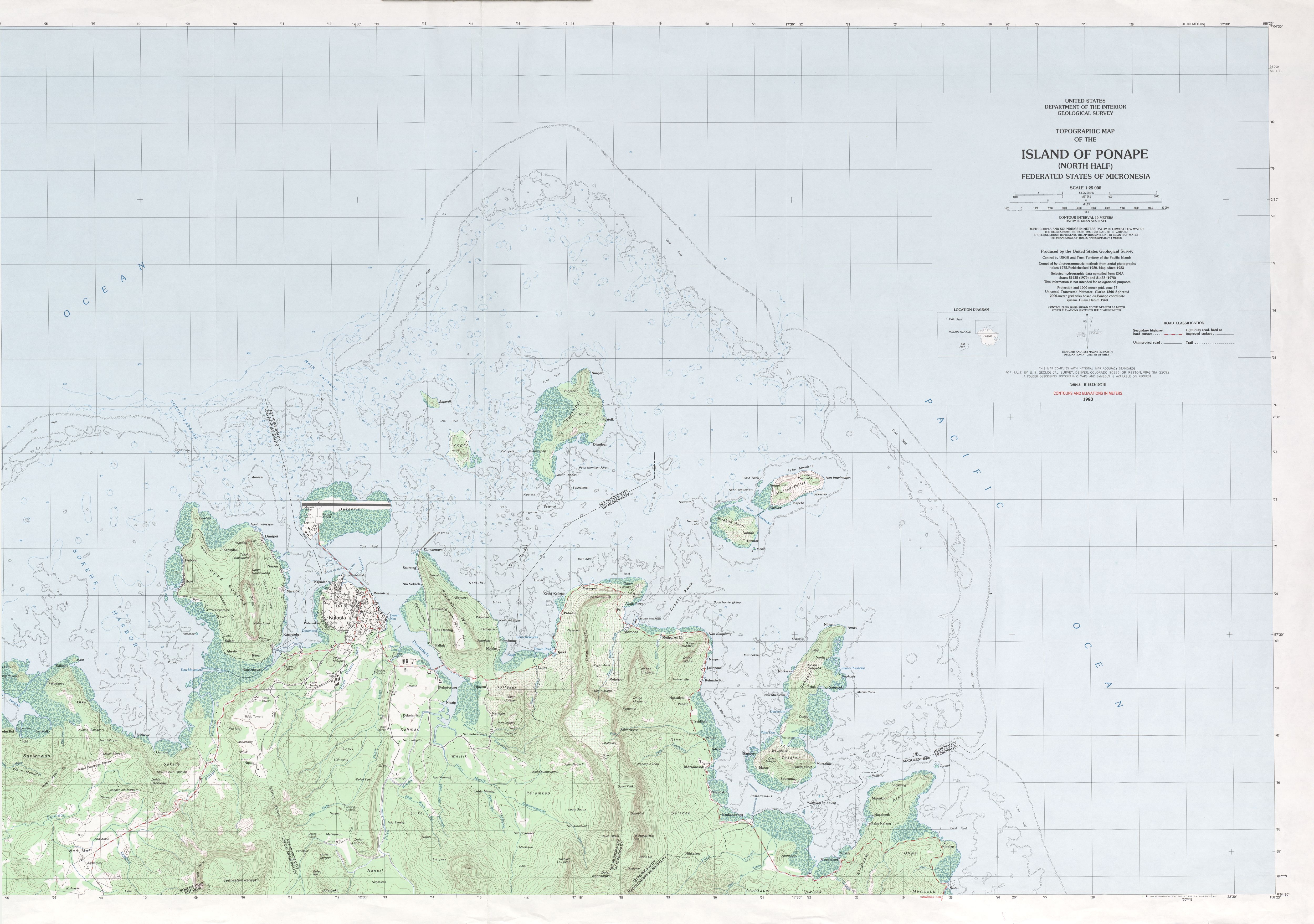
http://www.lib.utexas.edu/maps/topo/pacific_islands/txu-oclc-17153631-ponape-north-b.jpg |
|||
| Author | USGS, stitching by NordNordWest | |||
| Permission (Reusing this file) |
|
File history
Click on a date/time to view the file as it appeared at that time.
| Date/Time | Thumbnail | Dimensions | User | Comment | |
|---|---|---|---|---|---|
| current | 18:09, 26 February 2010 | | 6,554 × 6,924 (15.63 MB) | NordNordWest (talk | contribs) | corr |
| 14:42, 26 February 2010 |  | 6,554 × 6,924 (15.63 MB) | NordNordWest (talk | contribs) | == {{int:filedesc}} == {{Information |Description={{de|1=Pohnpei mit Gemeindegrenzen, Mikronesien, Pazifischer Ozean, vier Karten gestitcht}} {{en|1=Pohnpei Island with municipality boundaries, Micronesia, Pacific Ocean, stitching of 4 map |
You cannot overwrite this file.
File usage on Commons
The following page uses this file:
File usage on other wikis
The following other wikis use this file:
- Usage on de.wikipedia.org
- Usage on en.wikipedia.org
- Usage on fa.wikipedia.org
- Usage on gl.wikipedia.org
- Usage on tl.wikipedia.org
- Usage on uk.wikipedia.org
- Usage on www.wikidata.org
- Usage on zh.wikipedia.org