File:Point 5353 and vicinity OpenStreetMap.png
Size of this preview: 800 × 478 pixels. Other resolutions: 320 × 191 pixels | 640 × 382 pixels | 1,024 × 611 pixels | 1,328 × 793 pixels.
Original file (1,328 × 793 pixels, file size: 655 KB, MIME type: image/png)
Captions
Captions
Point 5353 and vicinity
Summary
edit
| Description |
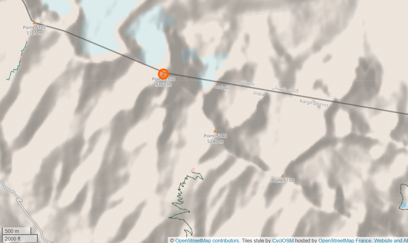
English: The map shows the peak Point 5353 near Drass and Gultari on the Indo-Pakistani w:Line of Control. The ridge extending southeast contains other peaks Point 5240 and Point 5100. To the northeast is Point 5105, which is believed to be under Indian control. |
| Date | |
| Source | https://www.openstreetmap.org/node/5926836342#map=14/34.5191/75.7071&layers=Y |
| Author | Contributors to OpenStreetMap |
Licensing
edit
This file is licensed under the Creative Commons Attribution-Share Alike 2.0 Generic license.
- You are free:
- to share – to copy, distribute and transmit the work
- to remix – to adapt the work
- Under the following conditions:
- attribution – You must give appropriate credit, provide a link to the license, and indicate if changes were made. You may do so in any reasonable manner, but not in any way that suggests the licensor endorses you or your use.
- share alike – If you remix, transform, or build upon the material, you must distribute your contributions under the same or compatible license as the original.
| This work is licensed under the Open Database License (summary). |
File history
Click on a date/time to view the file as it appeared at that time.
| Date/Time | Thumbnail | Dimensions | User | Comment | |
|---|---|---|---|---|---|
| current | 14:51, 22 February 2021 | | 1,328 × 793 (655 KB) | Kautilya3 (talk | contribs) | Uploaded a work by Contributors to OpenStreetMap, Us Office of the Geographer from https://www.openstreetmap.org/node/5926836342#map=14/34.5191/75.7071&layers=Y with UploadWizard |
You cannot overwrite this file.
File usage on Commons
There are no pages that use this file.