File:Polar siberia 4.png
No higher resolution available.
Polar_siberia_4.png (488 × 487 pixels, file size: 23 KB, MIME type: image/png)
Captions
Captions
Add a one-line explanation of what this file represents
Transferred from en.wikipedia to Commons by Maksim.
The original description page was here. All following user names refer to en.wikipedia.
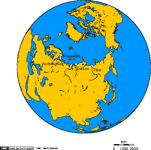
Murmansk, Archangelsk, Dikson, Tiksi, on the Arctic Ocean.
This online map creation tool archive copy at the Wayback Machine was used to create this map. The following longitude and latitude were used to specify the location of the cities:
- 32.3394,68.9650,Murmansk
- 40.4242,64.3475,Archangelsk
- 80.7111,73.5333,Dikson
- 128.870,71.6300,Tiksi

|
Permission is granted to copy, distribute and/or modify this document under the terms of the GNU Free Documentation License, Version 1.2 or any later version published by the Free Software Foundation; with no Invariant Sections, no Front-Cover Texts, and no Back-Cover Texts. A copy of the license is included in the section entitled GNU Free Documentation License. |
| This file is licensed under the Creative Commons Attribution-Share Alike 3.0 Unported license. | ||
| ||
| This licensing tag was added to this file as part of the GFDL licensing update. |
| I, the copyright holder of this work, release this work into the public domain. This applies worldwide. In some countries this may not be legally possible; if so: I grant anyone the right to use this work for any purpose, without any conditions, unless such conditions are required by law. |
| date/time | username | edit summary |
|---|---|---|
| 20:49, 25 January 2005 | en:User:Geo Swan | (longitude, latitude, links) |
| 02:29, 24 January 2005 | en:User:Geo Swan | (tagged image) |
| 01:32, 24 January 2005 | en:User:Geo Swan | (Murmansk, Archangelsk, Dikson, Tiksi, on Arctic Ocean) |
Original upload log edit
Legend: (cur) = this is the current file, (del) = delete this old version, (rev) = revert to this old version.
Click on date to download the file or see the image uploaded on that date.
- (del) (cur) 01:32, 24 January 2005 . . en:User:Geo_Swan Geo Swan ( en:User_talk:Geo_Swan Talk) . . 488x487 (24059 bytes) (Murmansk, Archangelsk, Dikson, Tiksi, on Arctic Ocean)
File history
Click on a date/time to view the file as it appeared at that time.
| Date/Time | Thumbnail | Dimensions | User | Comment | |
|---|---|---|---|---|---|
| current | 13:55, 25 March 2006 | | 488 × 487 (23 KB) | Maksim (talk | contribs) | La bildo estas kopiita de wikipedia:en. La originala priskribo estas: Murmansk, Archangelsk, Dikson, Tiksi, on the Arctic Ocean. This [http://www.aquarius.geomar.de/omc/ online map creation tool] was used to create this map. The foll |
You cannot overwrite this file.
File usage on Commons
There are no pages that use this file.
File usage on other wikis
The following other wikis use this file:
- Usage on bs.wikipedia.org
- Usage on en.wikipedia.org
- Usage on eo.wikipedia.org
- Usage on es.wikipedia.org
- Usage on fr.wikipedia.org
- Usage on hr.wikipedia.org
- Usage on id.wikipedia.org
- Usage on it.wikipedia.org
- Usage on pt.wikipedia.org
- Usage on zh.wikipedia.org