File:Pori.sijainti.suomi.2015.svg

Size of this PNG preview of this SVG file: 344 × 599 pixels. Other resolutions: 138 × 240 pixels | 276 × 480 pixels | 441 × 768 pixels | 588 × 1,024 pixels | 1,176 × 2,048 pixels | 1,850 × 3,220 pixels.
Original file (SVG file, nominally 1,850 × 3,220 pixels, file size: 216 KB)
Captions
Captions
Add a one-line explanation of what this file represents
Summary
edit
| Description |
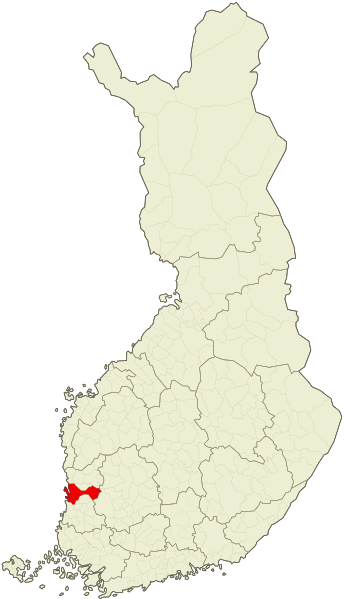
English: Location of the city of Pori, Finland as of 2015, after the consolidation with the municipality of Lavia.
Suomi: Porin kaupungin sijainti vuoden 2015 kuntajaon mukaan, Lavian kuntaliitoksen jälkeen. |
| Date | |
| Source | File:Suomi.karttapohja.2015.svg |
| Author | Care, Apalsola |
| SVG development |
Licensing
edit
| I, the copyright holder of this work, release this work into the public domain. This applies worldwide. In some countries this may not be legally possible; if so: I grant anyone the right to use this work for any purpose, without any conditions, unless such conditions are required by law. |
File history
Click on a date/time to view the file as it appeared at that time.
| Date/Time | Thumbnail | Dimensions | User | Comment | |
|---|---|---|---|---|---|
| current | 18:45, 11 January 2015 | | 1,850 × 3,220 (216 KB) | Heraldia (talk | contribs) | Anttoora/Lampaluoto/Pastuskari/Reposaari island |
| 17:33, 6 January 2015 |  | 1,850 × 3,220 (216 KB) | Apalsola (talk | contribs) | {{Information |Description ={{en|1=Location of the city of Pori, Finland as of 2015, after the consolidation with the municipality of Lavia.}} {{fi|1=Porin kaupungin sijainti vuoden 2015 kuntajaon mukaan, Lavian kuntaliitoksen jälkeen.}} |Source... |
You cannot overwrite this file.
File usage on Commons
The following 2 pages use this file:
File usage on other wikis
The following other wikis use this file: