File:Portefølje nr 12, 1860.jpg
Size of this preview: 597 × 600 pixels. Other resolutions: 239 × 240 pixels | 478 × 480 pixels | 765 × 768 pixels | 1,020 × 1,024 pixels | 2,039 × 2,048 pixels | 7,230 × 7,261 pixels.
Original file (7,230 × 7,261 pixels, file size: 8.91 MB, MIME type: image/jpeg)
Captions
Captions
Add a one-line explanation of what this file represents
Summary edit
| Title |
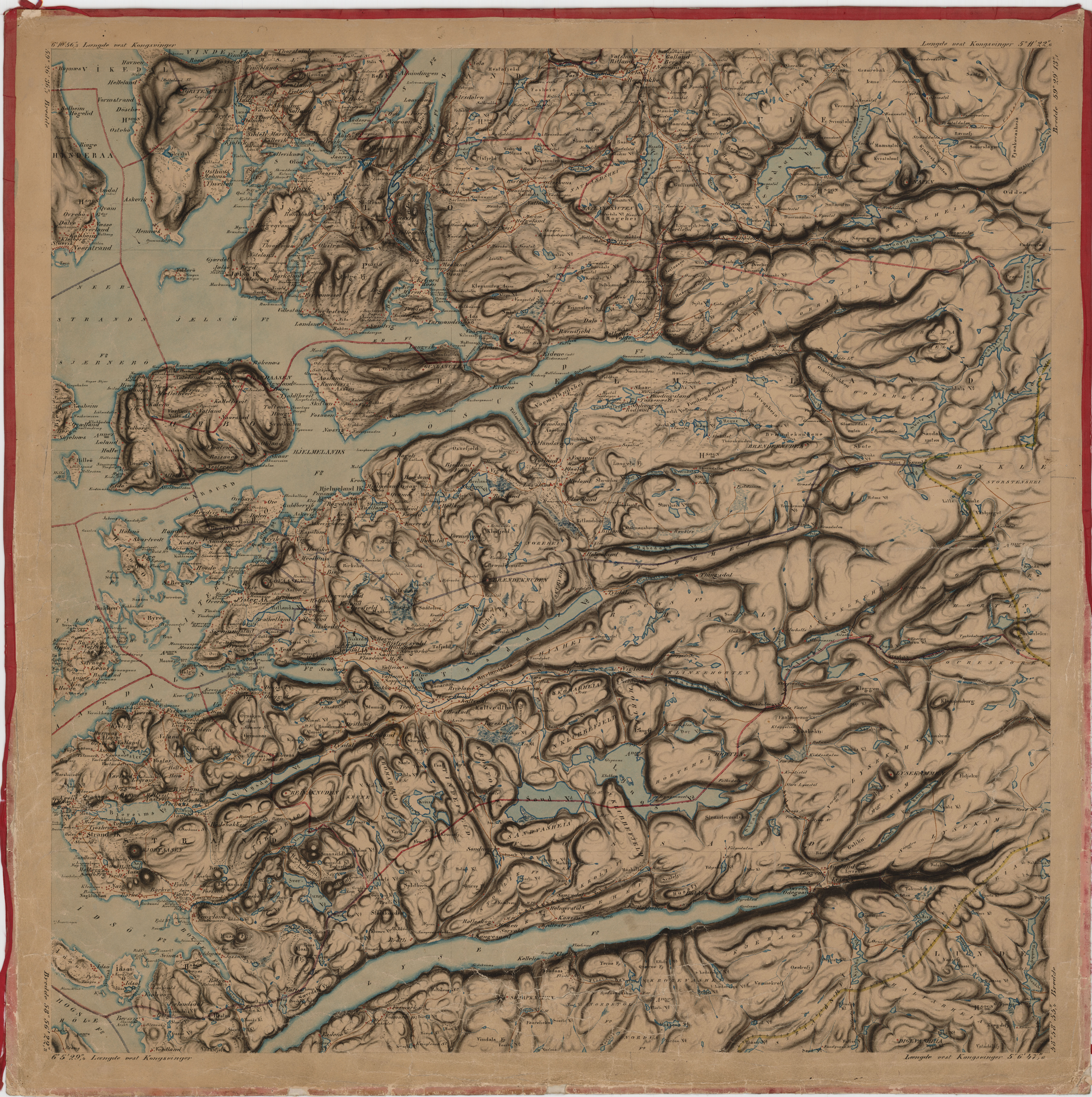
Norsk bokmål: Portefølje nr 12, 1860 |
||||||||||||||||||||||||||
| Description |
Norsk bokmål: Løpenummer 12; Usikkert produksjonsår |
||||||||||||||||||||||||||
| Date | |||||||||||||||||||||||||||
| Source |
|
||||||||||||||||||||||||||
| Creator |
F. Staib. |
||||||||||||||||||||||||||
| Permission (Reusing this file) |
This file is licensed under the Creative Commons Attribution 4.0 International license.
|
||||||||||||||||||||||||||
| Geotemporal data | |||||||||||||||||||||||||||
| Date depicted | |||||||||||||||||||||||||||
| Map location | Vest-Agder,Høgsfjorden,Sirdal,Strand,Hjelmeland,Jelsa,Vikedal,Sand,Suldal (Vest-Agder,Høgsfjord,Sirdal,Strand,Hjelmeland,Nerstrand,Jelsa,Vikedal,Sand,Suldal,Høgsfjorden) | ||||||||||||||||||||||||||
| Scale | 100 000 | ||||||||||||||||||||||||||
| Georeferencing | If inappropriate please set warp_status = skip to hide. | ||||||||||||||||||||||||||
| Bibliographic data | |||||||||||||||||||||||||||
| Part of the series | Category:Norway series 166 maps | ||||||||||||||||||||||||||
| Map sheet | 12 | ||||||||||||||||||||||||||
| Language | Norwegian | ||||||||||||||||||||||||||
| Archival data | |||||||||||||||||||||||||||
| Collection |
|
||||||||||||||||||||||||||
| Accession number | |||||||||||||||||||||||||||
| Dimensions | ca. 60 × 60 cm (23.6 × 23.6 in) | ||||||||||||||||||||||||||
| Medium | drawing | ||||||||||||||||||||||||||
File history
Click on a date/time to view the file as it appeared at that time.
| Date/Time | Thumbnail | Dimensions | User | Comment | |
|---|---|---|---|---|---|
| current | 16:29, 19 November 2015 | | 7,230 × 7,261 (8.91 MB) | Artturimatias (talk | contribs) | GWToolset: Creating mediafile for Artturimatias. |
You cannot overwrite this file.
File usage on Commons
The following page uses this file: