File:Portwood Member over the Boyle Dolomite (Middle Devonian; Waco roadcut, Madison County, Kentucky, USA) 2.jpg
Original file (1,280 × 960 pixels, file size: 968 KB, MIME type: image/jpeg)
Captions
Captions
Summary edit
_2.jpg&action=edit§ion=1)
| Description |
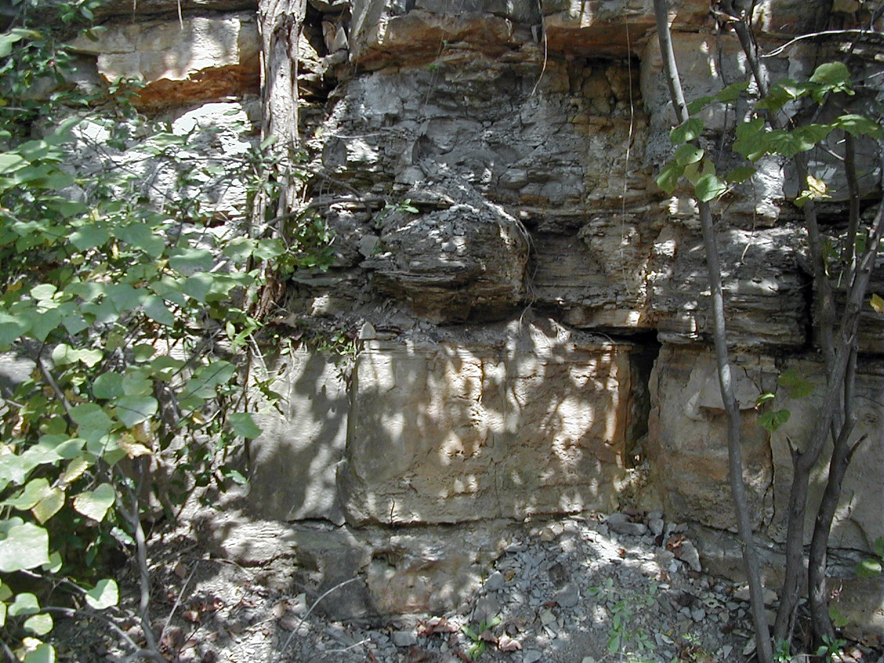
English: Weathered shales unconformably overlying dolostone in the Devonian of Kentucky, USA.
The upper part of this overgrown roadcut consists of weathered dark shales of the Portwood Member, an offshore marine succession at the base of the New Albany Shale / Ohio Shale. The lower Portwood has linguloid and orbiculoid brachiopods and Zoophycos trace fossils. Intervals with deformed bedding interpreted as seismites are present in the lower Portwood. The base of the middle Portwood is an unconformity. The basal bed of the middle Portwood is a dolostone with a burrowed lower surface. Brachiopods identical to forms in the Tully Limestone of New York State occur in the middle Portwood. The lower part of the cut consists of carbonates (less than 1 meter thick) that are the lateral equivalent of the Beechwood Member of the North Vernon Limestone (= Middle Devonian crinoidal limestones). At this site, the equivalent beds are called the Boyle Dolomite or Boyle Formation. Stratigraphy: Portwood Member of the basal New Albany Shale / Ohio Shale (middle Polygnathus varcus zone, Givetian Stage, upper Middle Devonian) over the Beechwood Member of the Boyle Dolomite / Boyle Formation (lower Polygnathus varcus zone, Givetian Stage, upper Middle Devonian) Locality: Waco Cut - roadcut along the northern side of Route 52, ~0.2 miles east of the Route 52-Route 977 intersection at the town of Waco, eastern Madison County, east-central Kentucky, USA (37˚ 44.471’ North latitude, 84˚ 08.566’ West longitude) Info. at: Schieber, J. & R. Lazar (eds.). 2004. Devonian black shales of the eastern U.S. New insights into sedimentology and stratigraphy from the subsurface and outcrops in the Illinois and Appalachian Basins. Field Guide for the 2004 Annual Field Conference of the Great Lakes Section of SEPM. Indiana Geological Survey Open-File Study 04-05. 90 pp. |
| Date | |
| Source | https://www.flickr.com/photos/47445767@N05/52883156290/ |
| Author | James St. John |
Licensing edit
_2.jpg&action=edit§ion=2)
- You are free:
- to share – to copy, distribute and transmit the work
- to remix – to adapt the work
- Under the following conditions:
- attribution – You must give appropriate credit, provide a link to the license, and indicate if changes were made. You may do so in any reasonable manner, but not in any way that suggests the licensor endorses you or your use.
| This image was originally posted to Flickr by James St. John at https://flickr.com/photos/47445767@N05/52883156290. It was reviewed on 11 May 2023 by FlickreviewR 2 and was confirmed to be licensed under the terms of the cc-by-2.0. |
File history
Click on a date/time to view the file as it appeared at that time.
| Date/Time | Thumbnail | Dimensions | User | Comment | |
|---|---|---|---|---|---|
| current | 13:14, 11 May 2023 | | 1,280 × 960 (968 KB) | Ser Amantio di Nicolao (talk | contribs) | Uploaded a work by James St. John from https://www.flickr.com/photos/47445767@N05/52883156290/ with UploadWizard |
You cannot overwrite this file.
File usage on Commons
There are no pages that use this file.
_2.jpg&oldid=764863773)