File:Powiat śremski location map.png
Size of this preview: 727 × 600 pixels. Other resolutions: 291 × 240 pixels | 582 × 480 pixels | 822 × 678 pixels.
Original file (822 × 678 pixels, file size: 108 KB, MIME type: image/png)
Captions
Captions
Add a one-line explanation of what this file represents
| Description |
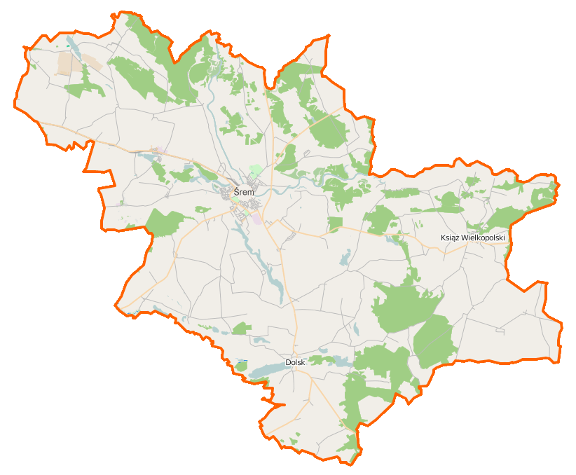
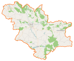
Polski: Mapa powiatu śremskiego, Polska
English: Map of Powiat śremski, Poland |
|||||||||
| Date | ||||||||||
| Source | You may find a page on the OpenStreetMap wiki page for Powiat śremski | |||||||||
| Creator |
OpenStreetMap contributors OpenStreetMap contributors |
|||||||||
| Permission (Reusing this file) |
OpenStreetMap data is available under the Open Database License (details). Map tiles are licensed under the Creative Commons Attribution-ShareAlike 2.0 license (CC-BY-SA 2.0).
This file is licensed under the Creative Commons Attribution-Share Alike 2.0 Generic license.
|
|||||||||
| Geotemporal data | ||||||||||
| Bounding box |
|
|||||||||
| Georeferencing | If inappropriate please set warp_status = skip to hide. | |||||||||
File history
Click on a date/time to view the file as it appeared at that time.
| Date/Time | Thumbnail | Dimensions | User | Comment | |
|---|---|---|---|---|---|
| current | 12:26, 30 December 2014 | | 822 × 678 (108 KB) | VanWiel (talk | contribs) | {{OpenStreetMap | name = Powiat śremski | location = Powiat śremski | description = {{pl|Mapa powiatu śremskiego, Polska}} {{en|Map of Powiat śremski, Poland}} | top = 52.2051 | bottom = 51.9189... |
You cannot overwrite this file.
File usage on Commons
There are no pages that use this file.
File usage on other wikis
The following other wikis use this file:
- Usage on eo.wikipedia.org
- Usage on fr.wikipedia.org
- Usage on pl.wikipedia.org
- Śrem
- Powiat śremski
- Grzybno (województwo wielkopolskie)
- Rezerwat przyrody Miranowo
- Dolsk
- Książ Wielkopolski
- Binkowo
- Błociszewo
- Bodzyniewo
- Borgowo
- Brześnica
- Brzóstownia
- Bystrzek
- Chaławy
- Chwałkowo Kościelne
- Drzonek (powiat śremski)
- Esterpole
- Grodzewo
- Grzymysław
- Iłówiec Wielki
- Kadzewo
- Kaleje (województwo wielkopolskie)
- Kiełczynek
- Lubiatówko
- Luciny
- Łężek (województwo wielkopolskie)
- Manieczki
- Mełpin
- Mórka
- Mszczyczyn
- Niesłabin
- Nochowo
- Nowieczek
- Orkowo
- Ostrowieczno
- Radoszkowo
- Radoszkowo Drugie
- Sebastianowo
- Szołdry
- Sroczewo
- Świączyń
- Trąbinek
- Wirginowo
- Włościejewice
- Włościejewki
- Wyrzeka
- Zakrzewice
- Zbrudzewo
View more global usage of this file.