File:Powiat chrzanowski location map.png
Original file (816 × 791 pixels, file size: 271 KB, MIME type: image/png)
Captions
Captions
Summary
edit
| Description |
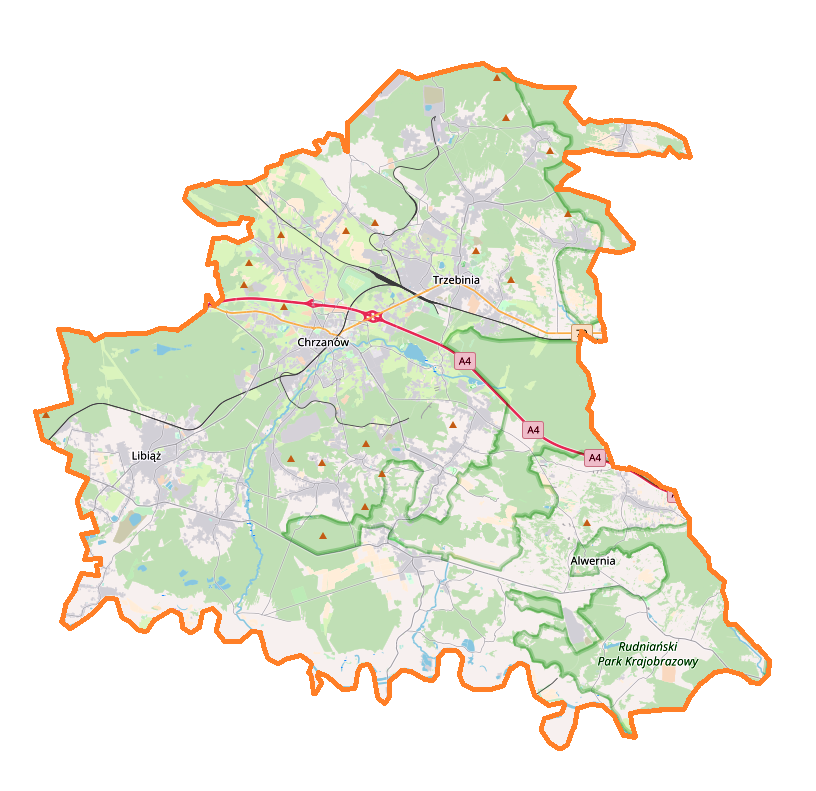
English: Location map |
| Date | |
| Source | Own work |
| Author | Smat |
| Description |
Polski: Mapa powiatu chrzanowskiego, Polska
English: Map of powiat chrzanowski, Poland |
|||||||||
| Date | ||||||||||
| Source | You may find a page on the OpenStreetMap wiki page for powiat chrzanowski | |||||||||
| Creator |
OpenStreetMap contributors OpenStreetMap contributors |
|||||||||
| Permission (Reusing this file) |
OpenStreetMap data is available under the Open Database License (details). Map tiles are licensed under the Creative Commons Attribution-ShareAlike 2.0 license (CC-BY-SA 2.0).
This file is licensed under the Creative Commons Attribution-Share Alike 2.0 Generic license.
|
|||||||||
| Geotemporal data | ||||||||||
| Bounding box |
|
|||||||||
| Georeferencing | If inappropriate please set warp_status = skip to hide. | |||||||||
Licensing
edit
| This work contains information from OpenStreetMap, which is made available under the Open Database License (ODbL).
The ODbL does not require any particular license for maps produced from ODbL data. Prior to 1 August 2020, map tiles produced by the OpenStreetMap Foundation were licensed under the CC-BY-SA-2.0 license. Maps produced by other people may be subject to other licences. |
File history
Click on a date/time to view the file as it appeared at that time.
| Date/Time | Thumbnail | Dimensions | User | Comment | |
|---|---|---|---|---|---|
| current | 19:49, 19 February 2018 | | 816 × 791 (271 KB) | Smat (talk | contribs) | User created page with UploadWizard |
You cannot overwrite this file.
File usage on Commons
There are no pages that use this file.
File usage on other wikis
The following other wikis use this file:
- Usage on pl.wikipedia.org
- Chrzanów
- Alwernia
- Fablok
- Trzebinia
- Libiąż
- Babice (powiat chrzanowski)
- Wygiełzów (województwo małopolskie)
- Zamek Lipowiec
- Park Etnograficzny Krakowiaków Zachodnich
- Myślachowice
- Bolęcin (województwo małopolskie)
- Czyżówka (województwo małopolskie)
- Dulowa
- Karniowice (powiat chrzanowski)
- Młoszowa
- Piła Kościelecka
- Płoki
- Psary (województwo małopolskie)
- Podłęże (powiat chrzanowski)
- Osiedle Energetyków
- Chechło (dopływ Wisły)
- Rozkochów (województwo małopolskie)
- Jankowice (powiat chrzanowski)
- Mętków
- Olszyny (powiat chrzanowski)
- Zagórze (powiat chrzanowski)
- ZKKM Chrzanów
- Siersza
- Luszowice (powiat chrzanowski)
- Lgota (powiat chrzanowski)
- Gaj (Trzebinia)
- Górka (Trzebinia)
- Krakowska (Trzebinia)
- Krze
- Piaski (Trzebinia)
- Północ (Trzebinia)
- Trzebionka
- Salwator (Trzebinia)
- Wodna (Trzebinia)
- Osiedle Widokowe
- Źrebce (Pogorzyce)
- Gromiec
- Żarki (województwo małopolskie)
- Brodła (wieś)
- Kwaczała
- Nieporaz
- Okleśna
- Płaza
- Pogorzyce
- Poręba Żegoty
View more global usage of this file.