File:Profil altimétrique Augronne amont.jpg
Size of this preview: 800 × 290 pixels. Other resolutions: 320 × 116 pixels | 640 × 232 pixels | 1,024 × 371 pixels | 1,280 × 463 pixels | 4,320 × 1,564 pixels.
Original file (4,320 × 1,564 pixels, file size: 944 KB, MIME type: image/jpeg)
Captions
Captions
Add a one-line explanation of what this file represents
Summary edit
| Description |
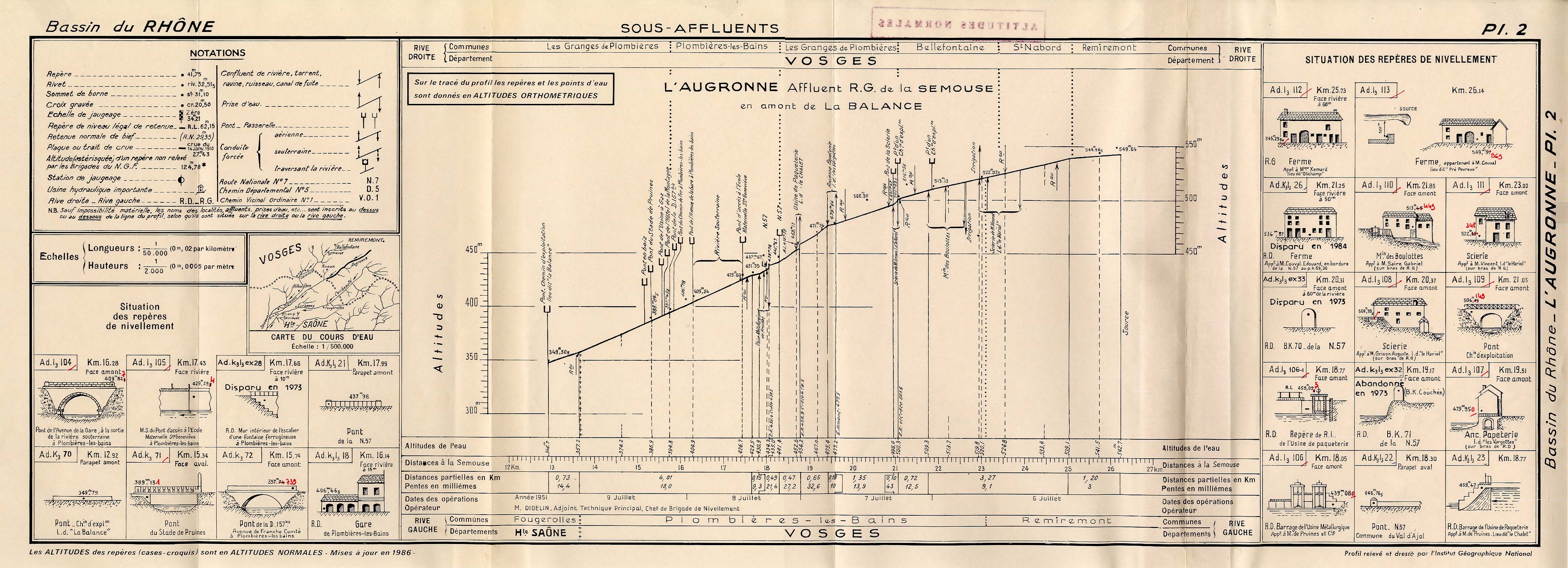
Français : Profil altimètrique de la rivière Augronne entre sa source à Remiremont et le lieu-dit la Balance, commune de Plombières-les-Bains (88). Levé par M. Didelin, chef de Brigade nivellement à l'IGN. |
| Date | Summer 1951 |
| Source | Institut Géographique National, France |
| Author | Nico88-62 |
Licensing edit
| I, the copyright holder of this work, release this work into the public domain. This applies worldwide. In some countries this may not be legally possible; if so: I grant anyone the right to use this work for any purpose, without any conditions, unless such conditions are required by law. |
File history
Click on a date/time to view the file as it appeared at that time.
| Date/Time | Thumbnail | Dimensions | User | Comment | |
|---|---|---|---|---|---|
| current | 12:08, 26 August 2010 | 4,320 × 1,564 (944 KB) | Nico88-62 (talk | contribs) | {{Information |Description={{fr|1=Profil altimètrique de la rivière Augronne entre sa source à Remiremont et le lieu-dit la Balance, commune de Plombières-les-Bains (88). Levé par M. Didelin, chef de Brigade nivellement à l'IGN.}} |Source=Institut G |
You cannot overwrite this file.
File usage on Commons
There are no pages that use this file.
File usage on other wikis
The following other wikis use this file:
- Usage on fr.wikipedia.org