File:Profil fossé Bresse St Cyr Menthon.svg

Size of this PNG preview of this SVG file: 800 × 442 pixels. Other resolutions: 320 × 177 pixels | 640 × 353 pixels | 1,024 × 565 pixels | 1,280 × 707 pixels | 2,560 × 1,413 pixels | 815 × 450 pixels.
Original file (SVG file, nominally 815 × 450 pixels, file size: 150 KB)
Captions
Captions
Add a one-line explanation of what this file represents
Summary edit
| Description |
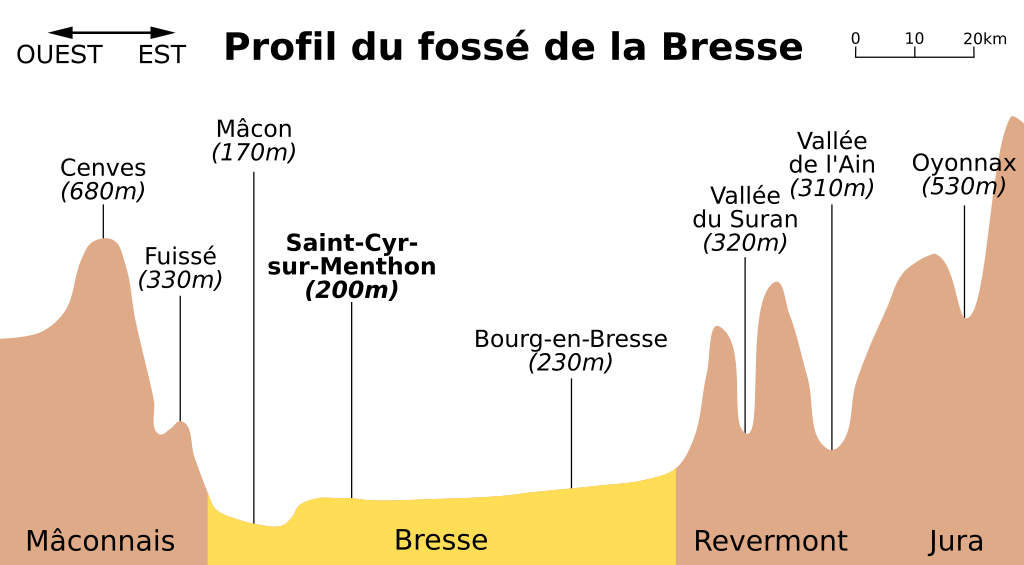
Français : Profil altimétrique du fossé de la Bresse entre Mâcon et Bourg-en-Bresse en passant par Saint-Cyr-sur-Menthon. |
| Date | |
| Source | Own work |
| Author | Chabe01 |
Licensing edit
I, the copyright holder of this work, hereby publish it under the following license:
This file is licensed under the Creative Commons Attribution-Share Alike 4.0 International license.
- You are free:
- to share – to copy, distribute and transmit the work
- to remix – to adapt the work
- Under the following conditions:
- attribution – You must give appropriate credit, provide a link to the license, and indicate if changes were made. You may do so in any reasonable manner, but not in any way that suggests the licensor endorses you or your use.
- share alike – If you remix, transform, or build upon the material, you must distribute your contributions under the same or compatible license as the original.
File history
Click on a date/time to view the file as it appeared at that time.
| Date/Time | Thumbnail | Dimensions | User | Comment | |
|---|---|---|---|---|---|
| current | 18:52, 5 May 2020 | | 815 × 450 (150 KB) | Chabe01 (talk | contribs) | Unicité dans les polices d'écriture |
| 07:21, 4 May 2020 |  | 815 × 450 (143 KB) | A.BourgeoisP (talk | contribs) | Est Ouest | |
| 22:40, 28 March 2017 |  | 815 × 450 (141 KB) | Chabe01 (talk | contribs) | User created page with UploadWizard |
You cannot overwrite this file.
File usage on Commons
There are no pages that use this file.
File usage on other wikis
The following other wikis use this file:
- Usage on fr.wikipedia.org