File:Prora WorldWind.jpg

Size of this preview: 444 × 599 pixels. Other resolutions: 178 × 240 pixels | 355 × 480 pixels | 948 × 1,280 pixels.
Original file (948 × 1,280 pixels, file size: 199 KB, MIME type: image/jpeg)
Captions
Captions
Add a one-line explanation of what this file represents
| Description |
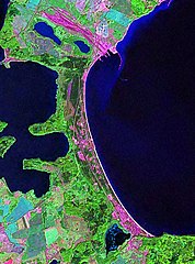
Deutsch: Seebad Prora, Satellitenaufnahme. Bildausschnitt ca. 10 x 13,5 Kilometer.
English: Seaside resort Prora, satellite image. Image covers about 10 x 13,5 kilometers. |
| Source | Created with NASA WorldWind by User:Vesta using Landsat 7 (false color) satellite image. |
| Author | User:Vesta |
54°26′20″N 13°34′30″E / 54.4389°N 13.575°E
| This image is in the public domain because it is a screenshot from NASA’s globe software World Wind using a public domain layer, such as Blue Marble, MODIS, Landsat, SRTM, USGS or GLOBE.
|
 |
File history
Click on a date/time to view the file as it appeared at that time.
| Date/Time | Thumbnail | Dimensions | User | Comment | |
|---|---|---|---|---|---|
| current | 22:46, 20 January 2006 | | 948 × 1,280 (199 KB) | Vesta~commonswiki (talk | contribs) | *'''Description:''' :*{{Deutsch}} Seebad Prora, Satellitenaufnahme. :*{{Englisch}} Seaside resort Prora, satellite image. *'''Source:''' Created with NASA WorldWind by User:Vesta using Landsat 7 (false color) satellite image. {{PD-WorldWind}} |
You cannot overwrite this file.
File usage on Commons
File usage on other wikis
The following other wikis use this file:
- Usage on ceb.wikipedia.org
- Usage on de.wikipedia.org
- Usage on en.wikipedia.org
- Usage on mk.wikipedia.org
- Usage on www.wikidata.org