File:Province of Flemish Brabant (Belgium) location.svg

Size of this PNG preview of this SVG file: 721 × 600 pixels. Other resolutions: 289 × 240 pixels | 577 × 480 pixels | 923 × 768 pixels | 1,231 × 1,024 pixels | 2,462 × 2,048 pixels | 1,136 × 945 pixels.
Original file (SVG file, nominally 1,136 × 945 pixels, file size: 150 KB)
Captions
Captions
Add a one-line explanation of what this file represents
Summary
edit_location.svg&action=edit§ion=1)
| Description |
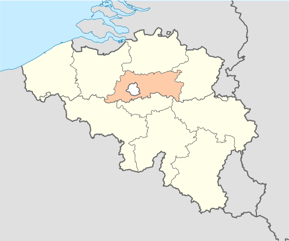
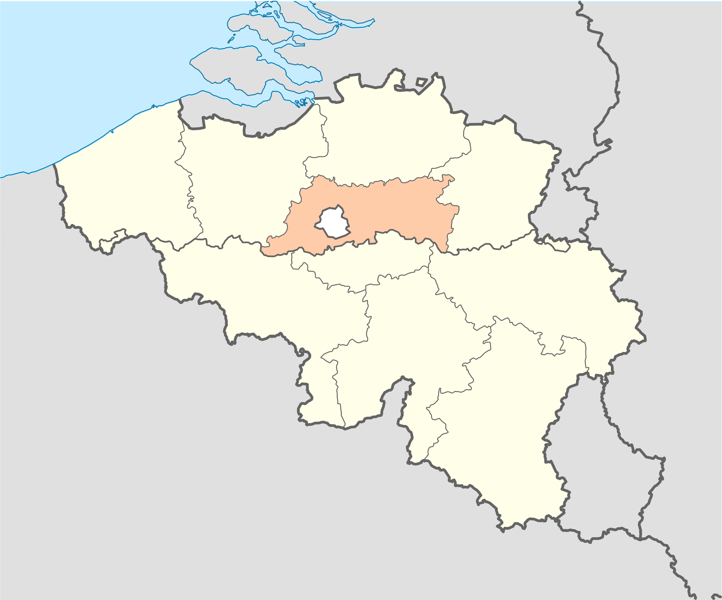
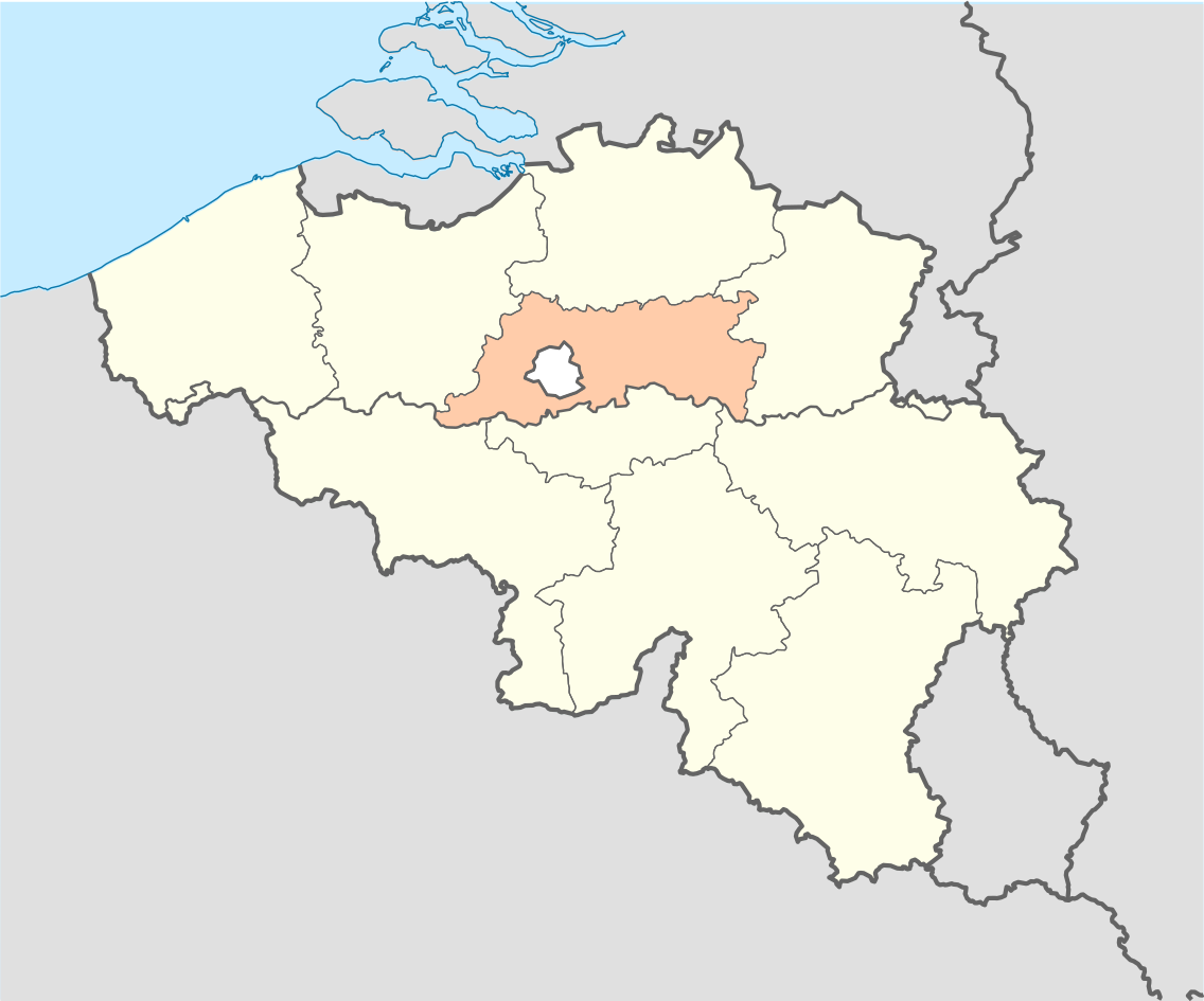
English: Location map of Province of Flemish Brabant, Belgium
Equirectangular projection, N/S stretching 150 %. Geographic limits of the map: * N: 51.8° N * S: 49.2° N * W: 2.2° E * E: 6.9° E Français : Localisation de la province du Brabant flamand, Belgique Projection equirectangulaire, N/S etirement 150 %. Limites géographiques de la cartes: * N: 51.8° N * S: 49.2° N * W: 2.2° E * E: 6.9° E |
| Source | Own work |
| Author | Vascer |
| Other versions | Belgium_location_map.svg |
Licensing
edit_location.svg&action=edit§ion=2)
I, the copyright holder of this work, hereby publish it under the following licenses:

|
Permission is granted to copy, distribute and/or modify this document under the terms of the GNU Free Documentation License, Version 1.2 or any later version published by the Free Software Foundation; with no Invariant Sections, no Front-Cover Texts, and no Back-Cover Texts. A copy of the license is included in the section entitled GNU Free Documentation License. |
This file is licensed under the Creative Commons Attribution-Share Alike 3.0 Unported license.
- You are free:
- to share – to copy, distribute and transmit the work
- to remix – to adapt the work
- Under the following conditions:
- attribution – You must give appropriate credit, provide a link to the license, and indicate if changes were made. You may do so in any reasonable manner, but not in any way that suggests the licensor endorses you or your use.
- share alike – If you remix, transform, or build upon the material, you must distribute your contributions under the same or compatible license as the original.
You may select the license of your choice.
File history
Click on a date/time to view the file as it appeared at that time.
| Date/Time | Thumbnail | Dimensions | User | Comment | |
|---|---|---|---|---|---|
| current | 17:49, 16 October 2010 | | 1,136 × 945 (150 KB) | Vascer (talk | contribs) | {{Information |Description={{en|1=Location map of Province of Flemish Brabant, Belgium<br />Equirectangular projection, N/S stretching 150 %. Geographic limits of the map: * N: 51.8° N * S: 49.2° N * W: 2.2° E * E: 6.9° E}} {{fr|1=Localisation de la p |
You cannot overwrite this file.
File usage on Commons
The following 9 pages use this file:
- Maps of Belgium
- File:Belgievlbrabant.png
- File:BelgiumFlemishBrabant.png
- File:Province of Walloon Brabant (Belgium) location.svg
- Category:Births in Flemish Brabant
- Category:Culture of Flemish Brabant
- Category:Deaths in Flemish Brabant
- Category:Flemish Brabant
- Category:Visitor attractions in Flemish Brabant
_location.svg)
File usage on other wikis
The following other wikis use this file:
- Usage on af.wikipedia.org
- Usage on ar.wikipedia.org
- Usage on arz.wikipedia.org
- Usage on ast.wikipedia.org
- Usage on be-tarask.wikipedia.org
- Usage on be.wikipedia.org
- Usage on bs.wikipedia.org
- Usage on ca.wikipedia.org
- Usage on cs.wikipedia.org
- Usage on da.wikipedia.org
- Usage on de.wiktionary.org
- Usage on el.wikipedia.org
- Usage on eo.wikipedia.org
- Usage on et.wikipedia.org
- Usage on fa.wikipedia.org
- Usage on fr.wikipedia.org
- Usage on gl.wikipedia.org
- Usage on hy.wikipedia.org
- Usage on ja.wikipedia.org
- Usage on ko.wikipedia.org
- Usage on la.wikipedia.org
- Usage on lb.wikipedia.org
- Usage on oc.wikipedia.org
- Usage on pcd.wikipedia.org
- Usage on pt.wikipedia.org
- Usage on ru.wikipedia.org
- Usage on simple.wikipedia.org
- Usage on sk.wikipedia.org
- Usage on sr.wikipedia.org
- Usage on uk.wikipedia.org
- Usage on uz.wikipedia.org
- Usage on vo.wikipedia.org
- Usage on www.wikidata.org
_location.svg&oldid=532991906)