File:Proyecto de limitación territorial de las Provincias de la República Argentina y demarcación de los Territorios Nacionales 1869.jpg

Size of this preview: 478 × 600 pixels. Other resolutions: 191 × 240 pixels | 382 × 480 pixels | 612 × 768 pixels | 816 × 1,024 pixels | 1,632 × 2,048 pixels.
Original file (1,632 × 2,048 pixels, file size: 1.01 MB, MIME type: image/jpeg)
Captions
Captions
Add a one-line explanation of what this file represents
Summary
edit
| Description |
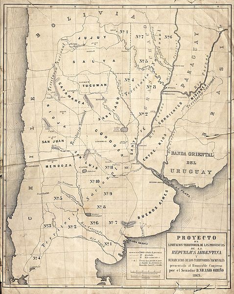
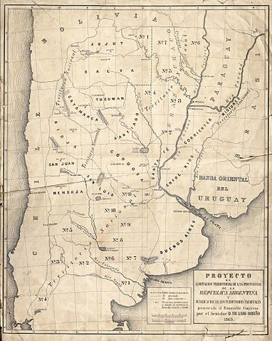
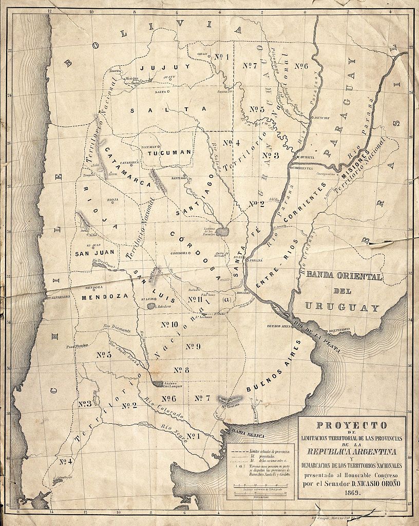
Español: Proyecto de limitación territorial de las Provincias de la República Argentina y demarcación de los Territorios Nacionales presentado por el Senador Nacional Nicasio Oroño al Congreso Nacional, 1869. - Mapoteca - Archivo General de la Nacion |
| Date | |
| Source | Archivo General de la Nación - República Argentina |
| Author | Archivo General de la Nación - República Argentina |
Licensing
edit
The copyright of this anonymous work belonging to an institution, corporation or legal entity, registered in Argentina, has expired, and it has entered the public domain. At least 50 years have passed after the anonymous work was first published (Law 11.723, articles 8 and 28 and its modifications).
Nevertheless, its source must be acknowledged. |
 | |
File history
Click on a date/time to view the file as it appeared at that time.
| Date/Time | Thumbnail | Dimensions | User | Comment | |
|---|---|---|---|---|---|
| current | 15:54, 29 October 2016 | | 1,632 × 2,048 (1.01 MB) | Anderwsont (talk | contribs) | User created page with UploadWizard |
You cannot overwrite this file.
File usage on Commons
There are no pages that use this file.