File:Przemęt (gmina) location map.png

Size of this preview: 800 × 566 pixels. Other resolutions: 320 × 226 pixels | 640 × 453 pixels | 1,079 × 763 pixels.
Original file (1,079 × 763 pixels, file size: 175 KB, MIME type: image/png)
Captions
Captions
Add a one-line explanation of what this file represents
| Description |
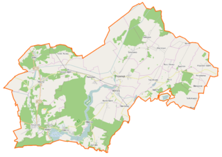
Polski: Mapa gminy Przemęt, Polska
English: Map of Gmina Przemęt, Poland |
|||||||||
| Date | ||||||||||
| Source | You may find a page on the OpenStreetMap wiki page for Przemęt (gmina) | |||||||||
| Creator |
OpenStreetMap contributors OpenStreetMap contributors |
|||||||||
| Permission (Reusing this file) |
OpenStreetMap data is available under the Open Database License (details). Map tiles are licensed under the Creative Commons Attribution-ShareAlike 2.0 license (CC-BY-SA 2.0).
This file is licensed under the Creative Commons Attribution-Share Alike 2.0 Generic license.
|
|||||||||
| Geotemporal data | ||||||||||
| Bounding box |
|
|||||||||
| Georeferencing | If inappropriate please set warp_status = skip to hide. | |||||||||
File history
Click on a date/time to view the file as it appeared at that time.
| Date/Time | Thumbnail | Dimensions | User | Comment | |
|---|---|---|---|---|---|
| current | 21:39, 4 January 2015 | | 1,079 × 763 (175 KB) | VanWiel (talk | contribs) | {{OpenStreetMap | name = Przemęt (gmina) | location = Przemęt (gmina) | description = {{pl|Mapa gminy Przemęt, Polska}} {{en|Map of Gmina Przemęt, Poland}} | top = 52.0860 | bottom = 51.9248 | l... |
You cannot overwrite this file.
File usage on Commons
There are no pages that use this file.
File usage on other wikis
The following other wikis use this file:
- Usage on fr.wikipedia.org
- Usage on pl.wikipedia.org
- Wieleń (powiat wolsztyński)
- Kaszczor
- Przemęt (województwo wielkopolskie)
- Przemęt (gmina)
- Mochy
- Olejnica
- Perkowo (województwo wielkopolskie)
- Kluczewo (powiat wolsztyński)
- Osłonin
- Starkowo (województwo wielkopolskie)
- Barchlin
- Bucz
- Popowo Stare
- Poświętno
- Siekowo
- Siekówko
- Solec Nowy
- Sączkowo
- Jezioro Mochyńskie
- Błotnica (województwo wielkopolskie)
- Górsko (województwo wielkopolskie)
- Radomierz (województwo wielkopolskie)
- Sokołowice (województwo wielkopolskie)
- Biskupice (powiat wolsztyński)
- Borek (powiat wolsztyński)
- Solec (powiat wolsztyński)
- Nowa Wieś (powiat wolsztyński)
- Dębina (powiat wolsztyński)
- Starkowo-Bambry
- Wincentowo (powiat wolsztyński)
- Rezerwat przyrody Jezioro Trzebidzkie
- Rezerwat przyrody Torfowisko nad Jeziorem Świętym
- Rezerwat przyrody Wyspa Konwaliowa
- Bucz Nowy
- Parafia św. Jana Chrzciciela w Przemęcie
- Starkowo (przystanek kolejowy)
- Błotnica (przystanek kolejowy)
- Perkowo (przystanek kolejowy)
- Nowawieś Mochy
- Nowy Solec
- Opactwo Cystersów w Przemęcie
- Opactwo Cystersów w Wieleniu
- Kościół św. Jana Chrzciciela w Przemęcie
- Przemęt-Leśniczówka
- Radomierz-Leśniczówka
- Święte Jezioro (województwo wielkopolskie)
- Wroniawy-Leśniczówka
- Kościół Świętych Apostołów Piotra i Pawła w Przemęcie
- Kościół św. Andrzeja w Przemęcie
View more global usage of this file.
_location_map.png)
_location_map.png&oldid=519992832)