File:Pudong - panoramio (1).jpg

Size of this preview: 799 × 282 pixels. Other resolutions: 320 × 113 pixels | 640 × 226 pixels | 1,024 × 361 pixels | 1,280 × 452 pixels | 2,560 × 904 pixels | 6,484 × 2,289 pixels.
Original file (6,484 × 2,289 pixels, file size: 10.55 MB, MIME type: image/jpeg)
Captions
Captions
Add a one-line explanation of what this file represents
Summary edit
.jpg&action=edit§ion=1)
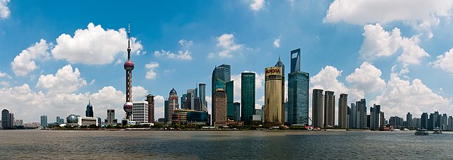
| Description | Pudong | ||
| Date | 12 December 2010 (original upload date) | ||
| Source | https://web.archive.org/web/20161016124615/http://www.panoramio.com/photo/44897536 | ||
| Author | Raffaele Nicolussi | ||
| Permission (Reusing this file) |
This file is licensed under the Creative Commons Attribution 3.0 Unported license. Attribution: Raffaele Nicolussi
|
||
| Tags (from Panoramio photo page) | Shanghai, ad est del fiume Hangpu, Asia, Chang Jiang, china, CHN, cina, città, city, geo:lat=31.23548500, geo:lon=121.48786300, geo:lon=121.48786333, geotagged, Hangpu, Huangpu, Hù, Paese Centrale, People's Republic of China, popolosa, PRC, Pudong, Pudong New Area, Pǔdōng, Pǔdōng Xīn Qū, Repubblica Popolare Cinese, Sciangai, Shanghai, Shànghǎi, Shēn, sul mare, Zhōngguó, Zhōnghuá Rénmín Gònghéguó, Zånhae, ʂɑ́ŋxài, 上海, 中华人民共和国, 中国, 中國, 中華人民共和國, 沪, 浦东, 浦东新区, 浦東, 浦東新區, 滬, 申 |
| Camera location | | View this and other nearby images on: OpenStreetMap |
|---|
.jpg¶ms=031.239591_N_0121.494884_E_globe:Earth_type:camera_source:Panoramio_&language=en)
File history
Click on a date/time to view the file as it appeared at that time.
| Date/Time | Thumbnail | Dimensions | User | Comment | |
|---|---|---|---|---|---|
| current | 19:41, 21 November 2016 | 6,484 × 2,289 (10.55 MB) | Panoramio upload bot (talk | contribs) | == {{int:filedesc}} == {{Information |description=Pudong |date={{Original upload date|2010-12-12}} |source=http://www.panoramio.com/photo/44897536 |author=[http://www.panoramio.com/user/38219?with_photo_id=44897536 Raffaele Nicolussi] |permission={{cc-... |
You cannot overwrite this file.
File usage on Commons
There are no pages that use this file.
File usage on other wikis
The following other wikis use this file:
- Usage on zh.wikipedia.org
.jpg&oldid=692704639)