File:Queen Mary Falls at flooding 1.jpg

Size of this preview: 414 × 600 pixels. Other resolutions: 165 × 240 pixels | 331 × 480 pixels | 828 × 1,200 pixels.
Original file (828 × 1,200 pixels, file size: 292 KB, MIME type: image/jpeg)
Captions
Captions
Add a one-line explanation of what this file represents
Summary
edit
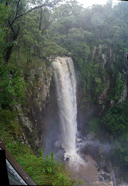
| Description | Main Range National Park, Australia. Waterfall near Killarney. Once named Upper Daggs Falls, Queen Mary Falls plunges 40m down sheer rock face. |
| Date | |
| Source | Queen Mary Falls at flooding |
| Author | Tatiana Gerus from Brisbane, Australia |
| Camera location | | View this and other nearby images on: OpenStreetMap |
|---|
Licensing
edit
This file is licensed under the Creative Commons Attribution 2.0 Generic license.
- You are free:
- to share – to copy, distribute and transmit the work
- to remix – to adapt the work
- Under the following conditions:
- attribution – You must give appropriate credit, provide a link to the license, and indicate if changes were made. You may do so in any reasonable manner, but not in any way that suggests the licensor endorses you or your use.
| This image, originally posted to Flickr, was reviewed on 5 January 2011 by the administrator or reviewer Elekhh, who confirmed that it was available on Flickr under the stated license on that date. |
File history
Click on a date/time to view the file as it appeared at that time.
| Date/Time | Thumbnail | Dimensions | User | Comment | |
|---|---|---|---|---|---|
| current | 22:04, 3 January 2011 | | 828 × 1,200 (292 KB) | Lodo27 (talk | contribs) | {{Information |Description= Main Range National Park, Australia Famous waterfall near Killarney. Once named Upper Daggs Falls, Queen Mary Falls plunges '''40m''' down sheer rock face. The walking track to the bottom was closed. Day before access to this |
You cannot overwrite this file.
File usage on Commons
There are no pages that use this file.