File:Qvistrum1788.jpg

Size of this preview: 800 × 428 pixels. Other resolutions: 320 × 171 pixels | 640 × 342 pixels | 1,024 × 548 pixels | 1,280 × 684 pixels | 2,480 × 1,326 pixels.
Original file (2,480 × 1,326 pixels, file size: 577 KB, MIME type: image/jpeg)
Captions
Captions
Add a one-line explanation of what this file represents
Summary
edit
| Description |
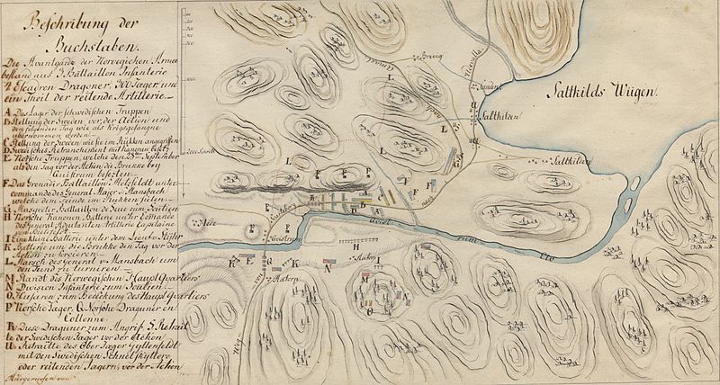
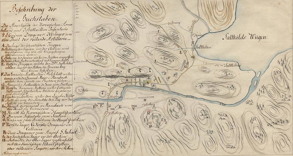
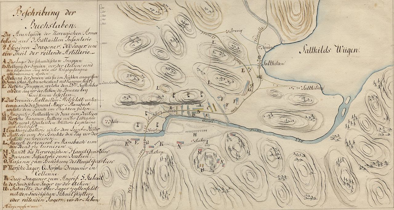
English: Map over the battlefield at Kvistrum, south of Munkedal in Bohuslän, Sweden. The battle was fought between Sweden and Norway-Denmark in 1788. The map view is from west, and explanation in german.
Svenska: Karta över slagfältet vid Kvistrum söder om Munkedal i Bohuslän, mellan Sverige och Norge-Danmark 1788.
Kartvy från väster, och teckenförklaring på tyska. |
| Date | |
| Source | Krigsarkivet, Sveriges Krig 0425:18:004 Qvistrum 1788 |
| Author | Unknown author |
Licensing
edit
|
This work is in the public domain in its country of origin and other countries and areas where the copyright term is the author's life plus 100 years or fewer. | |
| This file has been identified as being free of known restrictions under copyright law, including all related and neighboring rights. | |
File history
Click on a date/time to view the file as it appeared at that time.
| Date/Time | Thumbnail | Dimensions | User | Comment | |
|---|---|---|---|---|---|
| current | 18:38, 11 June 2012 | | 2,480 × 1,326 (577 KB) | Dagjoh (talk | contribs) | {{Information |Description ={{en|1=Map over the battlefield at Kvistrum, south of Munkedal in Bohuslän, Sweden. The battle was fought between Sweden and Norway-Denmark in 1788. The map view is from west, and explanation in german.}} {{sv|1=Karta ... |
You cannot overwrite this file.
File usage on Commons
There are no pages that use this file.
File usage on other wikis
The following other wikis use this file:
- Usage on sv.wikipedia.org