File:Réseau voie de 60 Somme 1923 map-fr-.svg

Size of this PNG preview of this SVG file: 800 × 592 pixels. Other resolutions: 320 × 237 pixels | 640 × 474 pixels | 1,024 × 758 pixels | 1,280 × 948 pixels | 2,560 × 1,896 pixels | 1,997 × 1,479 pixels.
Original file (SVG file, nominally 1,997 × 1,479 pixels, file size: 82 KB)
Captions
Captions
Add a one-line explanation of what this file represents
Summary
edit| Description |
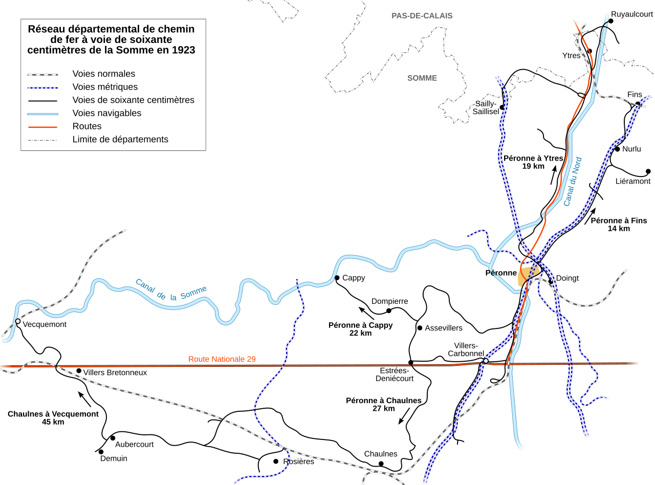
English: Map of the 600 mm (1 ft 11⅝ in) narrow gauge railway network in 1923 in the department of Somme, France.
Français : Plan du réseau départemental à voie étroite de 60 cm de la Somme en 1923, exploité par le Ministère des Régions Libérées. |
||
| Date | |||
| Source |
travail personnel (own work). Source :
|
||
| Author | Sémhur | ||
| Other versions | |||
| Attribution (required by the license) | © Sémhur / Wikimedia Commons / | ||
| SVG | W3C-validity not checked.
|
||
| Graphic Lab |


| Camera location | | View this and other nearby images on: OpenStreetMap |
|---|
Licensing
edit
I, the copyright holder of this work, hereby publish it under the following licenses:
| Copyleft: This work of art is free; you can redistribute it and/or modify it according to terms of the Free Art License. You will find a specimen of this license on the Copyleft Attitude site as well as on other sites. |
This file is licensed under the Creative Commons Attribution-Share Alike Attribution-Share Alike 4.0 International, 3.0 Unported, 2.5 Generic, 2.0 Generic and 1.0 Generic license.
- You are free:
- to share – to copy, distribute and transmit the work
- to remix – to adapt the work
- Under the following conditions:
- attribution – You must give appropriate credit, provide a link to the license, and indicate if changes were made. You may do so in any reasonable manner, but not in any way that suggests the licensor endorses you or your use.
- share alike – If you remix, transform, or build upon the material, you must distribute your contributions under the same or compatible license as the original.
You may select the license of your choice.
File history
Click on a date/time to view the file as it appeared at that time.
| Date/Time | Thumbnail | Dimensions | User | Comment | |
|---|---|---|---|---|---|
| current | 09:20, 31 July 2008 | | 1,997 × 1,479 (82 KB) | Sémhur (talk | contribs) | {{Information |Description={{en|1=Map of the 600 mm (1 ft 11⅝ in) narrow gauge railway network in 1923 in the department of Somme, France.}} {{fr|1=Plan du réseau départemental à [[:fr:Voie étroite|voie ét |
You cannot overwrite this file.
File usage on Commons
The following page uses this file:
File usage on other wikis
The following other wikis use this file: