File:Río-cosapilla.png

Size of this preview: 280 × 598 pixels. Other resolutions: 112 × 240 pixels | 224 × 480 pixels | 747 × 1,596 pixels.
Original file (747 × 1,596 pixels, file size: 3.51 MB, MIME type: image/png)
Captions
Captions
Add a one-line explanation of what this file represents
Summary edit
| Description |
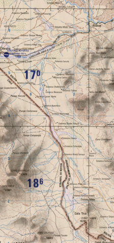
English: frontera Chile-Peru-Bolivia, Cosapilla River |
| Date | |
| Source |
This file was derived from: Txu-oclc-224300691-se19-6.jpg: |
| Author |
|
| This is a retouched picture, which means that it has been digitally altered from its original version. Modifications: cropped. The original can be viewed here: Txu-oclc-224300691-se19-6.jpg:
|
Licensing edit
This image is a work of the United States National Geospatial-Intelligence Agency or one of its predecessor agencies. As a work of the U.S. federal government, the image is in the public domain.
|
 |
Original upload log edit
This image is a derivative work of the following images:
- File:Txu-oclc-224300691-se19-6.jpg licensed with PD-USGov-Military-NGA
- 2011-12-30T23:03:24Z Createaccount 5164x3929 (10764508 Bytes)
Uploaded with derivativeFX
File history
Click on a date/time to view the file as it appeared at that time.
| Date/Time | Thumbnail | Dimensions | User | Comment | |
|---|---|---|---|---|---|
| current | 21:48, 13 June 2012 | | 747 × 1,596 (3.51 MB) | Keysanger (talk | contribs) | == {{int:filedesc}} == {{Information |Description={{en|1=frontera Chile-Peru-Bolivia, Cosapilla River}} |date=2010-05-17 |Source={{Derived from|Txu-oclc-224300691-se19-6.jpg|display=50}} |Date=2012-06-13 21:45 (UTC) |Author=*[[:File:Txu-oclc-224300691-... |
You cannot overwrite this file.
File usage on Commons
The following page uses this file:
File usage on other wikis
The following other wikis use this file:
- Usage on arz.wikipedia.org
- Usage on en.wikipedia.org
- Usage on ru.wikipedia.org
- Usage on www.wikidata.org