File:R1 Canberra light rail diagram.svg

Size of this PNG preview of this SVG file: 424 × 600 pixels. Other resolutions: 170 × 240 pixels | 339 × 480 pixels | 543 × 768 pixels | 724 × 1,024 pixels | 1,448 × 2,048 pixels | 794 × 1,123 pixels.
Original file (SVG file, nominally 794 × 1,123 pixels, file size: 68 KB)
Captions
Captions
Add a one-line explanation of what this file represents
Summary
edit
| Description |
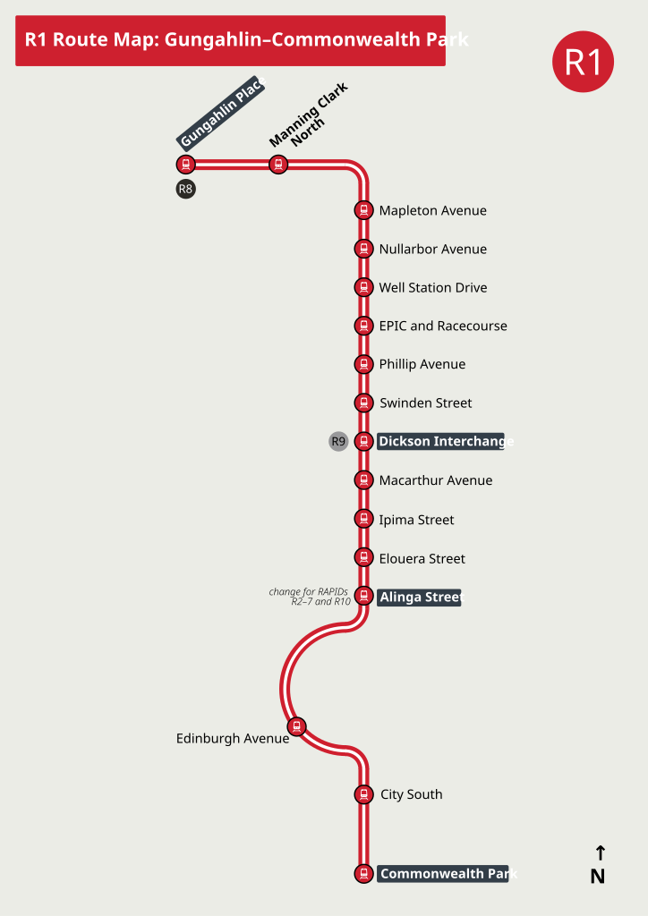
English: Route diagram of route R1 on the Canberra Metro network. |
| Date | |
| Source | Own work, except for File:Canberra Metro icon.svg |
| Author | SHB2000 |
| Other versions | PNG file |
Licensing
edit
I, the copyright holder of this work, hereby publish it under the following license:
This file is licensed under the Creative Commons Attribution-Share Alike 4.0 International license.
- You are free:
- to share – to copy, distribute and transmit the work
- to remix – to adapt the work
- Under the following conditions:
- attribution – You must give appropriate credit, provide a link to the license, and indicate if changes were made. You may do so in any reasonable manner, but not in any way that suggests the licensor endorses you or your use.
- share alike – If you remix, transform, or build upon the material, you must distribute your contributions under the same or compatible license as the original.
File history
Click on a date/time to view the file as it appeared at that time.
| Date/Time | Thumbnail | Dimensions | User | Comment | |
|---|---|---|---|---|---|
| current | 03:58, 18 July 2024 | | 794 × 1,123 (68 KB) | SHB2000 (talk | contribs) | add Sandford St, which is seemingly absent in official maps (allowable per COM:OW – minor uncontroversial change) |
| 08:25, 12 June 2024 |  | 794 × 1,123 (66 KB) | SHB2000 (talk | contribs) | Uploaded own work with UploadWizard |
You cannot overwrite this file.
File usage on Commons
The following 6 pages use this file:
- User:Chumwa/OgreBot/Public transport information/2024 July 11-20
- User:Chumwa/OgreBot/Public transport information/2024 June 11-20
- User:Chumwa/OgreBot/Transport Maps/2024 July 11-20
- User:Chumwa/OgreBot/Transport Maps/2024 June 11-20
- User:Chumwa/OgreBot/Travel and communication maps/2024 July 11-20
- User:Chumwa/OgreBot/Travel and communication maps/2024 June 11-20