File:RBD airport map.PNG
Size of this preview: 390 × 599 pixels. Other resolutions: 156 × 240 pixels | 516 × 792 pixels.
Original file (516 × 792 pixels, file size: 51 KB, MIME type: image/png)
Captions
Captions
Add a one-line explanation of what this file represents
Summary edit
| Description |
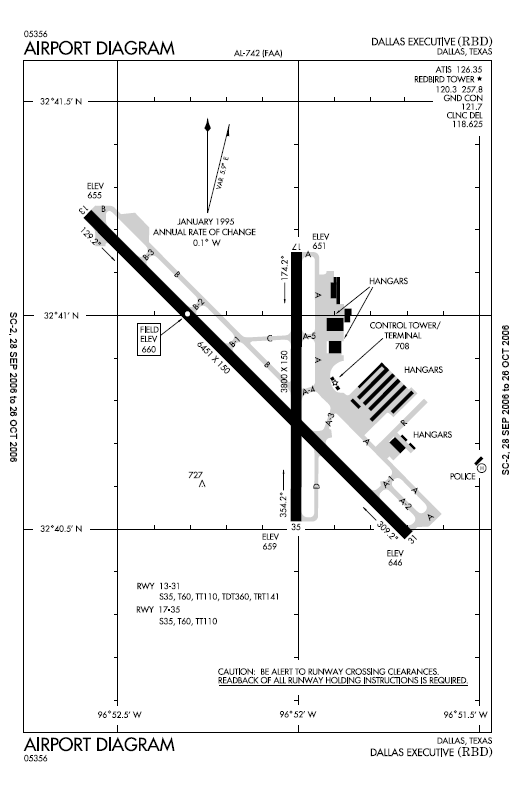
Airport map Dallas Executive Airport w:commons:category:Dallas Executive Airport w:commons:category:Federal Aviation Administration w:commons:category:Maps |
| Source | FAA |
| Author | See below |
Licensing edit
This image or file is a work of a Federal Aviation Administration employee, taken or made as part of that person's official duties. As a work of the U.S. federal government, the image is in the public domain in the United States.
|
 |
Original upload log edit
The original description page was here. All following user names refer to en.wikipedia.
| Date/Time | Dimensions | User | Comment |
|---|---|---|---|
| 2006-10-28 01:08:55 | 516× 792× | MJHankel | Airport map Dallas Executive Airport {{PD-USGov-FAA}} |
File history
Click on a date/time to view the file as it appeared at that time.
| Date/Time | Thumbnail | Dimensions | User | Comment | |
|---|---|---|---|---|---|
| current | 20:07, 5 November 2016 | | 516 × 792 (51 KB) | FastilyClone (talk | contribs) | Transferred from en.wikipedia (MTC!) |
You cannot overwrite this file.
File usage on Commons
The following page uses this file: