File:ROAD LAYOUT LNTKE 1984-2012.svg

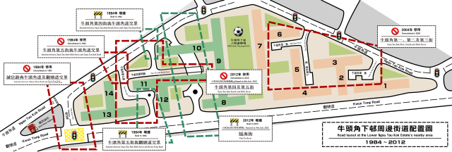
Size of this PNG preview of this SVG file: 800 × 269 pixels. Other resolutions: 320 × 108 pixels | 640 × 215 pixels | 1,024 × 344 pixels | 1,280 × 430 pixels | 2,560 × 860 pixels | 2,491 × 837 pixels.
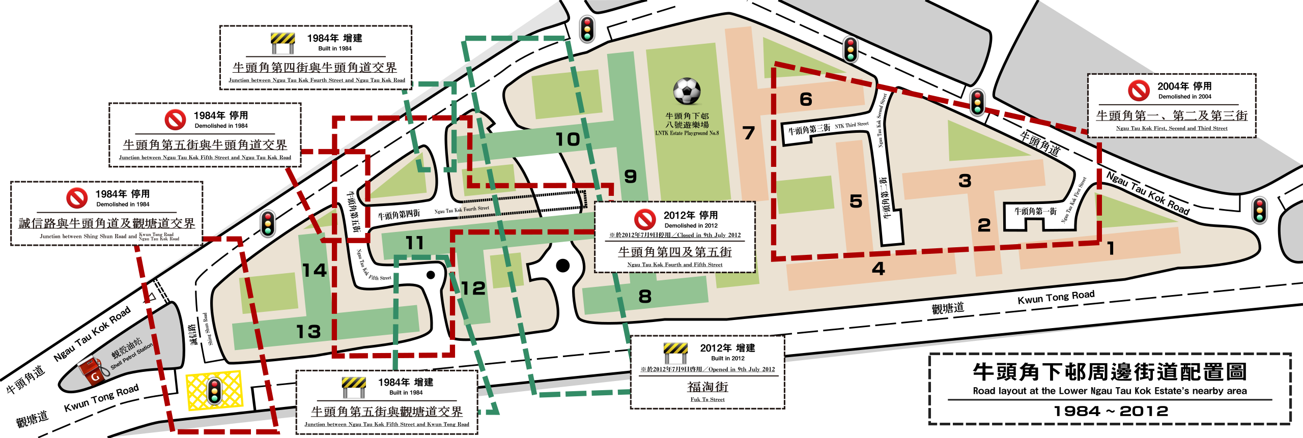
Original file (SVG file, nominally 2,491 × 837 pixels, file size: 3.55 MB)
Captions
Captions
Add a one-line explanation of what this file represents
Summary edit
| Description |
English: A road layout plan of the Lower Ngau Tau Kok Estate's nearby area. The changes during the period 1984 to 2012 of this area in the aspect of road design is seen. |
| Date | |
| Source | Own work |
| Author | Own work |
| Attribution (required by the license) | User:Eric028 / Wikimedia Commons / |
Licensing edit
I, the copyright holder of this work, hereby publish it under the following license:
This file is licensed under the Creative Commons Attribution-Share Alike 3.0 Unported license.
- You are free:
- to share – to copy, distribute and transmit the work
- to remix – to adapt the work
- Under the following conditions:
- attribution – You must give appropriate credit, provide a link to the license, and indicate if changes were made. You may do so in any reasonable manner, but not in any way that suggests the licensor endorses you or your use.
- share alike – If you remix, transform, or build upon the material, you must distribute your contributions under the same or compatible license as the original.
File history
Click on a date/time to view the file as it appeared at that time.
| Date/Time | Thumbnail | Dimensions | User | Comment | |
|---|---|---|---|---|---|
| current | 04:47, 24 July 2012 | 2,491 × 837 (3.55 MB) | Eric028 (talk | contribs) | Newer Version. | |
| 05:56, 4 March 2012 |  | 1,000 × 678 (971 KB) | Eric028 (talk | contribs) | Design altered. | |
| 05:28, 4 March 2012 |  | 1,000 × 678 (901 KB) | Eric028 (talk | contribs) | == {{int:filedesc}} == {{Information |Description= {{en|A road layout plan of the Lower Ngau Tau Kok Estate's nearby area. The changes during the period 1984 to 2012 of this area in the aspect of road design is seen.}} |Date=2012-03-04 |Source={{Own}}... |
You cannot overwrite this file.
File usage on Commons
There are no pages that use this file.
File usage on other wikis
The following other wikis use this file:
- Usage on en.wikipedia.org
- Usage on zh-yue.wikipedia.org
- Usage on zh.wikipedia.org