File:RU-VGG-Frolovsky-outline.svg

Original file (SVG file, nominally 410 × 436 pixels, file size: 616 KB)
Captions
Captions
Summary
edit
| Description |
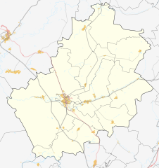
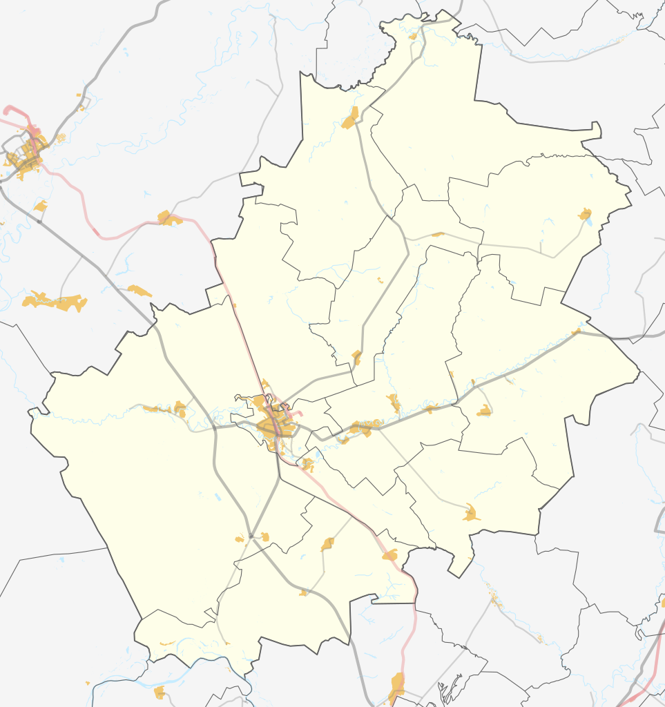
Русский: Карта Фроловского района Волгоградской области России. |
|||||||||
| Date | ||||||||||
| Source | You may find a page on the OpenStreetMap wiki page for Frolovsky District | |||||||||
| Creator |
OpenStreetMap contributors |
|||||||||
| Permission (Reusing this file) |
OpenStreetMap data is available under the Open Database License (details). Standard style map tiles are licensed as ODbL Produced Works.
|
|||||||||
| Geotemporal data | ||||||||||
| Bounding box |
|
|||||||||
| Georeferencing | If inappropriate please set warp_status = skip to hide. | |||||||||
Licensing
edit
| This work contains information from OpenStreetMap, which is made available under the Open Database License (ODbL).
The ODbL does not require any particular license for maps produced from ODbL data. Prior to 1 August 2020, map tiles produced by the OpenStreetMap Foundation were licensed under the CC-BY-SA-2.0 license. Maps produced by other people may be subject to other licences. |
File history
Click on a date/time to view the file as it appeared at that time.
| Date/Time | Thumbnail | Dimensions | User | Comment | |
|---|---|---|---|---|---|
| current | 19:54, 13 January 2021 | | 410 × 436 (616 KB) | Redboston (talk | contribs) | Reverted to version as of 01:04, 4 November 2020 (UTC) - ошибка отрисовки |
| 19:48, 13 January 2021 |  | 410 × 436 (665 KB) | Redboston (talk | contribs) | Reverted to version as of 00:55, 4 November 2020 (UTC) | |
| 01:04, 4 November 2020 |  | 410 × 436 (616 KB) | Redboston (talk | contribs) | убрал лишние правки для нормального отображения | |
| 00:55, 4 November 2020 |  | 410 × 436 (665 KB) | Redboston (talk | contribs) | Uploaded a work by OSM from {{OpenStreetMap| | name = Frolovsky District | location = Frolovsky District | description = {{ru|1=Карта Фроловского района Волгоградской области России.}} | top = 50.2332 | bottom = 49.4610 | left = 43.1873 | right = 44.3134 | date = 2020-11-04 | authors = | other_versions = <gallery>Russia Primorsky Krai Mikhaylovsky District location map.svg</gallery> }} with UploadWizard |
You cannot overwrite this file.
File usage on Commons
The following 2 pages use this file:
File usage on other wikis
The following other wikis use this file:
- Usage on ce.wikipedia.org
- Usage on fr.wikipedia.org
- Usage on hy.wikipedia.org
- Usage on ru.wikipedia.org
- Фроловский район
- Образцы
- Рубёжный
- Арчедино-Чернушинский
- Манский (Волгоградская область)
- Козлов (Фроловский район)
- Амелино (Волгоградская область)
- Большой Лычак
- Кудиновский (Фроловский район)
- Ветютнев
- Гуляевка (Волгоградская область)
- Колобродов
- Летовский
- Любимовский
- Новая Паника
- Падок
- Посёлок Арчединского лесхоза
- Школьный (Волгоградская область)
- Дудаченский
- Нижнеосиновский (Фроловский район)
- Русско-Осиновский
- Красные Липки
- Верхние Липки
- Шляховский
- Выездинский
- Зимовская Паника
- Зимовский (Фроловский район)
- Лычак
- Банный (Волгоградская область)
- Благодатный (Волгоградская область)
- Парижская Коммуна (Волгоградская область)
- Малодельская
- Муравли (Волгоградская область)
- Пригородный (Волгоградская область)
- Садовый (Фроловский район)
- Зеленовский (Волгоградская область)
- Илясов (хутор)
- Кашулин
- Кирпичный (Волгоградская область)
- Короли (Волгоградская область)
- Писарёвка (Фроловский район)
- Нижние Липки
- Терновка (Фроловский район)
- Калиновский (Фроловский район)
- Перфиловский
- Шуруповский
- Железнодорожный (Волгоградская область)
View more global usage of this file.