File:RU RYA Mihailovsky outline.svg

Original file (SVG file, nominally 592 × 726 pixels, file size: 481 KB)
Captions
Captions
Summary
edit
| Description |
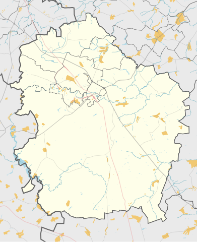
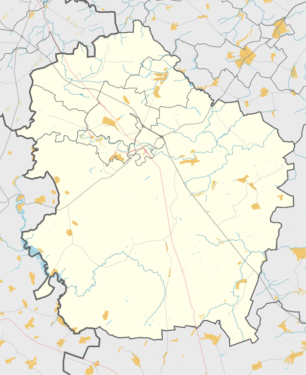
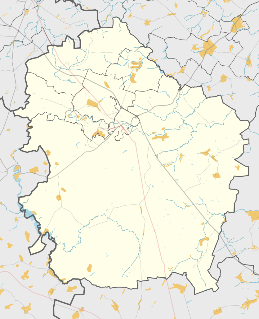
Русский: Карта, Михайловский район Рязанской области. |
| Date | |
| Source | Own work |
| Author | Nzeemin |
Licensing
edit
| Description |
This map was created from OpenStreetMap project data, collected by the community. This map may be incomplete, and may contain errors. Don't rely solely on it for navigation. |
|||
| Date | (see file history) | |||
| Source | openstreetmap.org | |||
| Creator |
OpenStreetMap contributors |
|||
| Permission (Reusing this file) |
OpenStreetMap data is available under the Open Database License (details). Map tiles are licensed under the Creative Commons Attribution-ShareAlike 2.0 license (CC-BY-SA 2.0).
This file is licensed under the Creative Commons Attribution-Share Alike 2.0 Generic license.
|
|||
| Georeferencing | If inappropriate please set warp_status = skip to hide. |
Details
edit
Maperitive commands:
set-geo-bounds 38.625,53.875,39.4375,54.45833
set-print-bounds-geo
zoom 10
export-svg compatibility=inkscape
File history
Click on a date/time to view the file as it appeared at that time.
| Date/Time | Thumbnail | Dimensions | User | Comment | |
|---|---|---|---|---|---|
| current | 16:31, 3 November 2014 | | 592 × 726 (481 KB) | Nzeemin (talk | contribs) | User created page with UploadWizard |
You cannot overwrite this file.
File usage on Commons
The following page uses this file:
File usage on other wikis
The following other wikis use this file:
- Usage on myv.wikipedia.org
- Usage on ru.wikipedia.org
- Михайлов (город)
- Михайловский район (Рязанская область)
- Костыли (Михайловский район)
- Ижеславль
- Стрелецкие Выселки
- Виленка (Рязанская область)
- Малое Свистово
- Малинки (Рязанская область)
- Поздное
- Каморино
- Бычки (Михайловский район)
- Кукуй (Рязанская область)
- Вилки (Рязанская область)
- Бутырки (Михайловский район)
- Лубянка (Михайловский район)
- Дугинка I
- Красное (Красновское сельское поселение)
- Локня (Рязанская область)
- Заречье 1
- Маково (Рязанская область)
- Грязное (Рязанская область)
- Глинки (Трепольское поселение)
- Марьино (Михайловский район)
- Киндяково (Рязанская область)
- Феняево
- 10-й год Октября
- Бекленевка (Рязанская область)
- Большая Дорогинка
- Большое Свистово
- Бояринцево (посёлок станции, Рязанская область)
- Внуково (Рязанская область)
- Завидовка (Рязанская область)
- Заречье 2
- Лобановские Выселки
- Митякино (Рязанская область)
- Новопанское
- Половнево (Рязанская область)
- Помозово (Рязанская область)
- Старые Свечи
- Щетиновка (Рязанская область)
- Глинки (Горностаевское поселение)
- Классон (Рязанская область)
- Покровское 1 (Рязанская область)
- Серебрянь (Рязанская область)
- Оболенки
- Некрасово (Михайловский район)
- Горностаевка (Михайловский район)
- Конуры
- Наумовка (Рязанская область)
View more global usage of this file.