File:Radzyń Chełmiński (gmina) location map.png

Size of this preview: 800 × 534 pixels. Other resolutions: 320 × 214 pixels | 640 × 427 pixels | 959 × 640 pixels.
Original file (959 × 640 pixels, file size: 81 KB, MIME type: image/png)
Captions
Captions
Add a one-line explanation of what this file represents
| Description |
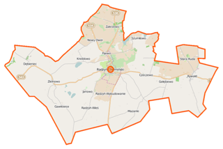
Polski: Mapa gminy Radzyń Chełmiński, Polska
English: Map of Gmina Radzyń Chełmiński, Poland |
|||||||||
| Date | ||||||||||
| Source | You may find a page on the OpenStreetMap wiki page for Radzyń Chełmiński (gmina) | |||||||||
| Creator |
OpenStreetMap contributors OpenStreetMap contributors |
|||||||||
| Permission (Reusing this file) |
OpenStreetMap data is available under the Open Database License (details). Map tiles are licensed under the Creative Commons Attribution-ShareAlike 2.0 license (CC-BY-SA 2.0).
This file is licensed under the Creative Commons Attribution-Share Alike 2.0 Generic license.
|
|||||||||
| Geotemporal data | ||||||||||
| Bounding box |
|
|||||||||
| Georeferencing | If inappropriate please set warp_status = skip to hide. | |||||||||
File history
Click on a date/time to view the file as it appeared at that time.
| Date/Time | Thumbnail | Dimensions | User | Comment | |
|---|---|---|---|---|---|
| current | 06:19, 29 October 2014 | | 959 × 640 (81 KB) | VanWiel (talk | contribs) | {{OpenStreetMap | name = Radzyń Chełmiński (gmina) | location = Radzyń Chełmiński (gmina) | description = {{pl|Mapa gminy Radzyń Chełmiński, Polska}} {{en|Map of Gmina Radzyń Chełmiński, Poland}} | top... |
You cannot overwrite this file.
File usage on Commons
There are no pages that use this file.
File usage on other wikis
The following other wikis use this file:
- Usage on pl.wikipedia.org
- Radzyń Chełmiński
- Radzyń Chełmiński (gmina)
- Dębieniec
- Kneblowo
- Radzyń-Wieś
- Radzyń-Wybudowanie
- Szumiłowo
- Czeczewo (województwo kujawsko-pomorskie)
- Fijewo (województwo kujawsko-pomorskie)
- Gawłowice (województwo kujawsko-pomorskie)
- Gołębiewo (województwo kujawsko-pomorskie)
- Mazanki (województwo kujawsko-pomorskie)
- Rywałd (województwo kujawsko-pomorskie)
- Stara Ruda (województwo kujawsko-pomorskie)
- Zielnowo (województwo kujawsko-pomorskie)
- Nowy Dwór (powiat grudziądzki)
- Zakrzewo (powiat grudziądzki)
- Synagoga w Radzyniu Chełmińskim
- Sanktuarium Maryjne w Rywałdzie
- Wymysłowo (Czeczewo)
- Gziki (województwo kujawsko-pomorskie)
- Rozental
- Zamek w Radzyniu Chełmińskim
- Janowo (powiat grudziądzki)
- Radzyń Chełmiński (stacja kolejowa)
- Parafia św. Sebastiana i Narodzenia Najświętszej Maryi Panny w Rywałdzie
- Parafia św. Anny w Radzyniu Chełmińskim
- Cmentarz żydowski w Radzyniu Chełmińskim
- Kościół św. Anny w Radzyniu Chełmińskim
- Zakrzewo Pomorskie
- Dębiniec (przystanek kolejowy)
- Moduł:Mapa/dane/Radzyń Chełmiński
- Moduł:Mapa/dane/Radzyń Chełmiński (gmina)
- Usage on pl.wikibooks.org
_location_map.png&oldid=519994805)