File:Rafah (FL165866638 5062341).jpg

Size of this preview: 621 × 600 pixels. Other resolutions: 248 × 240 pixels | 497 × 480 pixels | 795 × 768 pixels | 1,060 × 1,024 pixels | 2,120 × 2,048 pixels | 15,606 × 15,074 pixels.
Original file (15,606 × 15,074 pixels, file size: 247.39 MB, MIME type: image/jpeg)
Captions
Captions
Add a one-line explanation of what this file represents
Summary
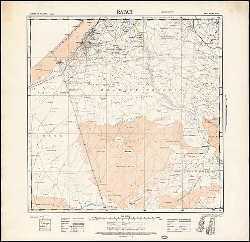
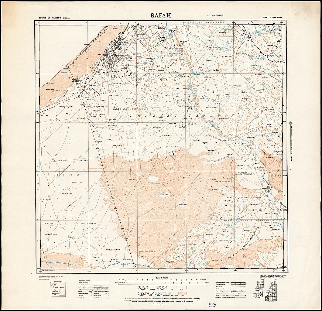
edit| Rafah
( |
||||||||||||||||||||||||
|---|---|---|---|---|---|---|---|---|---|---|---|---|---|---|---|---|---|---|---|---|---|---|---|---|
| Title |
Rafah |
|||||||||||||||||||||||
| Publisher |
War office |
|||||||||||||||||||||||
| Description |
Rafah.. |
|||||||||||||||||||||||
| Language | English | |||||||||||||||||||||||
| Publication date | 1941 | |||||||||||||||||||||||
| Medium | 1 sheet : color ; | |||||||||||||||||||||||
| Dimensions | 63 × 66 cm (24.8 × 25.9 in) | |||||||||||||||||||||||
| Collection |
|
|||||||||||||||||||||||
| Current location |
|
|||||||||||||||||||||||
| Place of publication | unknown | |||||||||||||||||||||||
| search Merhav catalog | unknown | |||||||||||||||||||||||
| Notes |
Compiled from a map by Dept. of Lands & Surveys, Palestine, 1935, with road revision to 1939. Heliographed at O.S. and printed by W.O, 1941.; Geographical Section, General Staff, No. 4079.; Published at the War Office 1940. Second ed., 1941. English: Palestine. 1:100,000 New Series ; 10 | |||||||||||||||||||||||
| scale | 1:100,000 cm | |||||||||||||||||||||||
| IE PID | IE165866636 | |||||||||||||||||||||||
| Rosetta filename | FL165866638 | |||||||||||||||||||||||
| NNL item ID (P3959) | 990050623410205171 | |||||||||||||||||||||||
| search Merhav catalog | English | |||||||||||||||||||||||
| search Merhav catalog | War office | |||||||||||||||||||||||
| Source/Photographer |
|
|||||||||||||||||||||||
| Other versions | ||||||||||||||||||||||||
| Jpg / Tif version |
|
|||||||||||||||||||||||

.jpg)

.jpg&action=edit§ion=1)
Licensing
edit.jpg&action=edit§ion=2)
This UK artistic or literary work, of which the author is unknown and cannot be ascertained by reasonable enquiry, is in the public domain because it is one of the following:
|
 |
File history
Click on a date/time to view the file as it appeared at that time.
| Date/Time | Thumbnail | Dimensions | User | Comment | |
|---|---|---|---|---|---|
| current | 15:31, 2 September 2023 | | 15,606 × 15,074 (247.39 MB) | Geagea (talk | contribs) | pattypan 22.03 |
You cannot overwrite this file.
File usage on Commons
The following page uses this file:
.jpg&oldid=818886454)