File:Rail Tracks map Hatta Station.svg

Size of this PNG preview of this SVG file: 700 × 365 pixels. Other resolutions: 320 × 167 pixels | 640 × 334 pixels | 1,024 × 534 pixels | 1,280 × 667 pixels | 2,560 × 1,335 pixels.
Original file (SVG file, nominally 700 × 365 pixels, file size: 82 KB)
Captions
Captions
Add a one-line explanation of what this file represents
Summary
edit
| Description |
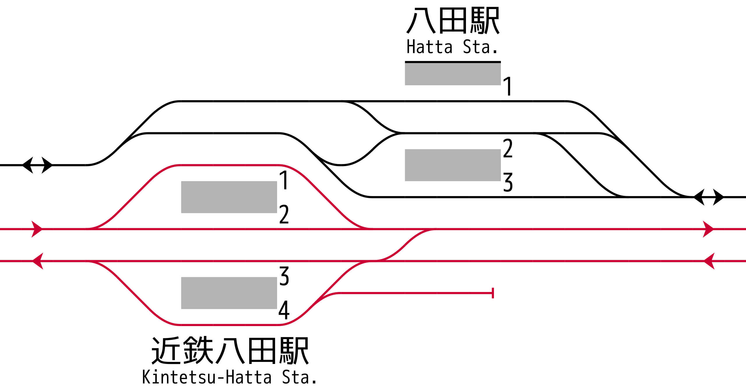
English: Rail tracks map of Central Japan Railway Company Kansai Main Line
Hatta Station and Kintetsu Corporation Nagoya Line Kintetsu-Hatta Station.
Reference material: Ryozo KAWASHIMA, "TOKAIDŌ LINE All lines,stations and rail tracks (ja:Zensen, Zen-eki, Zen-haisen) No.8 Southern Nagoya and Eastern Kisei Area", ISBN 978-4062700184 , p.8, Kodansha, 2009-09. Created from icons in Category:Rail_tracks_map_template 日本語: JR東海 関西線八田駅・近鉄 名古屋線 近鉄八田駅 配線図 参考文献:川島令三、『東海道ライン 全線・全駅・全配線 第8巻 名古屋南部・紀勢東部』、p.8, 講談社、2009年9月、ISBN 978-4062700184) 凡例は駅配線図テンプレートを参照 |
| Date | |
| Source | Own work |
| Author | ButuCC |
Licensing
edit
I, the copyright holder of this work, hereby publish it under the following license:
This file is licensed under the Creative Commons Attribution-Share Alike 4.0 International license.
- You are free:
- to share – to copy, distribute and transmit the work
- to remix – to adapt the work
- Under the following conditions:
- attribution – You must give appropriate credit, provide a link to the license, and indicate if changes were made. You may do so in any reasonable manner, but not in any way that suggests the licensor endorses you or your use.
- share alike – If you remix, transform, or build upon the material, you must distribute your contributions under the same or compatible license as the original.
File history
Click on a date/time to view the file as it appeared at that time.
| Date/Time | Thumbnail | Dimensions | User | Comment | |
|---|---|---|---|---|---|
| current | 17:08, 8 January 2018 | | 700 × 365 (82 KB) | ButuCC (talk | contribs) | User created page with UploadWizard |
You cannot overwrite this file.
File usage on Commons
The following 2 pages use this file: