File:Railway viaduct, New Road, Mytholmroyd - geograph.org.uk - 1040608.jpg
Size of this preview: 631 × 599 pixels. Other resolutions: 253 × 240 pixels | 505 × 480 pixels | 640 × 608 pixels.
Original file (640 × 608 pixels, file size: 97 KB, MIME type: image/jpeg)
Captions
Captions
Add a one-line explanation of what this file represents
Summary
edit
| Description |
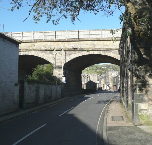
English: Railway viaduct, New Road, Mytholmroyd The next span to the left goes over Cragg Brook. The name 'New Road' probably means that a turnpike trust constructed a new road here c. 1815 to replace an older packhorse track. The railway was later, c. 1840. |
| Date | |
| Source | From geograph.org.uk |
| Author | Humphrey Bolton |
| Attribution (required by the license) | Humphrey Bolton / Railway viaduct, New Road, Mytholmroyd / |
| Camera location | | View this and other nearby images on: OpenStreetMap |
|---|
_heading:22.00&language=en)
| Object location | | View this and other nearby images on: OpenStreetMap |
|---|
_heading:22.00&language=en)
Licensing
edit

|
This image was taken from the Geograph project collection. See this photograph's page on the Geograph website for the photographer's contact details. The copyright on this image is owned by Humphrey Bolton and is licensed for reuse under the Creative Commons Attribution-ShareAlike 2.0 license.
|
This file is licensed under the Creative Commons Attribution-Share Alike 2.0 Generic license.
Attribution: Humphrey Bolton
- You are free:
- to share – to copy, distribute and transmit the work
- to remix – to adapt the work
- Under the following conditions:
- attribution – You must give appropriate credit, provide a link to the license, and indicate if changes were made. You may do so in any reasonable manner, but not in any way that suggests the licensor endorses you or your use.
- share alike – If you remix, transform, or build upon the material, you must distribute your contributions under the same or compatible license as the original.
File history
Click on a date/time to view the file as it appeared at that time.
| Date/Time | Thumbnail | Dimensions | User | Comment | |
|---|---|---|---|---|---|
| current | 22:10, 23 February 2011 | | 640 × 608 (97 KB) | GeographBot (talk | contribs) | == {{int:filedesc}} == {{Information |description={{en|1=Railway viaduct, New Road, Mytholmroyd The next span to the left goes over Cragg Brook. The name 'New Road' probably means that a turnpike trust constructed a new road here c. 1815 to replace an old |
You cannot overwrite this file.
File usage on Commons
There are no pages that use this file.