File:Raleigh Hills OR10 and OR210.JPG

Size of this preview: 800 × 536 pixels. Other resolutions: 320 × 214 pixels | 640 × 428 pixels | 1,024 × 685 pixels | 1,280 × 857 pixels | 2,560 × 1,714 pixels | 3,872 × 2,592 pixels.
Original file (3,872 × 2,592 pixels, file size: 3.81 MB, MIME type: image/jpeg)
Captions
Captions
Add a one-line explanation of what this file represents
Summary edit
| Description |
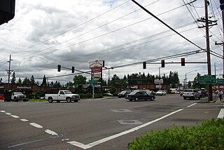
English: w:Raleigh Hills, Oregon, neighborhood near w:Portland, Oregon. w:Oregon Route 10 (Beaverton-Hillsdale Highway) runs from top to bottom; w:Oregon Route 210 (Scholls Ferry Road) is only visible in the distance underneath the far right red light. Oleson Road is on the left and ends at Scholls Ferry Road off-frame. |
| Date | |
| Source | Own work |
| Author | M.O. Stevens |
Licensing edit
| I, the copyright holder of this work, release this work into the public domain. This applies worldwide. In some countries this may not be legally possible; if so: I grant anyone the right to use this work for any purpose, without any conditions, unless such conditions are required by law. |
File history
Click on a date/time to view the file as it appeared at that time.
| Date/Time | Thumbnail | Dimensions | User | Comment | |
|---|---|---|---|---|---|
| current | 21:47, 25 June 2009 | | 3,872 × 2,592 (3.81 MB) | Aboutmovies (talk | contribs) | {{Information |Description={{en|1=w:Raleigh Hills, Oregon, neighborhood near w:Portland, Oregon. w:Oregon Route 10 runs from top to bottom; wOregon Route 210 (Scholls Ferry Road) runs left to right}} |Source=Own work by uploader |Author=[[ |
You cannot overwrite this file.
File usage on Commons
The following 2 pages use this file:
File usage on other wikis
The following other wikis use this file:
- Usage on ar.wikipedia.org
- Usage on arz.wikipedia.org
- Usage on azb.wikipedia.org
- Usage on ca.wikipedia.org
- Usage on ceb.wikipedia.org
- Usage on ce.wikipedia.org
- Usage on en.wikipedia.org
- Usage on eu.wikipedia.org
- Usage on fa.wikipedia.org
- Usage on hu.wikipedia.org
- Usage on it.wikipedia.org
- Usage on ja.wikipedia.org
- Usage on lld.wikipedia.org
- Usage on pl.wikipedia.org
- Usage on pt.wikipedia.org
- Usage on sh.wikipedia.org
- Usage on sr.wikipedia.org
- Usage on tt.wikipedia.org
- Usage on uk.wikipedia.org
- Usage on vi.wikipedia.org
- Usage on www.wikidata.org
- Usage on zh-min-nan.wikipedia.org