File:Rampe de lancement de V1 Base lourde N°16 Château du Pannelier.jpg

Size of this preview: 723 × 599 pixels. Other resolutions: 290 × 240 pixels | 579 × 480 pixels | 926 × 768 pixels | 1,235 × 1,024 pixels | 2,470 × 2,048 pixels | 2,991 × 2,480 pixels.
Original file (2,991 × 2,480 pixels, file size: 2.05 MB, MIME type: image/jpeg)
Captions
Captions
Add a one-line explanation of what this file represents
Summary
edit
| Camera location | | View this and other nearby images on: OpenStreetMap |
|---|
| Description |
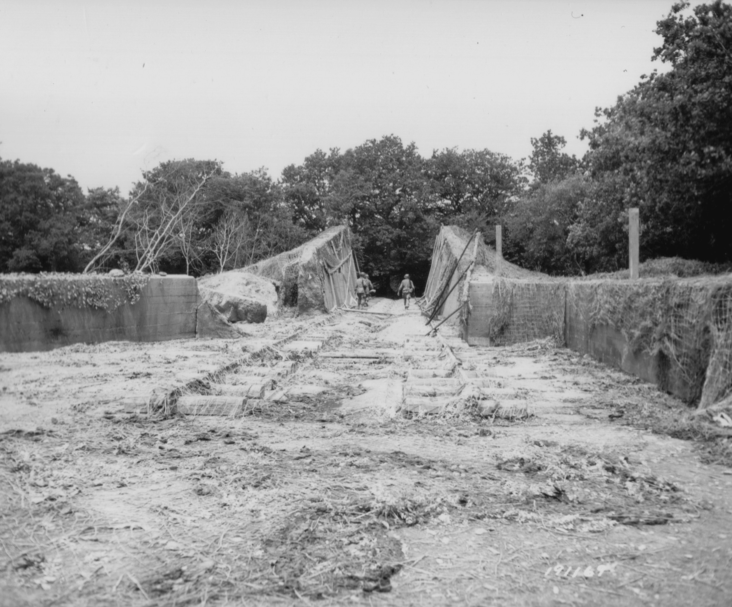
Français : Rampe de lancement de V1 inspectée par trois GI's de la 79th US ID; secteur atteint le 20 juin 1944.
Base lourde N°16 Château du Pannelier Au nord de Brix et à l'est de la N13 |
| Date | |
| Source | Armée américaine |
| Author | Armée américaine |
Licensing
edit
This file is a work of a U.S. Army soldier or employee, taken or made as part of that person's official duties. As a work of the U.S. federal government, it is in the public domain in the United States.
|
 |
| This image, originally posted to Flickr, was reviewed on 14 January 2013 by the administrator or reviewer File Upload Bot (Magnus Manske), who confirmed that it was available on Flickr under the stated license on that date. |
File history
Click on a date/time to view the file as it appeared at that time.
| Date/Time | Thumbnail | Dimensions | User | Comment | |
|---|---|---|---|---|---|
| current | 05:00, 14 January 2013 | | 2,991 × 2,480 (2.05 MB) | File Upload Bot (Magnus Manske) (talk | contribs) | Transferred from Flickr by User:oaktree_b using flickr2commons |
You cannot overwrite this file.
File usage on Commons
The following page uses this file:
File usage on other wikis
The following other wikis use this file:
- Usage on fr.wikipedia.org