File:Rand McNally & Co. (Chicago), Empire of Amraphel or Hammurabi Period of about 1930 B.C (FL36587227 3917018).jpg

Size of this preview: 475 × 599 pixels. Other resolutions: 190 × 240 pixels | 381 × 480 pixels | 609 × 768 pixels | 812 × 1,024 pixels | 1,624 × 2,048 pixels | 2,696 × 3,400 pixels.
Original file (2,696 × 3,400 pixels, file size: 2.76 MB, MIME type: image/jpeg)
Captions
Captions
Add a one-line explanation of what this file represents
Summary
edit| Rand McNally: Empire of Amraphel or Hammurabi Period of about 1930 B.C
( |
||||||||||||||||||||||||
|---|---|---|---|---|---|---|---|---|---|---|---|---|---|---|---|---|---|---|---|---|---|---|---|---|
| Artist |
|
|||||||||||||||||||||||
| Title |
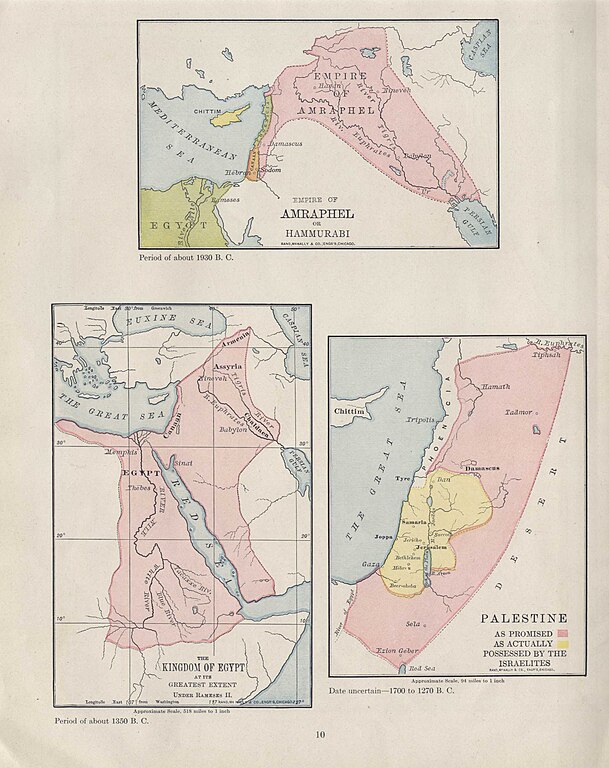
Empire of Amraphel or Hammurabi Period of about 1930 B.C |
|||||||||||||||||||||||
| Publisher |
Rand McNally & Company |
|||||||||||||||||||||||
| Description |
Empire of Amraphel or Hammurabi Period of about 1930 B.C. Rand McNally & Co. Engr's, Chicago. |
|||||||||||||||||||||||
| Language | English | |||||||||||||||||||||||
| Publication date | 1938 | |||||||||||||||||||||||
| Medium | 1 online resource (1 map). | |||||||||||||||||||||||
| Collection |
|
|||||||||||||||||||||||
| Current location |
|
|||||||||||||||||||||||
| Place of publication | New York Chicago San Francisco | |||||||||||||||||||||||
| search Merhav catalog | New York Chicago San Francisco | |||||||||||||||||||||||
| Notes | Digital image of the original in Amir Cahanovitc Collection, Israel. ACC 610-3.; Digital image received from donor.; From: Rand McNally historical atlas of the Holy Land. | |||||||||||||||||||||||
| IE PID | IE36587225 | |||||||||||||||||||||||
| Rosetta filename | FL36587227 | |||||||||||||||||||||||
| NNL item ID (P3959) | 990039170180205171 | |||||||||||||||||||||||
| search Merhav catalog | English, Rand McNally | |||||||||||||||||||||||
| search Merhav catalog | Kingdom of EgyptPalestineRand McNally & Company | |||||||||||||||||||||||
| Source/Photographer |
|
|||||||||||||||||||||||
| Other versions | ||||||||||||||||||||||||
| Jpg / Tif version |
|
|||||||||||||||||||||||


,_Empire_of_Amraphel_or_Hammurabi_Period_of_about_1930_B.C_(FL36587227_3917018).jpg)

,_Empire_of_Amraphel_or_Hammurabi_Period_of_about_1930_B.C_(FL36587227_3917018).jpg&action=edit§ion=1)
Licensing
edit,_Empire_of_Amraphel_or_Hammurabi_Period_of_about_1930_B.C_(FL36587227_3917018).jpg&action=edit§ion=2)
This work is in the public domain because it was published in the United States between 1929 and 1963, and although there may or may not have been a copyright notice, the copyright was not renewed. For further explanation, see Commons:Hirtle chart and the copyright renewal logs. Note that it may still be copyrighted in jurisdictions that do not apply the rule of the shorter term for US works (depending on the date of the author's death), such as Canada (70 years p.m.a.), Mainland China (50 years p.m.a., not Hong Kong or Macao), Germany (70 years p.m.a.), Mexico (100 years p.m.a.), Switzerland (70 years p.m.a.), and other countries with individual treaties.
|
 |
File history
Click on a date/time to view the file as it appeared at that time.
| Date/Time | Thumbnail | Dimensions | User | Comment | |
|---|---|---|---|---|---|
| current | 21:35, 3 September 2023 | | 2,696 × 3,400 (2.76 MB) | Geagea (talk | contribs) | pattypan 22.03 |
You cannot overwrite this file.
File usage on Commons
The following page uses this file:
,_Empire_of_Amraphel_or_Hammurabi_Period_of_about_1930_B.C_(FL36587227_3917018).jpg&oldid=798244640)